Jalan Eunos Service Reservoir

Last updated

Jalan Eunos Service Reservoir is a service reservoir located along Kaki Bukit Avenue 4 in Singapore. It is found in the northern part of Kaki Bukit estate near the Paya Lebar Air Base and is therefore part of the Bedok planning area. The reservoir provides water supply to the eastern regions of Singapore and stores treated water mainly from Bedok Reservoir. It can reportedly hold 22 million gallons/ 100,000 cubic metres of water. [1] Access to this service reservoir is restricted unlike the neighbouring Bedok Reservoir.

Singapore Republic in Southeast Asia

Singapore, officially the Republic of Singapore, is an island city-state in Southeast Asia. It lies one degree north of the equator, at the southern tip of the Malay Peninsula, with Indonesia's Riau Islands to the south and Peninsular Malaysia to the north. Singapore's territory consists of one main island along with 62 other islets. Since independence, extensive land reclamation has increased its total size by 23%. The country is known for its transition from a developing to a developed one in a single generation under the leadership of its founder Lee Kuan Yew.

Kaki Bukit, Singapore Subzone of Bedok Planning Area in East Region, Singapore

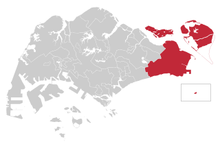
Kaki Bukit is an industrial area located in Bedok in the East Region of Singapore. It is home to many high tech industrial companies and warehouses. There used to be a prison complex called Kaki Bukit Centre, which was converted to a prison school in 2000, however it has since moved to Tanah Merah and the Acacia Welfare Home now stands in its place. On the south of Kaki Bukit is Jalan Tenaga and Jalan Damai neighbourhoods of Bedok Reservoir Road. Redevelopments are in the pipeline for Kaki Bukit beyond 2030 when Paya Lebar Airbase located just north of the estate relocates to Changi. Not only would land be freed up for use but building height restrictions, that are currently in place for safety reasons because the estate is directly aligned with the airbase runway, would also be lifted. Kaki Bukit is classified by Urban Redevelopment Authority (URA) as a subzone under the planning area of Bedok, its boundaries differ from the constituency boundaries used by the Singapore Parliament.

Paya Lebar Air Base Military airbase of the Republic of Singapore Air Force

Paya Lebar Air Base (PLAB) is a military airbase of the Republic of Singapore Air Force located at Paya Lebar, in the central-eastern part of Singapore, the airbase goes by the motto of "Strength Through Readiness".

History

Jalan Eunos Service Reservoir was first constructed by the British Government in 1956 at an estimated cost of $4 million to improve water pressure in the Geylang, Katong and Changi areas of Singapore, as the Woodleigh Waterworks, constructed in 1912 and still stands today, was inadequate to channel water to the growing population. [2] The reservoir was first expanded in 1971 and was then expanded again in 1974 to increase water supply to the east of Singapore which was developing rapidly and was in need of connection to potable water. [3] As Singapore had gained independence by then, there were also fears that Malaysia would eventually cut off water supply from its reservoirs despite agreements made beforehand. In line with the need for self reliance to provide our own water, Bedok Reservoir was then finally completed in 1985 to provide Jalan Eunos Service Reservoir with even more water especially to the residences residing in the east of Singapore. Redevelopments in the area of Kaki Bukit also saw Jalan Eunos which was once linked to the reservoir no longer anywhere near it.

Geylang Planning Area and HDB Town in Central Region ----, Singapore

Geylang is a planning area and township located on the eastern fringe of the Central Region of Singapore, bordering Hougang and Toa Payoh in the north, Marine Parade in the south, Bedok in the east, and Kallang in the west.

Katong Subzone of Marine Parade Planning Area

Katong, also known as Tanjong Katong, is a residential neighbourhood in the eastern portion of the Central Region of Singapore, within Marine Parade planning area. It used to be located by the sea, but land has been reclaimed all the way to East Coast Park to provide more land for housing and recreational purposes due to the shortage of land in the late 1960s after Singapore gained independence.

Changi Planning Area in East Region ----, Singapore

Changi is a planning area located in the East Region of Singapore. Sharing borders with Pasir Ris and Tampines to the west, Changi Bay to the southeast, the South China Sea to the east and the Serangoon Harbour to the north. Changi, excluding the two water catchments and islands of Singapore, is the largest planning area by land size.

Related Research Articles

Kallang Planning Area and HDB Town in Central Region ----, Singapore

Kallang is a planning area and residential town located in the Central Region of Singapore.

Aljunied Group Representation Constituency An electoral constituency in Singapore

Aljunied Group Representation Constituency is a five-member group representation constituency (GRC) in the north-eastern and eastern region of Singapore. This opposition-held GRC consists of a large part of Hougang, Paya Lebar, Serangoon Gardens, the southern half of Serangoon North, as well as a portion of Bedok and a very small section of Tampines.

East Coast Group Representation Constituency

East Coast Group Representation Constituency is a four-member Group Representation Constituency in the eastern area of Singapore. The areas of the Group Representation Constituency consists of East Coast, Bedok, Changi-Simei, Siglap, Tampines, Pasir Ris, Kampong Chai Chee, Changi Airport and the offshore islands of Pulau Tekong, Pulau Ubin and Pedra Branca. The GRC also covers a large portion of Singapore's eastern territorial waters.

Tanah Merah, Singapore Place in East Region, Singapore

Tanah Merah, is a geographical region located along the south-eastern coast of the East Region of Singapore. Although its boundaries aren't exactly clear, it is often widely accepted that term "Tanah Merah", is used to refer to the southern coast of present-day Bedok, Tampines, Changi and Changi Bay.

Taman Jurong is a residential precinct in Jurong West, Singapore. It is one of the oldest residential precincts in Singapore and a division of Jurong GRC, with the area's HDB flats under the management of Jurong-Clementi Town Council and Tharman Shanmugaratnam as the area's MP.

Kampong Ubi Subzone of Geylang Planning Area

Kampong Ubi, also known as Ubi Estate, is a subzone located in the planning area of Geylang in the Central Region of Singapore. It lies within a somewhat rhombic piece of land bounded by Airport Road at the north, the Pan-Island Expressway at the south, Eunos Link at the east and Paya Lebar Road at the west. The area was formerly a Malay village.

Bartley Road is a major road in Singapore extending from Upper Serangoon Road to Tampines Avenue 10. The road has a distance of 5.8 km. En route, it passes through the areas of Serangoon, Bartley, Paya Lebar, Defu, Kaki Bukit and Bedok Reservoir. Bus services 28, 93 and 158 ply along the original Bartley Road from Upper Serangoon Road to Upper Paya Lebar Road.

Teban Gardens Place in Singapore

Teban Gardens is a residential precinct located in Jurong East, Singapore. Immediately north of Pandan Reservoir, it comprises exclusively public housing built by the JTC Corporation and Housing and Development Board.

Thomson–East Coast MRT line

The Thomson–East Coast Line (TEL) is a medium-capacity Mass Rapid Transit (MRT) line in Singapore that is currently under construction, being the sixth line to be built. The line was announced on 15 August 2014 by the Land Transport Authority as a merger of the then planned Thomson Line (TSL) and the Eastern Region Line (ERL). The stretch from Woodlands North to Gardens by the Bay costs around S$18 billion. The line will open in five stages from 2019 onwards, and interchanges with all existing lines. When the line fully opens, it is expected to serve about 500,000 commuters daily in the initial years, rising to one million commuters daily in the long term. It will be the fourth MRT line to be operated by SMRT, after the North South Line, East West Line and the Circle Line and also the fourth to be completely automated and driverless. The line is coloured brown on the rail map.

Kaki Bukit MRT station MRT station in Singapore

Kaki Bukit MRT station (DT28) is an underground Mass Rapid Transit station on the Downtown Line in Bedok planning area, Singapore, located along Kaki Bukit Avenue 1, near the junction with Jalan Damai. The station serves both the industrial and residential areas in the Kaki Bukit district.

Masjid Alkaff Kampung Melayu, is a mosque located on the junction of Kaki Bukit Avenue 1 and Bedok Reservoir Road in Bedok, Singapore. The institution mainly serves worshippers from the Bedok Reservoir area.

References

  1. "Singapore to double water storage capacity". 1972-10-24. Retrieved 2018-03-26.
  2. "Work on big new Reservoir is on". 1956-04-22. Retrieved 2018-03-26.
  3. "Sources of our water supply through the years". 1977-02-27. Retrieved 2018-03-26.