Geylang

Last updated

Geylang
Other transcription(s)
   Malay Geylang(Rumi)
ݢيلڠ(Jawi)
   Chinese 芽笼(Simplified)
芽籠(Traditional)
Yálóng(Pinyin)
Gê-láng(Hokkien POJ)
   Tamil கேலாங்
Kēlāṅ(Transliteration)
Geylang-Road-By-Night-2008.jpg
EunosHDB.JPG
Geylang Road Shophouses.jpg
Seng Ong Temple, Dec 05.JPG
Circuit Rd bef Balam Rd 20060402.JPG
Eunos Bus Interchange.jpg
Singapore Post Headquarters (2336054323).jpg
From top left to right: Geylang Road at night, Aerial view of Geylang East, Shophouses along Geylang Road, Seng Ong Temple, Circuit Road, Eunos Bus Interchange, Headquarters of Singapore Post
Geylang in Central Region, Singapore.svg
Location in Central Region
Singapore location map (main island).svg
Red pog.svg
Geylang
Location of Geylang within Singapore
Coordinates: 1°19′14″N103°53′13″E / 1.32056°N 103.88694°E / 1.32056; 103.88694
CountryFlag of Singapore.svg  Singapore
Region Central Region
CDCs
Town councils
  • Jalan Besar Town Council
  • Marine Parade Town Council
Constituencies
Government
  MayorsCentral Singapore CDC

South East CDC


  Members of ParliamentJalan Besar GRC

MacPherson SMC

Marine Parade GRC

Mountbatten SMC

Potong Pasir SMC

Area
  Total9.64 km2 (3.72 sq mi)
  Residential2.14 km2 (0.83 sq mi)
Population
 (2019) [1] [2] [3]
  Total110,200
  Density11,000/km2 (30,000/sq mi)
Ethnic groups
[3]
   Chinese 88,060
   Malays 15,280
   Indians 9,900
  Others3,730
Postal districts
13, 14, 19
Dwelling units29,256
Projected ultimate49,000

Geylang is a planning area and township located on the eastern fringe of the Central Region of Singapore, bordering Hougang and Toa Payoh in the north, Marine Parade in the south, Bedok in the east, and Kallang in the west.

Contents

Geylang is previously known as a red-light district, particularly the areas along Geylang Road. Today only 3-4 units remains for brothels and street walkers are hard to come by. Geylang is also where one of Singapore's oldest Malay settlements, Geylang Serai, is located. [4] During Ramadan, the neighbourhood is famous for its popular and iconic Ramadan lights and bazaars. [5]

Etymology

The word Geylang is found early in Singapore's history and also in early topographical maps showing marsh and coconut plantations beside and adjacent to the mouth of the Kallang River, home to the Orang Laut (sea gypsies) called orang biduanda kallang who inhabited the area at the time of Raffles' arrival in 1819, and after whom the river is named. Geylang may be a corruption of Kallang. The place name appeared in an 1830 survey map of Singapore as Kilang, but by 1838 was spelled as Kelang, which when pronounced in correct Malay is nearly indistinguishable to the ear from Geylang. However, kilang also means press, mill, or factory in Malay and could be a reference to the presses and mills in the coconut plantations that used to be in the area. Another possible etymological link in the stock vocabulary of the Malay is geylanggan meaning to "twist" or "crush" a reference to the process of extracting the coconut meat and milk used by the locals to thicken curries in Malay-Chinese (Peranakan) cuisine. [6]

Another possible explanation is that Geylang is a corruption of the Malay word 'gelang' which is a type of edible creeper (Portulaca oleracea). This is a plausible explanation for the name because Malays typically name places based on the abundance of certain plant species (e.g. Melaka after the tree species of the same name) or geological formations (e.g. Bukit Gombak based on the comb-like hill summit).

Geography

Geylang Planning Area on Singapore Island. Geylang Planning Area locator map.png
Geylang Planning Area on Singapore Island.

Location

Grouped under the Central Region, Geylang Planning Area is bordered by Hougang and Toa Payoh in the north, Kallang in the west, Marine Parade in the south, and Bedok in the east. Beginning in the north and moving in a clockwise direction, the boundaries of Geylang are made up of MacPherson Road, Airport Road, Eunos Link, Jalan Eunos, Still Road, Koon Seng Road, Dunman Road, the Geylang River, Mountbatten Road, Sims Way, and the Pan Island Expressway (PIE).

Geylang New Town as defined by the Housing and Development Board (HDB) sits within the Geylang Planning Area.

Subdivisions

Geylang Planning Area is made up of five "subzones", as officially defined by the Urban Redevelopment Authority (URA).

SubzoneLocationNotable placesAccessibility
Aljunied Southwest Geylang Aljunied MRT station, Mountbatten MRT station, Dakota MRT station, Sims Place Bus Terminal, Mountbatten Community Club, Mountbatten Neighbourhood Police Post, James Cook University Singapore, Kong Hwa School, Geylang Methodist School (Primary), Geylang Methodist School (Secondary), Broadrick Secondary School, Housing and Development Board (HDB) Geylang Branch, HDB Sims Drive Branch, Geylang Polyclinic, Geylang East Swimming Complex, Singapore Association for the Deaf, Mun San Fook Tuck Chee, the former Kallang Airport, the future Kallang Fire Station, the future Geylang Neighbourhood Police CentreAljunied MRT station, Mountbatten MRT station, Dakota MRT station and buses
Kallang WayIndustrial estates along Kallang Way, Kallang Pudding Road and Tannery RoadThe Siemens Centre, Infineon buildingPotong Pasir MRT Station and buses
MacPherson Northern Geylang MacPherson MRT station, Mattar MRT station, Canossa Catholic Primary School, Aljunied Park, MacPherson Community Club, MacPherson Neighbourhood Police PostMacPherson MRT station, Mattar MRT station and buses
Geylang East Southeast Geylang Paya Lebar MRT station, Eunos MRT station, Paya Lebar Square, SingPost Centre, One KM Mall, Haig Girls' School, Eunos Primary School, Geylang Serai Community Club, Kembangan-Chai Chee Community Club, Kampong Ubi Community Centre, Eunos Bus Interchange, Eunos Neighbourhood Police Post, Kampong Ubi Neighbourhood Police Post, Eunos Fire Post, Sri Sivan Temple, Foo Hai Ch'an Monastery, Geylang United Temple, Paya Lebar Quarter, Wisma Geylang SeraiPaya Lebar MRT station, Eunos MRT station and buses
Kampong Ubi Northeast Geylang Ubi MRT station, Traffic Police Headquarters, Singapore Civil Defence Force (SCDF) Headquarters, Paya Lebar Fire Station, Geylang Neighbourhood Police Centre, Maha Bodhi School, Manjusri Secondary School, Teochew Funeral Parlour, Sze Cheng Keng TempleUbi MRT station and buses

History

The development of Geylang can best be observed along the main trunk road, Geylang Road, that leads westwards towards the city. Micro-businesses founded by Malay, Indian and Chinese entrepreneurs seized start-up opportunities as mechanics in bicycle or motor repair workshops, suppliers of wood for making boats, houses, furniture and as merchants in iron, of floor and roofing tiles, in rubber and later plastics for all kinds of marine, industrial, factory and home use, including the mosaic of temples, mosques and churches in Geylang that have its roots serving local worshippers in search of spirituality and the divine.

One of the distinctive hallmarks of Geylang architecture is the preservation of its shophouses used by the clan (kinship) associations, set up as a (first) point of contact for newcomers in the migrant wave between 1840 and 1940 for the purpose of integrating the newcomers into the ways and customs of locals. At present, the Geylang neighbourhood accurately reflects demographic changes in Singapore (2011) where out of every four Singaporeans, one is a foreigner (Goh, Mar 2011 paper on PRC Immigrants', Social Work Dept, National University of Singapore).

As a strategic and military outpost for the British, it was important that the sea lanes off the Straits of Malacca were kept free of pirates, and open for shipping. As the British expanded in influence and power, Singapore served East and West interests as a natural deep-harbour destination that played host to the French, Portuguese, Dutch and other European navies and their men. Other seaports in Asia, from Shanghai to Calcutta, also played a role in the traffic of women and girls for prostitution.

Geylang Serai

1900s A terminal for the first tramway in Singapore was then built in Geylang Serai while the farmers staying there already shifted to cultivate other cash crops, including rubber and coconuts. [7] Meanwhile, with the intensified urbanisation, the rural community in Geylang Serai, where the price of land was low, was turned into a suburb.

1940s During the occupation by Japanese in World War 2 (1942 to 1945), Geylang Serai was severely damaged, and the shortages of food that arose afterwards led to the replacement of the plantations of coconut and rubber by those of tapioca, which gave Geylang Serai the name, Kampong Ubi (tapioca in Malay). [7] With the end of Japanese occupation, Geylang Serai saw a rise in population and more areas were occupied. The inflow of more Malays and outflow of Chinese changed the demographic of Geylang Serai, which turned into predominantly a Malay community ever since. [4]

1960s In 1963, the Housing and Development Board (HDB) initiated The Geylang Serai Housing Redevelopment Scheme which was carried out in three phases, investing a sum of 3.8 million SGD for the renewal of the region. [8] Under the scheme, Many HDB flats and new facilities were constructed, including Taj cinema, Concourse, light industrial properties, shopping malls and Geylang Serai market. [9]

1980s the old kampungs in the region vanished and Geylang Serai turned into a modern residential district.

2000s In tandem with the urbanization of the region, the importance of preservation of Malay cultural heritage was recognized by the government. Under the Masterplan of 2008 by the Urban Redevelopment Authority (URA), the development of the Paya Lebar Central, within which Geylang Serai is situated, into a centre characterised with a distinct cultural identity was confirmed. Until now, Geylang Serai market is still one of the busiest and largest wet markets in Singapore, offering many Indian-Muslim and Malay dishes as well as a large variety of spices and ingredient for making of traditional Malay cuisine, such as cinnamon and nutmeg.

Infrastructure

The Geylang area is composed of north and south sections that are divided by Geylang Road which stretches for about three kilometres. Throughout the length of Geylang Road, there are lanes (or "lorongs" in the local Malay language) that extend perpendicularly from the main road. The lanes in the north are given odd numbered names (i.e. Lorong 1, Lorong 3, Lorong 5 and so on), and the lanes in the south are given even numbered names (i.e. Lorong 2, Lorong 4, Lorong 6 and so on).

Partly untouched by urban projects and developments and so far spared by the gentrification process that has changed the face of Singapore since the 1970s, Geylang's combination of shophouse scenery and hectic day and night life, including foreign workers quarters and karaoke lounges provides an alternative view of elements the rest of modern Singapore generally does not have. Shophouses along Geylang Road are protected from redevelopment, and many restaurants have sprung up along this major road. Geylang is also known for its durian shops.

Transport

Roads

The following expressways pass through Geylang:

Major roads within Geylang Planning Area include Aljunied Road, Kallang Way, Paya Lebar Road, Geylang East Central, Ubi Avenue 2 and Circuit Road.

Trains

There are eight Mass Rapid Transit (MRT) stations that serve Geylang Planning Area:

Cultural depiction

Related Research Articles

<span class="mw-page-title-main">Kallang</span> Planning Area and HDB Town in Central Region ----, Singapore

Kallang is a planning area and residential zone located in the Central Region of Singapore.

<span class="mw-page-title-main">Paya Lebar</span> Planning Area in East ----, Singapore

Paya Lebar is a planning area located in the East Region of Singapore, bordered by Hougang to the west, Sengkang to the northwest, Tampines to the east, Bedok to the south and Pasir Ris to the north.

<span class="mw-page-title-main">Serangoon</span> Planning Area and HDB Town in North-East Region ----, Singapore

Serangoon is a planning area and residential town located in the North-East Region of Singapore.

<span class="mw-page-title-main">MacPherson, Singapore</span> Neighbourhood in MacPherson, Geylang, Singapore

MacPherson is a neighbourhood located within the district of Geylang in the Central Region of Singapore. Its location roughly corresponds to the identically titled subzone in the Geylang Planning Area and is approximately sandwiched between the neighbourhoods of Aljunied and Paya Lebar. MacPherson largely consists of various public housing estates centered on Circuit Road and an industrial area. The Pelton Canal runs through the neighbourhood, which separates a private housing estate off MacPherson Road, and the public housing estate along Circuit Road.

<span class="mw-page-title-main">Hougang</span> Planning Area and HDB Town in North-East Region ----, Singapore

Hougang or Aukang is a planning area and mature residential town located in the North-East Region of Singapore. The town is the most populous in the region, being home to 247,528 residents as of 2018. Hougang planning area is bordered by Sengkang to the north, Geylang and Serangoon to the south, Bedok to the southeast, Toa Payoh to the southwest, Paya Lebar to the east, Ang Mo Kio to the west and Bishan to the southwest.

<span class="mw-page-title-main">Toa Payoh</span> Planning Area and HDB Town in Central Region ----, Singapore

Toa Payoh is a planning area and mature residential town located in the northern part of the Central Region of Singapore. Toa Payoh planning area borders Bishan and Serangoon to the north, the Central Water Catchment to the northwest, Kallang to the south, Geylang to the southeast, Novena to the west and Hougang to the east. Toa Payoh New Town is situated in the western portion of the Toa Payoh planning area. The latter occupies a much larger area, encompassing estates such as Potong Pasir and Bidadari.

<span class="mw-page-title-main">Bedok</span> Planning Area and HDB Town in East Region ----, Singapore

Bedok is a planning area and residential town located in the geographical region of Tanah Merah along the south-eastern coast of the East Region of Singapore. Bedok is bounded by five other planning areas: Paya Lebar to the north, Hougang to the northwest, Tampines to the northeast and east, Geylang to the west and Marine Parade to the southwest. It also shares a maritime boundary with the Singapore Strait to the south and southeast.

<span class="mw-page-title-main">Pan Island Expressway</span> Road in Singapore

The Pan Island Expressway is the oldest and longest expressway in Singapore. It is also Singapore's longest road. The expressway runs from the East Coast Parkway near Changi Airport in the east to Tuas in the west and has a total length of 42.8 kilometres (26.6 mi).

<span class="mw-page-title-main">Kallang River</span> Longest river in Singapore

The Kallang River is the longest river in Singapore, flowing for 10 kilometers from the Lower Peirce Reservoir to the Kallang Basin. It originates in the planning area of Central Water Catchment, flows in a southeast direction through Bishan and Toa Payoh, before finally arriving in Kallang.

<span class="mw-page-title-main">Geylang East</span> Subzone of Geylang Planning Area in Central Region, Singapore

Geylang East, as a planning subzone, covers what is more commonly known as Eunos. This is located in Geylang zone in the Central Region of Singapore. The vicinity is served by both Paya Lebar and Eunos MRT stations. This area is distinct from the Geylang East Central and estate, which is adjacent to and west of Eunos.

<span class="mw-page-title-main">Kampong Ubi</span> Subzone of Geylang Planning Area

Kampong Ubi, also known as Ubi Estate, is a subzone located in the planning area of Geylang in the Central Region of Singapore. It lies within a somewhat rhombic piece of land bounded by Airport Road at the north, the Pan-Island Expressway at the south, Eunos Link at the east and Paya Lebar Road at the west. The area was formerly a Malay village.

<span class="mw-page-title-main">Kovan, Singapore</span> Place in Singapore

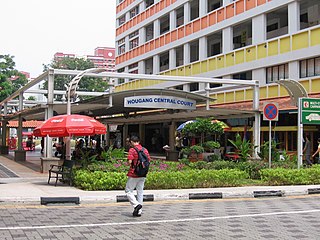
Kovan is a neighbourhood located within the town of Hougang, in Singapore. The neighbourhood today largely consists of private housing properties, where majority of the residents live in terrace homes, semi-detached houses and bungalows.

<span class="mw-page-title-main">Geylang River</span>

Geylang River is a canalised river flowing from Geylang to Kallang, in the Central Region of Singapore. With the formation of the Marina Reservoir after the completion of the Marina Barrage in 2008, the river now forms part of the reservoir.

<span class="mw-page-title-main">Kaki Bukit, Singapore</span> Subzone of Bedok Planning Area in East Region, Singapore

Kaki Bukit is an industrial area located in Bedok in the East Region of Singapore. It is home to many high tech industrial companies and warehouses. There used to be a prison complex called Kaki Bukit Centre, which was converted to a prison school in 2000, however it has since moved to Tanah Merah and the Acacia Welfare Home now stands in its place. On the south of Kaki Bukit is Jalan Tenaga and Jalan Damai neighbourhoods of Bedok Reservoir Road. Redevelopments are in the pipeline for Kaki Bukit beyond 2030 when Paya Lebar Airbase located just north of the estate relocates to Changi. Not only would land be freed up for use but building height restrictions, that are currently in place for safety reasons because the estate is directly aligned with the airbase runway, would also be lifted. Kaki Bukit is classified by Urban Redevelopment Authority (URA) as a subzone under the planning area of Bedok, its boundaries differ from the constituency boundaries used by the Singapore Parliament.

<span class="mw-page-title-main">Kampong Bugis</span> Subzone of Kallang Planning Area in Central Region, Singapore

Kampong Bugis is a subzone within the planning area of Kallang, Singapore, as defined by the Urban Redevelopment Authority (URA). This subzone is bounded by Kallang Road and Sims Avenue in the north; the Kallang–Paya Lebar Expressway (KPE) and Sims Way in the east; Nicoll Highway in the south; and Crawford Street in the west.

Joo Seng is a subzone located in Toa Payoh in the Central Region of Singapore. It gets its name from Bartley Road, which stretches from the end of Braddel Road to Upper Paya Lebar Road, as part of the Outer Ring Road System. There are some condominiums and houses in the area. It is also where the Gurkha Contingent is based. There are many Gurkhas and their families living there in private flats.

References

  1. 1 2 City Population - statistics, maps and charts | Geylang
  2. 1 2 HDB Key Statistics FY 2014/2015 Archived 4 March 2016 at the Wayback Machine
  3. 1 2 "Statistics Singapore - Geographic Distribution - 2018 Latest Data" . Retrieved 11 February 2019.
  4. 1 2 Vernon Cornelius-Takahama (2004). "Geylang Serai". Singapore Infopedia. National Library Board, Singapore.
  5. Auto, Hermes (25 March 2022). "Geylang Serai glitters with lights for Hari Raya as bazaar returns after 2-year hiatus | The Straits Times". www.straitstimes.com. Retrieved 3 April 2022.
  6. "Geylang | Infopedia". eresources.nlb.gov.sg. Retrieved 6 November 2020.
  7. 1 2 Hack, Karl, The Singapore Malay Community: Enclaves and Cultural Domains (PDF), UK: Open University
  8. "Geylang". Housing & Development Board. Retrieved 1 March 2017.
  9. Chew, P. (8 November 2008). "Geylang Serai". Nostalgia: My Golden Years. Retrieved 28 February 2017 via Blogger.

Further reading