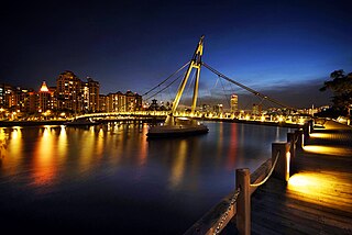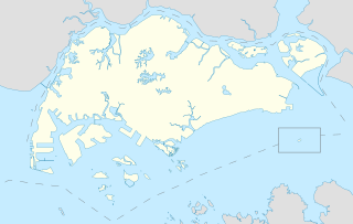
The Central Region is one of the five regions in the city-state of Singapore and the main metropolitan region surrounding the Central Area. Comprising 13,150 hectares of land area, it includes 11 planning areas within the Central Area, as well as another 11 more outside it. The region is home to many of Singapore's national monuments as it was historically the site where the city was first founded and the country's only UNESCO World Heritage Site, the Singapore Botanic Gardens, a 162 year old tropical garden is also located in the region.

Marine Parade is a planning area and residential estate located in the Central Region of Singapore. Straddling the tip of the southeastern coast of Pulau Ujong, Marine Parade serves as a buffer between the Central and East regions of the city-state. Bordering it are the planning areas of Geylang to the north, Kallang to the northwest, Bedok to the northeast, Marina East to the southwest and the Singapore Straits to the south.

Kallang is a planning area and residential town located in the Central Region of Singapore.

Serangoon is a planning area and residential town located in the North-East Region of Singapore.

Marina Bay MRT station is an underground Mass Rapid Transit (MRT) interchange station on the North South line (NSL) and Circle Line (CCL), operated by SMRT Trains. The station is located on the boundary of the Downtown Core and Straits View planning areas in Singapore and was built alongside Bayfront Avenue. As the name suggests, it is located near Marina Bay.

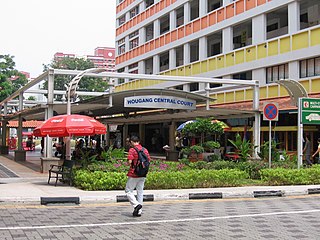
Hougang is a planning area and mature residential town located in the North-East Region of Singapore. The town is the most populous in the region, being home to 247,528 residents as of 2018. Hougang planning area is bordered by Sengkang to the north, Geylang and Serangoon to the south, Bedok to the southeast, Toa Payoh to the southwest, Paya Lebar to the east, Ang Mo Kio to the west and Bishan to the southwest.

Bedok is a planning area and matured residential town located in the geographical region of Tanah Merah along the south-eastern coast of the East Region of Singapore. Population wise, Bedok is the largest planning area in the Republic, being home to approximately 280,000 residents. This high demographic is largely explained by the affordable public housing in Bedok New Town, due to its relatively distant location from the Central Area. Besides public housing developments, private residences are also prevalent in the area, most of which are found in the neighbourhoods of Bayshore, Frankel Avenue and Siglap, in western and southwestern Bedok. Apart from the maritime boundary that the area shares with the Singapore Strait to the south and southeast, Bedok is also bounded by five other planning areas: Paya Lebar to the north, Hougang to the northwest, Tampines to the northeast and east, Geylang to the west and Marine Parade to the southwest.

Marina Bay is a bay located in the Central Area of Singapore, surrounded by the perimeter of four other planning areas, the Downtown Core, Marina East, Marina South and Straits View. The area surrounding the bay itself, also called Marina Bay, is a 360 hectare extension to the adjacent Central Business District. It is also the new downtown of Singapore, built on reclaimed land.

The Central Area, also called the City Area, and informally The City, is the city centre of Singapore. Located in the south-eastern part of the Central Region, the Central Area consists of eleven constituent planning areas: the Downtown Core, Marina East, Marina South, the Museum Planning Area, Newton, Orchard, Outram, River Valley, Rochor, the Singapore River and Straits View, as defined by the Urban Redevelopment Authority. The term Central Business District (CBD) has also been used to describe most of the Central Area as well, although its boundaries lie within the Downtown Core.

Marina South is a planning area located within the Central Area of the Central Region of Singapore. It is largely home to Gardens by the Bay as well as the Marina Barrage. The name has also been used to refer to the larger peninsula the planning area is situated on, which encompasses the planning areas of Straits View and a portion of the Downtown Core.

The Gardens by the Bay is a nature park spanning 101 hectares in the Central Region of Singapore, adjacent to the Marina Reservoir. The park consists of three waterfront gardens: Bay South Garden, Bay East Garden and Bay Central Garden. The largest of the gardens is the Bay South Garden at 54 hectares designed by Grant Associates. Its Flower Dome is the largest glass greenhouse in the world.

This article shows the notable future developments in Singapore. Most developments are found in the Downtown Core of Singapore. Majority of them are currently under construction with most to be completed within the next five years.

The Float at Marina Bay, stylised as The Float@Marina Bay and also known as the Marina Bay Floating Platform, is the world's largest floating stage and football stadium. It is located in the Marina Reservoir in Marina Bay, Central Region of Singapore.

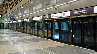
The Thomson–East Coast Line (TEL) is a medium-capacity Mass Rapid Transit (MRT) line in Singapore. Coloured brown on the rail map, it is fully underground and, when complete, will serve 32 stations over 43 kilometres (27 mi) in length, becoming one of the world's longest driverless rapid transit lines. It runs along a combined north–south and east–west corridor, starting in the north at Woodlands town, passing through Upper Thomson and the towns of Ang Mo Kio and Bishan, before heading south to Orchard Road and Marina Bay, then running eastwards along the east coast through Kallang, Marine Parade and Bedok South, before ending at Upper East Coast.

One Marina Boulevard, sometimes called NTUC Centre, is a 32-storey, 110 m (360 ft) skyscraper at 1 Marina Boulevard, in the zone of Raffles Place and Marina Bay, in the central business district of Singapore. The building is near other skyscrapers, such as One Raffles Quay, The Sail @ Marina Bay and Ocean Building, all of which are around 100 metres away. It has a direct link to Raffles Place MRT station via an air-conditioned underground mall.

Marina South MRT station is a future underground Mass Rapid Transit station on the Thomson-East Coast Line situated along the boundary of the planning areas of Straits View and Marina South, Singapore. It will be located near Marina South Pier and is within walking distance to Marina South Pier station.
Marine Parade Public Library is a public library in Marine Parade, Singapore. It is co-located with Marine Parade Community Club at Marine Parade Community Building. It is currently the only public library that is not located near any MRT station before it enhances connectivity to Marine Parade MRT station on the Thomson–East Coast line when it opens in 2023. It is the first public library owned by the National Library Board to be located inside a community building.

Seah Kian Peng is a Singaporean politician. A member of the country's governing People's Action Party (PAP), he is the CEO of NTUC Fairprice.


