
Geylang is a planning area and township located on the eastern fringe of the Central Region of Singapore, bordering Hougang and Toa Payoh in the north, Marine Parade in the south, Bedok in the east, and Kallang in the west.

Punggol, alternatively spelled as Ponggol, is a planning area and new town situated on the Tanjong Punggol peninsula in the North-East Region of Singapore. The town directly borders Sengkang to the south and shares riverine boundaries with the planning area of Seletar to the west and Pasir Ris to the east. Bounding the town to the north and north-east is the Straits of Johor, with Coney Island included as a part of the Punggol planning area.

Pasir Ris is a planning area and residential town located in the East Region of Singapore. It is bordered by Tampines and Paya Lebar to the south, Sengkang to the southwest and Changi to the east. The planning area also shares riverine boundary with Punggol to the west, separated by the Serangoon River, as well as having a maritime boundary with the North-Eastern Islands planning area, across the Straits of Johor.

Kallang is a planning area and residential town located in the Central Region of Singapore.

Tampines is a planning area and residential town in the geographical region of Tanah Merah located along the south-eastern coast of the East Region of Singapore. The planning area is bordered by Bedok and Paya Lebar to the west, Pasir Ris to the north, Changi to the east and the Singapore Straits to the south. Tampines New Town is located in the northern portion of Tampines planning area. Tampines is the third largest new town in Singapore by area, covering over 2089 hectares of land and also is the third most populated new town, following Bedok and Jurong West. It is the regional centre for the East Region.

The Tampines Expressway is a highway in the north-eastern fringe of Singapore, joining the Pan Island Expressway (PIE) near Singapore Changi Airport in the east with the Central Expressway (CTE) and Seletar Expressway (SLE) in the north of the island.
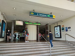
Tampines MRT station is a Mass Rapid Transit interchange station on the East West and Downtown lines in Tampines, Singapore. The station is situated at the heart of the Tampines Town Centre next to Tampines Avenue 4, Tampines Central 4 and Tampines Central 5, within the proximity of Tampines Bus Interchange and Tampines Concourse Bus Interchange. It is one of five Singapore MRT stations that interchanges between an elevated and underground line.

Siglap is a neighbourhood located in Bedok in the East Region of Singapore. The area also encompasses the Frankel and Opera Estates and their names have sometimes been used interchangeably to refer to the approximate same area. The planning subzone area of Siglap as defined by the Urban Redevelopment Authority (URA) is confusingly and inaccurately referred to as the small strip of land between Victoria Junior College and Bedok South Avenue 1. It is a residential area where a majority live in landed homes such as freehold semi-detached houses and bungalows. Some of the land parcels near Siglap Centre have been redeveloped into serviced apartments and condominiums. The few Housing and Development Board flats in Siglap have been demolished in 2015 under the Selective En bloc Redevelopment Scheme. The East Coast Park is also located nearby, across the East Coast Parkway.

Sengkang is a planning area and residential town located in the North-East Region of Singapore. The town is the second most populous in the region, being home to 244,600 residents in 2019. Sengkang shares boundaries with Seletar and Punggol in the north, Pasir Ris and Paya Lebar in the east, Hougang and Serangoon to the south, as well as Yishun and Ang Mo Kio to the west.

Riviera MRT/LRT station is an LRT station on the Punggol LRT line (PGLRT) East Loop in Singapore, located at Punggol East between the junctions of Punggol Central and Punggol Field near Punggol East Container Park. It was opened on 29 January 2005 together with the Sengkang LRT West Loop.

Buangkok is a neighbourhood located in north eastern Singapore. Whilst its boundaries are vague, the neighbourhood is roughly spread across the Trafalgar and Compassvale subzones of the Hougang and Sengkang Planning Areas respectively, as designated by the URA.

Sungei Serangoon is a river in the north-eastern part of Singapore. The 8-kilometre river starts as a canal near Tampines Road, and flows through Hougang, where it is joined by tributary Sungei Pinang just before Sengkang, before flowing towards Lorong Halus, where it is joined by another tributary Sungei Blukar, before emptying into the Serangoon Harbour. The river is also known as the Serangoon Estuary. Since 2011, the river has been converted into a reservoir - Serangoon Reservoir.
Singapore has about 65 species of mammals, 390 species of birds, 110 species of reptiles, 30 species of amphibians, more than 300 butterfly species, 127 dragonfly species, and over 2,000 recorded species of marine wildlife.

The Western Water Catchment is a planning area located in the West Region of Singapore. The planning area borders Tuas and Pioneer to its south, Sungei Kadut, Choa Chu Kang and Tengah to its east, Jurong West to its southeast, Lim Chu Kang to its north and the Straits of Johor to its west.
CPG Corporation is one of the leading providers of infrastructure, building management and consultancy services in Asia Pacific.

Loyang is a subzone region located in the town of Pasir Ris in the East Region of Singapore. The region consists of three subzones, Loyang West, Loyang East and Flora Drive. The name means brass or tray in Malay.

Kaki Bukit is an industrial area located in Bedok in the East Region of Singapore. It is home to many high tech industrial companies and warehouses. There used to be a prison complex called Kaki Bukit Centre, which was converted to a prison school in 2000, however it has since moved to Tanah Merah and the Acacia Welfare Home now stands in its place. On the south of Kaki Bukit is Jalan Tenaga and Jalan Damai neighbourhoods of Bedok Reservoir Road. Redevelopments are in the pipeline for Kaki Bukit beyond 2030 when Paya Lebar Airbase located just north of the estate relocates to Changi. Not only would land be freed up for use but building height restrictions, that are currently in place for safety reasons because the estate is directly aligned with the airbase runway, would also be lifted. Kaki Bukit is classified by Urban Redevelopment Authority (URA) as a subzone under the planning area of Bedok, its boundaries differ from the constituency boundaries used by the Singapore Parliament.

Punggol MRT/LRT station is a Mass Rapid Transit (MRT) and Light Rail Transit (LRT) interchange station in Punggol, Singapore. It is currently an interchange between the North East line (NEL) and Punggol LRT (PGLRT), and the only MRT station located within Punggol planning area, located near Punggol Temporary Bus Interchange and Waterway Point along Punggol Central.

Kampong Bugis is a subzone within the planning area of Kallang, Singapore, as defined by the Urban Redevelopment Authority (URA). This subzone is bounded by Kallang Road and Sims Avenue in the north; the Kallang–Paya Lebar Expressway (KPE) and Sims Way in the east; Nicoll Highway in the south; and Crawford Street in the west.
