
The Central Region is one of the five regions in the city-state of Singapore and the main metropolitan region surrounding the Central Area. Comprising 13,150 hectares of land area, it includes 11 planning areas within the Central Area, as well as another 11 more outside it. The region is home to many of Singapore's national monuments as it was historically the site where the city was first founded and the country's only UNESCO World Heritage Site, the Singapore Botanic Gardens, a 163-year-old tropical garden is also located in the region.

Singapore is a very small, heavily urbanised, island city-state in Southeast Asia, located at the end of the Malayan Peninsula between Malaysia and Indonesia. Singapore has a total land area of 724.2 square kilometres (279.6 sq mi).

Bukit Panjang, often abbreviated as Bt Panjang, is a planning area and residential town located in the West Region of Singapore. A portion of this town is situated on a low-lying elongated hill. The planning area is bounded by Bukit Batok to the west, Choa Chu Kang to the northwest, Sungei Kadut to the north, the Central Water Catchment to the east and Bukit Timah to the south. Bukit Panjang New Town is located at the northern portion of the planning area. Bukit Panjang has an average elevation of 36m/118 ft.

Queenstown is a planning area and satellite residential town situated on the south-westernmost fringe of the Central Region of Singapore. It borders Bukit Timah to the north, Tanglin to the northeast, Bukit Merah to the east and southeast, as well as Clementi to the northwest and west. Its southern and southwesternmost limits are bounded by the Pandan Strait.
Toa Payoh is a planning area and matured residential town located in the northern part of the Central Region of Singapore. Toa Payoh planning area borders Bishan and Serangoon to the north, the Central Water Catchment to the northwest, Kallang to the south, Geylang to the southeast, Novena to the west and Hougang to the east. Toa Payoh New Town is situated in the eastern portion of the Toa Payoh planning area. The latter occupies a much larger area, encompassing estates such as Potong Pasir and Bidadari.

Bedok is a planning area and matured residential town located in the geographical region of Tanah Merah along the south-eastern coast of the East Region of Singapore. Population wise, Bedok is the largest planning area in the Republic, being home to approximately 280,000 residents. This high demographic is largely explained by the affordable public housing in Bedok New Town, due to its relatively distant location from the Central Area. Besides public housing developments, private residences are also prevalent in the area, most of which are found in the neighbourhoods of Bayshore, Frankel Avenue and Siglap, in western and southwestern Bedok. Apart from the maritime boundary that the area shares with the Singapore Strait to the south and southeast, Bedok is also bounded by five other planning areas: Paya Lebar to the north, Hougang to the northwest, Tampines to the northeast and east, Geylang to the west and Marine Parade to the southwest.
Bukit Merah, often abbreviated as Bt Merah, is a planning area and new town situated in the southernmost part of the Central Region of Singapore. The planning area borders Tanglin to the north, Queenstown to the west and the Downtown Core, Outram and Singapore River planning areas of the Central Area to the east. Bukit Merah also shares a maritime boundary with the Southern Islands planning area located beyond its southernmost point. Bukit Merah is the most populated planning area in the Central Region, and the 12th most populated planning area in the country overall, being home to more than 150,000 residents.

Boon Lay is a neighbourhood located in the town of Jurong West in the West Region of Singapore. Its borders very roughly correspond to the URA subzone of Boon Lay Place, situated within the Jurong West Planning Area.

The Battle of Pasir Panjang, which took place between 12 and 15 February 1942, was part of the final stage of the Empire of Japan's invasion of Singapore during World War II. The battle was initiated upon the advancement of elite Imperial Japanese Army forces towards Pasir Panjang Ridge on 13 February.
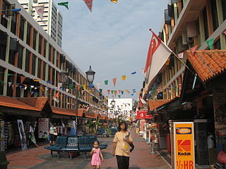
Telok Blangah is a subzone region and housing estate located in the area behind Keppel Harbour in Bukit Merah, Singapore. Teluk Blanga is the district between Pasir Panjang and Tanjong Pagar.

The Central Area, also called the City Area, and informally The City, is the city centre of Singapore. Located in the south-eastern part of the Central Region, the Central Area consists of eleven constituent planning areas: the Downtown Core, Marina East, Marina South, the Museum Planning Area, Newton, Orchard, Outram, River Valley, Rochor, the Singapore River and Straits View, as defined by the Urban Redevelopment Authority. The term Central Business District (CBD) has also been used to describe most of the Central Area as well, although its boundaries lie within the Downtown Core.

Labrador Park MRT station is an underground Mass Rapid Transit (MRT) station on the Circle line, located within Bukit Merah planning area, Singapore.

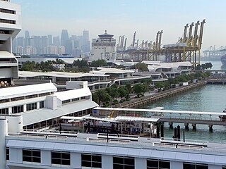
Mount Faber, formerly Telok Blangah Hill, is a hill about 94 metres (308 ft) in height, located in the town of Bukit Merah in the Central Region of Singapore. It overlooks the Telok Blangah area, and the western parts of the Central Area. The summit is accessible by Mount Faber Road or Mount Faber Loop via Morse Road, but there are many footpaths or trails leading up the hill. The main paths are: Marang Trail which leads from Marang Road at the Harbourfront MRT station and the Southern Ridges Park Connector which connects from Telok Blangah Hill Park, Kent Ridge Park and Henderson Waves.

Tanglin is a planning area located within the Central Region of Singapore. Tanglin is located west of Newton, Orchard, River Valley and Singapore River, south of Novena, east of Bukit Timah, northeast of Queenstown and north of Bukit Merah.
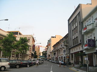
Bukit Pasoh Road is a road in Tanjong Pagar within the Outram Planning Area of Singapore. The road starts from Neil Road which is one way, but becomes two ways, when the road forks out into two parts, with one becoming Teo Hong Road, with both roads ending at New Bridge Road. The road is mainly lined with conserved shophouses and houses a high-end boutique hotel known as the New Majestic Hotel.
Jalan Bukit Merah is a major arterial road in Singapore. The road starts from the junction of Alexandra Road and Queensway in the west before ending at the junction of Kampong Bahru Road.
Bukit Ho Swee is a subzone within the planning area of Bukit Merah, Singapore, as defined by the Urban Redevelopment Authority (URA). Its boundary is made up of the Alexandra Canal in the north; Kim Seng Road and Outram Road in the east; Zion Road and Jalan Bukit Ho Swee in the south; Delta Road and Lower Delta Road in the west.
Bukit Purmei is a small housing estate within Bukit Merah planning area in Singapore, near Telok Blangah estate. Bukit Purmei consists of 15 HDB blocks, private apartments and landed property.
Yuhua is a subzone region located in the town of Jurong East, Singapore. Yuhua comprises two subzones, Yuhua East and Yuhua West. The area's HDB flats are under the management of Jurong-Clementi Town Council and the people of this precinct are represented in parliament by either Grace Fu or Rahayu Mahzam, depending on where they stay.
Everton Park is a subzone within the planning area of Bukit Merah, Singapore, as defined by the Urban Redevelopment Authority (URA). Its boundary is made up of New Bridge Road and Eu Tong Sen Street in the north; Kampong Bahru Road in the west; the Ayer Rajah Expressway (AYE) in the south; and Cantonment Road in the east.
