Buangkok

Last updated

Buangkok
Neighbourhood of Sengkang and Hougang Planning Area &
Housing Estate
Name transcription(s)
   Chinese 万国(Simplified)
萬國(Traditional)
Wànguó(Pinyin)
Bān-kok(Hokkien POJ)
Buāng-kok(Teochew PUJ)
   Malay Buangkok
   Tamil புவாங்கோக்
Puvāṅkōk(Transliteration)
Country Singapore
Buangkok includes public housing estates in the southern portion of Compassvale in Sengkang New Town. Buangkok 8, Compassvale, Sep 06.JPG
Buangkok includes public housing estates in the southern portion of Compassvale in Sengkang New Town.

Buangkok is a neighbourhood located in north eastern Singapore. The neighbourhood roughly encompasses the Trafalgar [1] and Compassvale subzones of the Hougang and Sengkang Planning Areas respectively, as designated by the URA. [2]

Contents

Etymology

The namesake road Lorong Buangkok was named Buangkok, meaning "ten thousand countries", after the rubber plantation company Singapore United Rubber Plantations Limited's Chinese name "Multi Nations" (万国) in Teochew. [3] In 1967, a track off Lorong Buangkok was named Lorong Buangkok Kechil.

History

Chinese farmers settled on the land in this vicinity in the early twentieth century. The land belonged partly to the state and partly to Singapore United Rubber Plantation Limited.

When Sengkang was developed in the late 1990s, a large section of Lorong Buangkok was removed for the development of the new town. Today, Lorong Buangkok is truncated into two sections one located at the west end of Buangkok with its entrance near Yio Chu Kang Road, and the other much shorter section located within Sengkang near Punggol Road.

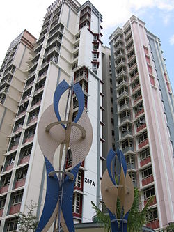
Buangkok was once filled and overcrowded by kampongs and villages. These were cleared between 2005 and 2009. The last kampong, Kampong Lorong Buangkok is the only remaining village and is conserved.

Buangkok Drive is a road that was completed in the second half of 1999 from Buangkok Green to Punggol Road, as the road shortens the travel drive from Ang Mo Kio Avenue 5 to Punggol Road. [4] The second section was opened all the way to Upper Serangoon Road in December 2001 together with the extension of Upper Serangoon Road all the way to Punggol East which was opened in 2002. Buangkok East Drive was subsequently opened on 22 March 2009, all the way to the Tampines Road. Yet another Buangkok Drive extension, from Buangkok Green to Buangkok Link started construction in 2017, and was opened on 25 August 2019. The final extension from Buangkok Link to Yio Chu Kang Road has also started construction, and will be completed at an unknown date in the near future. Construction of the road began in 2024.

Transportation

Buangkok MRT station (NE15) on the North East line of the Singapore MRT serves the residents of Buangkok. It was opened on 15 January 2006. The station is served by bus services 27, 43, 43e, 43M, 102 and 114. In addition, bus services 101 and 329 enters the western part of Buangkok, with bus services 43, 43M, 88, 109, 156, 159, 161, 325, 575, 660, 672 and 729 passing by. Bus service 329 was introduced on 9 July 2017. [5]

A new bus interchange, [6] which is part of a mixed, integrated development called Sengkang Grand Residences & Mall, [7] is being built at the empty field in front of Compassvale Ancilla Park, is due to be completed by 2024.

Buangkok, panorama, Aug 06.jpg
Panoramic view of new apartment blocks being built in Buangkok in Hougang Town.

Amenities

Shopping

Parks

Sources

  1. "Singapore's Hougang Planning Area". Key Location. Archived from the original on 12 May 2021. Retrieved 18 November 2017.
  2. "SingStat – Planning Areas/Subzones in Singapore (Year 2016)" (PDF). SingStat. Archived from the original (PDF) on 8 September 2017. Retrieved 17 August 2017.
  3. Ng Yew Peng (28 September 2017). What's In The Name? How The Streets And Villages In Singapore Got Their Names. World Scientific. p. 293. ISBN   978-981-322-147-5.
  4. Buangkok Green and Buangkok Drive were completed in the second half of 1999. They shorten the drive from the Central Expressway near Ang Mo Kio Avenue 5 to Punggol Road: Karamjit Kaur (21 December 1999). "New roads cut down travel time". The Straits Times . p. 40.
  5. "Welcome to SBS Transit". www.sbstransit.com.sg. Retrieved 18 November 2017.
  6. "North East Region, where the familiar meets the future" . Retrieved 19 October 2021.
  7. "Buangkok residents get a first look at plans for new complex with community club, mall and private homes" . Retrieved 18 October 2021.
  8. Matt Jamil (16 September 2023). Buangkok Forest | Hiking Vlog – Ep 2 . Retrieved 2 June 2024 via YouTube.
  9. Adventures of Baby Crab and Tilapia (11 September 2021). buangkok forest – adventures of baby crab and tilapia . Retrieved 2 June 2024 via YouTube.
  10. Follow My Compass (15 June 2022). Hiking in Singapore||Buangkok Forest . Retrieved 2 June 2024 via YouTube.

Related Research Articles

<span class="mw-page-title-main">Ang Mo Kio</span> Planning Area and HDB Town in Singapore

Ang Mo Kio is a planning area and residential town situated in the North-East region of Singapore. Located approximately 11 km (6.8 mi) north of the Downtown Core district, Ang Mo Kio is the 3rd most populated planning area in the North-East region and ranks 8th in terms of population in the country overall. The planning area is located at the south-western corner of the North-East region, bordered by the planning areas of Yishun to the north, Sengkang to the north-east, Serangoon to the east, Bishan to the south and the Central Water Catchment to the west.

<span class="mw-page-title-main">Punggol</span> Planning Area and HDB Town in North-East Region ----, Singapore

Punggol is a planning area and new town situated on the Tanjong Punggol peninsula in the North-East Region of Singapore. The town directly borders Sengkang to the south and shares riverine boundaries with the planning area of Seletar to the west and Pasir Ris to the east. Bounding the town to the north and north-east is the Straits of Johor, with Coney Island included as a part of the Punggol planning area.

<span class="mw-page-title-main">Pasir Ris</span> Planning Area and HDB Town in East Region ----, Singapore

Pasir Ris is a planning area and residential town located in the East Region of Singapore. It is bordered by Tampines and Paya Lebar to the south, Sengkang to the southwest and Changi to the east. The planning area also shares riverine boundary with Punggol to the west, separated by the Serangoon River, as well as having a maritime boundary with the North-Eastern Islands planning area, across the Straits of Johor.

<span class="mw-page-title-main">Kallang</span> Planning Area and HDB Town in Central Region ----, Singapore

Kallang is a planning area and residential zone located in the Central Region of Singapore.

<span class="mw-page-title-main">Serangoon</span> Planning Area and HDB Town in North-East Region ----, Singapore

Serangoon is a planning area and residential town located in the North-East Region of Singapore.

<span class="mw-page-title-main">Hougang</span> Planning Area and HDB Town in North-East Region ----, Singapore

Hougang is a planning area and mature residential town located in the North-East Region of Singapore. It is the largest housing estate in Singapore based on land area, and is home to 247,528 residents as of 2018. Hougang planning area is bordered by Sengkang to the north, Geylang and Serangoon to the south, Bedok to the southeast, Toa Payoh to the southwest, and Paya Lebar to the east.

<span class="mw-page-title-main">Seletar</span> Planning Area and Regional Centre in North-East Region ----, Singapore

Seletar is an area located in the north-east of Singapore. Its name can also refer to the Seletar Planning Area, situated in the North-East Region of Singapore. The place name was derived from the Malay subgroup who were indigenous to the area, the Orang Seletar. It shares boundaries with the planning areas of Sengkang to the south, Punggol to the east, Yishun and Simpang to the west, as well as the Straits of Johor to the north.

The Ang Mo Kio Police Division is one of the seven land divisions of the Singapore Police Force. It was first established in 1965. It was previously located in Paya Lebar. In 1987, the division HQ moved to its present location to better serve the public and meet its operational needs. Ang Mo Kio Division serves a residential population of over 1.1 million residents. Ang Mo Kio Division’s area of coverage includes mature housing estates such as Ang Mo Kio, Hougang and Serangoon. It also oversees young but rapidly-developing residential estates like Sengkang and Punggol.

<span class="mw-page-title-main">Punggol Temporary Bus Interchange</span> Temporary bus interchange in Punggol, Singapore

Punggol Temporary Bus Interchange is a temporary bus interchange in Punggol New Town, Singapore, located adjacent to the Punggol MRT/LRT station. It was built to allow for easy dismantling when the site is redeveloped as part of a major commercial development when Punggol New Town is more developed. The bus interchange was officially opened on 30 November 2003.

Compassvale is a neighbourhood of Sengkang New Town, and is located between Rivervale and Anchorvale. Compassvale encompasses the Sengkang Town Centre.

<span class="mw-page-title-main">Rivervale, Singapore</span> Place in Sengkang Planning Area, Singapore

Rivervale is a neighbourhood of Sengkang New Town located between Sungei Serangoon and Compassvale. The block numbers of the public apartment blocks in Rivervale begin with the number '1' (1xx). Rivervale was the first neighbourhood of Sengkang New Town to be built, and many of the existing housing estates in Rivervale were completed by the Housing and Development Board (HDB) as early as 1997.

<span class="mw-page-title-main">Fernvale, Singapore</span> Place in Singapore

Fernvale is a neighbourhood of Sengkang New Town in Singapore. It is located between Sungei Punggol and the proposed Sengkang West Industrial Estate. The house numbers of the public apartment blocks in Fernvale begin with the number '4' (4xx). Fernvale is the newest neighbourhood in Sengkang Town to be completed by the Housing and Development Board (HDB). Seletar Mall, a new shopping amenity which houses Sengkang's first cineplex, is located within this neighbourhood. In 2017, a proposed community facility to be located next to Seletar Mall was announced, which houses a community club, childcare centre, hawker centre and wet market. The community facility which was slated to be ready by the second half of 2020, had stopped construction in April 2020 due to the COVID-19 measures set by the government. Construction of the facility has since continued in the second half of 2020 and was completed in 2022.

<span class="mw-page-title-main">Sengkang</span> Planning Area and HDB Town in North-East Region ----, Singapore

Sengkang is a planning area and residential town located in the North-East Region of Singapore. The town is the second most populous in the region, being home to 249,370 residents in 2020. Sengkang shares boundaries with Seletar and Punggol in the north, Pasir Ris and Paya Lebar in the east, Hougang and Serangoon to the south, as well as Yishun and Ang Mo Kio to the west.

Cheng San Group Representation Constituency was a Group Representation Constituency (GRC) in the North-eastern region in Singapore. The GRC consisted of the eastern part of Ang Mo Kio, Jalan Kayu, Seletar Hills, part of Serangoon North, a large part of Hougang, Buangkok, and the whole of Sengkang New Town and Punggol New Town.

<span class="mw-page-title-main">North-East Region, Singapore</span> Region in Singapore

The North-East Region of Singapore is one of the five regions in the country. The region is the most densely populated and has the highest population among the five, with Sengkang being its most populous town as of 2020 and Seletar as the regional centre. Comprising 13,810 hectares, it includes seven planning areas and is largely a residential region with 217,120 homes. Housing largely consists of high-density HDB public housing estates, however private housing is also present in the region. As its name implies, it is located in the north-eastern part of Singapore.

<span class="mw-page-title-main">Kovan, Singapore</span> Place in Singapore

Kovan is a neighbourhood located within the town of Hougang, in Singapore. The neighbourhood today largely consists of private housing properties, where majority of the residents live in terrace homes, semi-detached houses and bungalows.

<span class="mw-page-title-main">Kampong Lorong Buangkok</span> Village in Singapore

Kampong Lorong Buangkok is a village located in Buangkok in Hougang, Singapore. Built in 1956, it is the last surviving kampong located on Singapore Island in the 21st century. It is situated right beside a canal that drains into the nearby Sungei Punggol.

<span class="mw-page-title-main">Lorong Chuan</span> Subzone of Serangoon Planning Area in Singapore

Lorong Chuan is a subzone and a precinct located in the town of Serangoon in the North-East Region of Singapore.

<span class="mw-page-title-main">North East Community Development Council</span>

The North East Community Development Council is one of five Community Development Councils (CDCs) set up across the Republic of Singapore to aid in local administration of governmental policies and schemes. They are funded in part by the government although they are free to engage in fund-raising activities.

References