Punggol is a planning area and new town situated on the Tanjong Punggol peninsula in the North-East Region of Singapore. The town directly borders Sengkang to the south and shares riverine boundaries with the planning area of Seletar to the west and Pasir Ris to the east. Bounding the town to the north and north-east is the Straits of Johor, with Coney Island included as a part of the Punggol planning area.

Pasir Ris is a planning area and residential town located in the East Region of Singapore. It is bordered by Tampines and Paya Lebar to the south, Sengkang to the southwest and Changi to the east. The planning area also shares riverine boundary with Punggol to the west, separated by the Serangoon River, as well as having a maritime boundary with the North-Eastern Islands planning area, across the Straits of Johor.

Yishun, formerly known as Nee Soon, is a residential town located in the northeastern corner of the North Region of Singapore, bordering Simpang and Sembawang to the north, Mandai to the west, the Central Water Catchment to its southwest, Ang Mo Kio to its south, as well as Seletar and Sengkang to its east and southeast respectively.

The Sengkang LRT is a 10.7-kilometre (6.6 mi) automated guideway transit line in Singapore. The line, which initially opened on 18 January 2003, connects the residential districts and suburbs of Sengkang to Sengkang Town Centre, where it connects with the North East MRT line, Sengkang Bus Interchange, Compass One and Compassvale Bus Interchange. It is the second line of the LRT system in Singapore and like all other LRT lines, it is fully elevated and uses automated trains. It is the first LRT line to be operated by SBS Transit.
Subang Jaya is a city in Petaling District, Selangor, Malaysia. It comprises the southern third district of Petaling. It consists of the neighbourhoods from SS12 to SS19, UEP Subang Jaya (USJ), Putra Heights, Batu Tiga as well as PJS7, PJS9 and PJS11 of Bandar Sunway, the latter of which are partially jurisdictional within Petaling Jaya under the MBPJ. The city is governed by Subang Jaya City Council (MBSJ), which also governs other areas of the Petaling district, such as Puchong and Seri Kembangan. According to Subang Jaya City Council, Subang Jaya has a population of 968,930 in 2020, which makes it the sixth largest city in Malaysia by population.

The Light Rail Transit system, locally known by the initialism LRT, are a series of localised automated guideway transit (AGT) systems in Singapore which acts as feeder services to the heavy rail Mass Rapid Transit (MRT), and together forms the core of the country's rail transport services. The first LRT line was opened in 1999 and the system has since expanded to two lines, each serving three new towns, namely Bukit Panjang, Sengkang and Punggol, with a total system length of approximately 30 km (19 mi). Trains on these lines have at least one station interchange link to the MRT.
Bukit Merah, also known as Redhill, is a planning area and new town situated in the southernmost part of the Central Region of Singapore. The planning area borders Tanglin to the north, Queenstown to the west and the Downtown Core, Outram and Singapore River planning areas of the Central Area to the east. It also shares a maritime boundary with the Southern Islands planning area to the south. Bukit Merah is linked to Sentosa Island via Sentosa Gateway, Sentosa Broadwalk, Sentosa Express and the Cable Car.
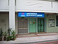
Compassvale is a neighbourhood of Sengkang New Town, and is located between Rivervale and Anchorvale. Compassvale encompasses the Sengkang Town Centre.
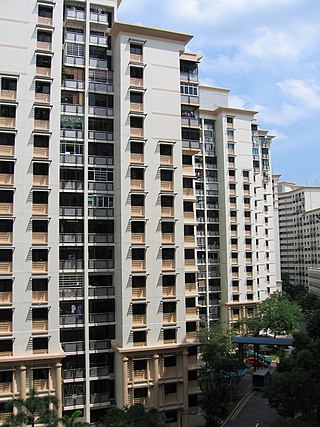
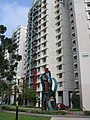
Rivervale is a neighbourhood of Sengkang New Town located between Sungei Serangoon and Compassvale. The block numbers of the public apartment blocks in Rivervale begin with the number '1' (1xx). Rivervale was the first neighbourhood of Sengkang New Town to be built, and many of the existing housing estates in Rivervale were completed by the Housing and Development Board (HDB) as early as 1997.
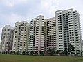
Fernvale is a neighbourhood of Sengkang New Town in Singapore. It is located between Sungei Punggol and the proposed Sengkang West Industrial Estate. The house numbers of the public apartment blocks in Fernvale begin with the number '4' (4xx). Fernvale is the newest neighbourhood in Sengkang Town to be completed by the Housing and Development Board (HDB). Seletar Mall, a new shopping amenity which houses Sengkang's first cineplex, is located within this neighbourhood. In 2017, a proposed community facility to be located next to Seletar Mall was announced, which houses a community club, childcare centre, hawker centre and wet market. The community facility which was slated to be ready by the second half of 2020, had stopped construction in April 2020 due to the COVID-19 measures set by the government. Construction of the facility has since continued in the second half of 2020 and was completed in 2022.

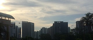
Sengkang is a planning area and residential town located in the North-East Region of Singapore. The town is the second most populous in the region, being home to 249,370 residents in 2020. Sengkang shares boundaries with Seletar and Punggol in the north, Pasir Ris and Paya Lebar in the east, Hougang and Serangoon to the south, as well as Yishun and Ang Mo Kio to the west.

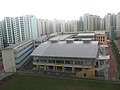
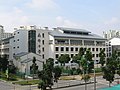
Sengkang Community Hub is an amenity centre in Sengkang, within the North-East Region of Singapore.

Bandar Baru Selayang is the capital of Gombak District, Selangor, Malaysia. The capital moved from Rawang to Bandar Baru Selayang in 1997. The capital is named after Selayang, a town located 2 km southeast of Selayang Newtown.

The North-East Region of Singapore is one of the five regions in the country. The region is the most densely populated and has the highest population among the five, with Sengkang being its most populous town as of 2020 and Seletar as the regional centre. Comprising 13,810 hectares, it includes seven planning areas and is largely a residential region with 217,120 homes. Housing largely consists of high-density HDB public housing estates, however private housing is also present in the region. As its name implies, it is located in the north-eastern part of Singapore.

Kovan is a neighbourhood located within the town of Hougang, in Singapore. The neighbourhood today largely consists of private housing properties, where majority of the residents live in terrace homes, semi-detached houses and bungalows.

Batu Caves is a mukim and town in Gombak District, Selangor, Malaysia. Named after the limestone caves and Hindu shrine Batu Caves, the town is experiencing an increase in residences due to a housing boom in the center of the city.

Punggol MRT/LRT station is a Mass Rapid Transit (MRT) and Light Rail Transit (LRT) interchange station in Punggol, Singapore. It is an interchange station between the North East Line (NEL) and Punggol LRT (PGLRT), and the only MRT station located within Punggol planning area. Stretching across Punggol Central, the station is situated next to Punggol Temporary Bus Interchange and the retail development of Waterway Point.

Sengkang MRT/LRT station is a Mass Rapid Transit (MRT) and Light Rail Transit (LRT) interchange station in Sengkang, Singapore. It is an interchange between the North East line (NEL) and Sengkang LRT (SKLRT). Along with Buangkok station, it is located within the Sengkang planning area.
Sekolah Jenis Kebangsaan (Cina) Katholik, is a state primary school located at Gajah Berang Road in Malacca City. The school was initially established at Lorong Pandan.