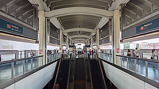
The North–South Line (NSL) is a high-capacity Mass Rapid Transit (MRT) line in Singapore, operated by SMRT Corporation. Coloured red on the Singapore rail map, the line is 45 kilometres (28 mi) long and serves 27 stations, 11 of which, between the Bishan and Marina South Pier stations, are underground. It runs from Jurong East station, located in Western Singapore, to Marina South Pier station in the Central Area, via Woodlands station in northern Singapore. The line operates for almost 20 hours a day, with headways of up to 1 to 2 minutes during peak hours and 5 to 8 minutes during off-peak hours. All the trains on the North-South Line run with a six-car formation.

Ang Mo Kio is a planning area and residential town situated in the North-East of Singapore. Located approximately 11 km (6.8 mi) north of the Downtown Core district, Ang Mo Kio is the 3rd most populated planning area in the North-East Region and ranks 8th in terms of population in the country overall. The planning area is located at the south-western corner of the North-East Region, bordered by the planning areas of Yishun to the north, Sengkang to the north-east, Serangoon to the east, Bishan to the south and the Central Water Catchment to the west.

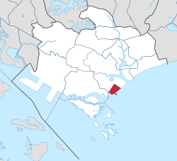
Kallang is a planning area and residential zone located in the Central Region of Singapore.
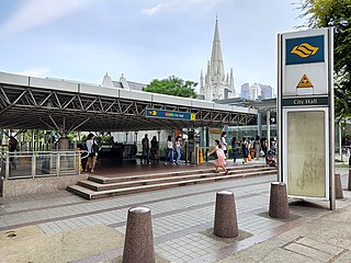
City Hall MRT station is an underground Mass Rapid Transit (MRT) interchange station on the North South line (NSL) and East West line (EWL). Situated in the Downtown Core district of Singapore, it is underneath Stamford Road near the road junctions with North Bridge Road and St Andrew's Road. The station is near landmarks such as the City Hall, Raffles City, the Padang, St Andrew's Cathedral and The Cenotaph.

Raffles Place MRT station is an underground Mass Rapid Transit (MRT) interchange station on the North South Line (NSL) and East West Line (EWL) in Singapore. Located in the Downtown Core, the station is underneath Raffles Place, the centre of Singapore's financial district, south of the Singapore River. The station serves various landmarks including Merlion Park and the Asian Civilisations Museum and various commercial buildings such as One Raffles Place and OCBC Centre.

Outram Park MRT station is an underground Mass Rapid Transit (MRT) interchange station on the East West, North East and Thomson-East Coast lines located on the boundary of Bukit Merah and Outram planning areas, Singapore, near the junction of Outram Road, Eu Tong Sen Street and New Bridge Road. It is the nearest MRT station to the Singapore General Hospital, Police Cantonment Complex, Outram Community Hospital and the Health Promotion Board.

Marina Bay MRT station is an underground Mass Rapid Transit (MRT) interchange station on the North South (NSL), Circle (CCL) and Thomson–East Coast (TEL) lines in Singapore. Located in the Downtown Core district near Marina Bay, the station serves the Marina One Residences, Marina Bay Suites and the Marina Bay Financial Centre.

The Singapore River is a river that flows parallel to Alexandra Road and feeds into the Marina Reservoir in the southern part of Singapore. The immediate upper watershed of the Singapore River is known as the Singapore River Planning Area, although the western part of the watershed is classified under the River Valley planning area.

Marina Bay is a bay located in the Central Area of Singapore, surrounded by the perimeter of four other planning areas, the Downtown Core, Marina East, Marina South and Straits View. The area surrounding the bay itself, also called Marina Bay, is a 360 hectare extension to the adjacent Central Business District. It is also the new downtown of Singapore, built on reclaimed land.

The Downtown Core is the historical and downtown centre of the city-state of Singapore and the main commercial area in Singapore excluding reclaimed lands with many integrated resorts such as the Marina Bay Sands, one of the most expensive buildings in the world, with a luxurious standalone casino at Bayfront Avenue. There are many skyscrapers in Raffles Place, Tanjong Pagar and Marina Bay CBD with a height limit of 280m. It is one of the eleven planning areas located within the most urbanised Central Area, forming the latter's dense urban core. It is bounded by Rochor to the north, Kallang to the northeast, Marina East and Marina South to the east, Straits View to the southeast, Bukit Merah to the south, as well as Outram, Museum and Singapore River to the west.

Promenade MRT station is an underground Mass Rapid Transit (MRT) interchange station on the Downtown (DTL) and Circle (CCL) lines in Downtown Core, Singapore. Located underneath Temasek Avenue and adjacent to Millenia Tower, the station is close to several key attractions and locations such as Suntec City and the Marina Promenade, which the station is named after. The station is at the junction of the Dhoby Ghaut and Marina Bay branches of the CCL.

The history of the Mass Rapid Transit (MRT) system of Singapore commenced with its planning in the 1960s, which finally led to its opening in 1987 with the launch of the 6 km section of the North South Line from Yio Chu Kang to Toa Payoh.

Downtown MRT station is an underground Mass Rapid Transit (MRT) station on the Downtown line (DTL) Located in Downtown Core, Singapore, underneath Central Boulevard, the station serves various commercial developments including the Marina Bay Financial Centre, Asia Square and SGX Centre. The station is operated by SBS Transit.

Marina South is a planning area located within the Central Area of the Central Region of Singapore. It is largely home to Gardens by the Bay as well as the Marina Barrage. The name has also been used to refer to the larger peninsula the planning area is situated on, which encompasses the planning areas of Straits View and a portion of the Downtown Core.

This article shows the notable future developments in Singapore. Majority of them are currently under construction with most to be completed within the next five years.

The Museum Planning Area is a planning area located in the Central Area of the Central Region of Singapore. The area plays a "bridging role" between the Orchard area and the Downtown Core, which necessitates proper transport networks for vehicles, pedestrians and public transport. Due to the sheer size of green areas in the district, the Urban Redevelopment Authority (URA) has designated it a 'green lung' in the Central Area. However, the Museum Planning Area is also home to cultural and commercial activities. Around 65% of the area is available for future development, making it a hotbed for new infrastructure and buildings.

Sungei Kadut is an industrial estate and planning area located in the North Region of Singapore. It is bounded by Bukit Panjang and Choa Chu Kang to the south, Mandai to the east, as well as Lim Chu Kang and the Western Water Catchment to the west. Its northern boundary is defined by the Straits of Johor. Sungei Kadut is divided into five subzones, namely Kranji, Turf Club, Gali Batu, Pang Sua and Reservoir View.

Marina South Pier MRT station is an underground Mass Rapid Transit (MRT) station in Straits View, Singapore, which is operated by SMRT Trains. Built as part of the 1-kilometre (0.62 mi) North South line (NSL) Extension, it is the southern terminus of the line. As the name suggests, the station is near the Marina South Pier and the Marina Bay Cruise Centre Singapore.

Crawford is a subzone within the planning area of Kallang, Singapore, as defined by the Urban Redevelopment Authority (URA). Its perimeter is made up of Rochor River and Rochor Canal in the north; Crawford Street, Nicoll Highway, Kallang Basin and Marina Channel in the east; East Coast Parkway (ECP) in the south; as well as Ophir Road, Beach Road and Jalan Sultan in the west.
Sungei Kadut MRT station is a future Mass Rapid Transit interchange station on the North South (NSL) and Downtown (DTL) lines, located in Sungei Kadut, Singapore. First announced as a provisional station on the NSL Woodlands Extension in the 1990s, plans for its construction was eventually confirmed in the Land Transport Master Plan (LTMP) 2040 by the Land Transport Authority (LTA).