Pioneer | |
|---|---|
| Other transcription(s) | |
| • Chinese | 先驱 |
| • Pinyin | Xiānqū |
| • Malay | Pioneer |
| • Tamil | பயனியர் |
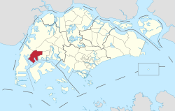 Location of Pioneer in Singapore | |
 Pioneer | |
| Coordinates: 1°18′55″N103°40′23″E / 1.31528°N 103.67306°E | |
| Country | |
| Region | West |
| Town Council |
|
| Constituencies | |
| Government | |
| • Mayors | South West CDC |
| • Members of Parliament | |
| Area | |
• Total | 12.1 km2 (4.7 sq mi) |
| Population (2025) [1] | |
• Total | 50 |
| • Density | 4.1/km2 (11/sq mi) |
| Ethnic groups | |
Pioneer is a planning area located in the West Region of Singapore, named after Pioneer Road. The area is bounded by Jurong West to the north, Boon Lay to the east, Tuas to the west, the Western Water Catchment to the northwest and Selat Jurong to the south. It contains several major industrial estates including Joo Koon, Benoi and Gul Circle, which form part of the larger Jurong Industrial Estate. Pioneer today comprises five subzones: Benoi Sector, Gul Basin, Gul Circle, Joo Koon and the Pioneer Sector itself.
.jpg)