Western Islands, Singapore

Last updated
Western Islands
Other transcription(s)
   Chinese 西部群岛
   Pinyin Xībù qúndǎo
   Malay Kepulauan Barat
   Tamil மேற்கத்திய தீவுகள்
Western Islands location.svg
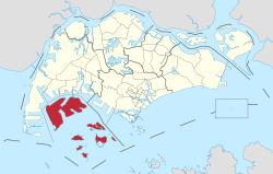
Location of Western Islands in Singapore
CountryFlag of Singapore.svg  Singapore
Region West
Government
  Mayors South West CDC
  Members of Parliament West Coast GRC
Area
  Total
39.47 km2 (15.24 sq mi)
Population
 (2024) [1]
  Total
10
  Density0.25/km2 (0.66/sq mi)
Ethnic groups

The Western Islands is a planning area located within the West Region of Singapore. It comprises a collection of islands located in the south-western waters of Singapore, namely Jurong Island, Pulau Bukom, and Sudong Islands. [2]

Contents

The Western Islands originally comprised 27 islands, once home to the native Malay islanders in the past. In the 1990s, the government decided to reclaim land to form one major island, called Jurong Island. It was subsequently formed from the amalgamation of several offshore islands, chiefly the seven main islands of Pulau Ayer Chawan, Pulau Ayer Merbau, Pulau Merlimau, Pulau Pesek Besar, Pulau Pesek Kechil, Pulau Sakra, Pulau Soraya, Pulau Hantu Besar, and Pulau Hantu Kechil.

The planning area is located on the Singapore Straits, with Tuas situated to its west, as well as Pioneer, Boon Lay, Jurong East and Queenstown to its north. Western Islands planning area also shares a maritime boundary with the Southern Islands to its east. It has three subzones, Jurong Island and Bukom, Semakau and Sudong.

Location

Although called 'Western Islands', the islands are not actually located on the west of the main island of Singapore. They are in fact located south-west of the main island. The islands are also relatively near to the Southern Islands.

Jurong Island

Jurong Island is the biggest and most important island among the Western Islands. It serves as the petroleum and petrochemical hub of the city-state, and it houses the third largest refining centre in the world. [3] Jurong Island is home to over 94 petroleum, petrochemical, specialty chemical and supporting companies with more than S$26 billion in fixed assets investment on Jurong Island. Multinational companies such as ExxonMobil and Shell have established a strong presence on Jurong Island. [4]

Jurong Island is linked to the main island by a 2.3 km causeway known as the Jurong Island Highway, opened in March 1999. Access to the island is restricted to persons who have a Jurong Island Security Pass. Other restrictions include that one must declare any photographic equipment that they are bringing to the island.

Related Research Articles

<span class="mw-page-title-main">Jurong</span> Commercial district and Regional centre in West Region, Singapore

Jurong is a major geographical region located at the south-westernmost point of the West Region of Singapore. Although mostly vaguely defined, the region's extent roughly covers the planning areas of Jurong East, Jurong West, Boon Lay, and Pioneer, along with Jurong Island in the Western Islands cluster and the southernmost portions of the Western Water Catchment. Should it be described at its greatest historical extent, the region can also include present-day Bukit Batok and Tuas.

<span class="mw-page-title-main">Jurong Island</span> Island in Singapore

Jurong Island is an island located to the southwest of the main island of Singapore. It was formed from the amalgamation of seven offshore islands, the islands of Pulau Ayer Chawan, Pulau Ayer Merbau, Pulau Merlimau, Pulau Pesek, Pulau Pesek Kechil, Pulau Sakra, Pulau Seraya, Pulau Meskol, Pulau Mesemut Laut, Pulau Mesemut Darat and Anak Pulau. This was done through Singapore's land reclamation efforts. Land reclamation on Jurong Island was completed on 25 September 2009, 20 years earlier than scheduled. Pulau Buaya was joined to Jurong Island via reclamation in 2010. Jurong Island forms a land area of about 32 km2 (12 sq mi) from an initial area of less than 10 km2 (4 sq mi), and is the largest of Singapore's outlying islands.

<span class="mw-page-title-main">Pulau Tekong</span> North-Eastern Island of Singapore

Pulau Tekong, also known colloquially as Tekong or Tekong Island, is the second-largest of Singapore's outlying islands after Jurong Island. Tekong is located off Singapore's northeastern coast, east of Pulau Ubin. Since the 1990s, the island has been used by the Singapore Armed Forces (SAF) and is generally restricted from public access. Transport to the island for permitted persons is via the SAF Changi Ferry Terminal at Changi Beach.

<span class="mw-page-title-main">Jurong Port</span> Singaporean Harbor

Jurong Port Pte Ltd is a port operator headquartered in Singapore. Jurong Port, which operates the only multi-purpose port in Singapore, handles bulk, break-bulk and containerised cargo. It handled over 40,000 vessel-calls annually in 2019.

Pulau Hantu is located to the south of the main island of Singapore, off the Straits of Singapore. Pulau Hantu is actually made up of two islets: Pulau Hantu Besar and Pulau Hantu Kechil, with a total area of 12.6 hectares. At low tide, it is possible to wade across the shallow lagoon between the two islands, but not at high tide.

<span class="mw-page-title-main">Jurong East</span> Planning Area and Regional Centre in West Region, Singapore

Jurong East is a planning area and residential town situated in the West Region of Singapore. It borders Jurong West and Boon Lay to the west, Clementi to the east, Tengah and Bukit Batok to the north and Selat Jurong to the south.

<span class="mw-page-title-main">Jurong West</span> Residential town in the West Region of Singapore

Jurong West is a planning area and residential town located in the West Region of Singapore. Jurong West shares boundaries with Tengah in the north, Jurong East in the east, Boon Lay and Pioneer in the south, and Western Water Catchment in the west.

<span class="mw-page-title-main">West Region, Singapore</span> Region in Singapore

The West Region of Singapore is one of the five regions in the city-state. The region is the largest in terms of land area and is the third most populous region after the North-East Region and Central Region. Jurong East is the regional centre of the region, with plans of developing the Jurong Lake District into a second CBD area. Jurong West is the most populous town in the region, with a population of 262,730 residents. Comprising 25,500 hectares of land area, it includes twelve planning areas and is home to about 922,540 residents.

Pulau Bukom, also known as Pulau Bukum, is a small restricted-access island belonging to Singapore that is located about five kilometres to the south of Mainland Singapore, off the Straits of Singapore. The size of Pulau Bukom is about 1.45 km2 (0.56 sq mi).

Pulau Sudong is a 209-hectare coral island off the southern coast of Singapore. It was enlarged through a land reclamation process during the late 1970s.

<span class="mw-page-title-main">West Coast Group Representation Constituency</span> Electoral ward in Singapore

The West Coast Group Representation Constituency is a five-member Group Representation Constituency (GRC) located in the western as well as the central area of Singapore. The five divisions consists: Ayer Rajah-Gek Poh, West Coast, Boon Lay, Nanyang and Telok Blangah managed by West Coast Town Council. West Coast GRC covers the areas of Ayer Rajah, Dover, Pasir Panjang, the south-western area, West Coast, Jurong, Jurong Island, Sentosa, Telok Blangah, Tuas and much of Singapore's southern & western territorial waters and offshore islands in the area. The current Members of Parliament for the constituency are Foo Mee Har, Desmond Lee, Ang Wei Neng and Rachel Ong from the People's Action Party (PAP) after the resignation of S. Iswaran.

Singapore has about 65 species of mammals, 390 species of birds, 110 species of reptiles, 30 species of amphibians, more than 300 butterfly species, 127 dragonfly species, and over 2,000 recorded species of marine wildlife.

Pulau Pawai, also known as Alligator Island during the colonial times, is a 182,000-square-metre (1,959,032-square-foot) island located within the Singapore Armed Forces Live Firing Area. It is located off the southwestern coast of Singapore, between Pulau Sudong to its north and Pulau Satumu to its south. It is one of the three islands owned by the Singapore Armed Forces for live firing exercises, the other two being Pulau Sudong and Pulau Senang.

<span class="mw-page-title-main">Pulau Senang</span> Place in Singapore

Pulau Senang is an 81.7-hectare (202-acre) coral island in the Republic of Singapore, located about 13 kilometres (8.1 mi) off the southern coast of Singapore Island. Along with Pulau Pawai to the north-west and Pulau Sudong, further north from Pulau Pawai, it is used as a military training area for live-fire exercises carried out by the Singapore Armed Forces (SAF).

<span class="mw-page-title-main">Shell Chemicals</span> Petrochemicals division of Shell plc

Shell Chemicals is the petrochemicals arm of Shell plc. The name "Shell Chemicals" refers to the nearly seventy companies engaged in chemicals businesses for Shell, which together make up one of the largest petrochemical producers in the world. The company has a wide range of products that include acetone, aromatics, ethylene oxide, ethylene glycols, alkenes, nonene, phenol, polyethylene, polyols, and solvents.

<span class="mw-page-title-main">Western Water Catchment</span> Planning area in Singapore

The Western Water Catchment is a planning area located in the West Region of Singapore. The planning area borders Tuas and Pioneer to its south, Sungei Kadut, Choa Chu Kang and Tengah to its east, Jurong West to its southeast, Lim Chu Kang to its north and the Straits of Johor to its west. It is the largest planning area by land area, covering nearly a tenth of Singapore Island. It is also one of the two main water catchments in Singapore, the other being Central Water Catchment.

Pulau Busing is a restricted-access island and a hub for oil shipping located off the southwestern coast of Singapore. The island is occupied by Tankstore Ltd, a petroleum storage company. Heavily industrialised, the island is home to oil and chemical storage facilities, at least one marine offshore terminal, and a fuel oil refinery.

<span class="mw-page-title-main">Jurong Island Highway</span> Road in Singapore

Jurong Island Highway is a major highway in Singapore which links Jurong Pier Road in Jurong Port of the main island to Jurong Island. It was opened in March 1999. It is also the only highway within Jurong Island.

<span class="mw-page-title-main">Jurong Road</span> Former road in western Singapore

Jurong Road was a road in western Singapore. It was the oldest road in Jurong area, having been first constructed between 1852 and 1853 during the early British colonial period to create a proper road link between the rural areas of Jurong and the rest of Singapore.

References

  1. "Statistics Singapore - Geographic Distribution - Latest Data" . Retrieved January 10, 2025.
  2. URA Planning Report - WATER CATCHMENT, LIM CHU KANG, TENGAH, NE & W ISD
  3. "Singapore : Jurong Island ( Developing an Integrated, World Class Petroleum & Petrochemical Hub )". Archived from the original on 2007-10-27. Retrieved 2007-12-27.
  4. "JTC Corporation - History of Jurong Island". Archived from the original on 2007-12-31. Retrieved 2007-12-27.