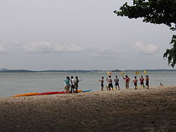
Geography | |
---|---|
Location | Southeast Asia |
Coordinates | 1°24′29″N104°03′21″E / 1.40806°N 104.05583°E |
Archipelago | Malay Archipelago |
Area | 25 [a] km2 (9.7 sq mi) |
Administration | |
Planning Area | North-Eastern Islands |
Demographics | |
Population | 8,000 |
Additional information | |
Transport SAF Changi Ferry Terminal Pulau Tekong Hot Spring Rocky Hill |
Pulau Tekong, also known colloquially as Tekong or Tekong Island, is the second-largest of Singapore's outlying islands after Jurong Island. Tekong is located off Singapore's northeastern coast, east of Pulau Ubin. Since the 1990s, the island has been used by the Singapore Armed Forces (SAF) and is generally restricted from public access. Transport to the island for permitted persons is via the SAF Changi Ferry Terminal at Changi Beach.
The original 25 km2 (6,178-acre) island has undergone extensive land reclamation works for military use on its southern and northwestern coasts subsuming many of its surrounding small islets, including the former 89-hectare (220-acre)Pulau Tekong Kechil (Small Tekong Island). When fully completed, the island is estimated to reach an area of about 75 km2 (18,530 acres). [1]
Pulau Tekong appears in the Franklin and Jackson's 1828 map as Po. Tukang. [2] The early name could have arisen because the island served as a trading station for both residents of Pulau Ubin and the state of Johor. Tukang means merchants in this case.
Tekong means "an obstacle", so-called because the island blocks the mouth of the Sungai Johor. Pulo Tekong Besar came under the Changi district, and the island had a sizeable population, being the largest island off Singapore and two miles from Fairy Point. Ferries plied from the pier at that point and the island daily. After 1920, it was mostly known for its rubber plantations.
The island was once home to 5000 inhabitants, the last of which moved out in 1987. 60 percent of the inhabitants were Chinese, out of which 70 percent were Hakkas and 30 percent were Teochews, and 40 percent were Malays. [3] [4] There were a few Indians as well.
The reason for Hakka being the majority of the Chinese population is that most of the Hokkien and Teochew businessmen already had flourishing businesses on the mainland. When the Hakkas arrived, they decided to make a living on an island less inhabited. Most were farmers, fishermen and shop owners selling sundry goods.
Wild pigs and deer were once plentiful on Pulau Tekong, and attracted hunters from Singapore. Pulo Tekong Besar had undergone so much development after World War II, with vegetable, fruit and poultry farms, that the wildlife has mostly disappeared.
On 29 May 1990, national servicemen spotted a family of three Indian elephants which had swum 1.5 km (0.9 mi) across the Straits of Johor. [5] The Singapore Zoo worked with the Malaysian Wildlife Department's Elephant Capture and Translocation Unit to help in its plan to recapture the runaway elephants. On 10 June, all three elephants were captured and relocated back to the jungles of Johor.
In March 2004, Pulau Tekong was the hiding place for a group of armed robbers comprising two Indonesians and a Malaysian. The robbers had fled from Malaysia, sparking off a massive coordinated manhunt involving Air Force helicopters, commandos, ground surveillance radar, troops from the 2nd Singapore Infantry Regiment, troops from the 40th Singapore Armoured Regiment and the Singapore Police Force. All three were caught by police officers; two by members of the Gurkha Contingent and one by the Police Coast Guard's Special Task Squadron. They were later charged with illegal entry and possession of firearms. [6]
On 25 September 2006, the Combat Engineers of Singapore Armed Forces handed over a new field camp, Sanyongkong Field Camp, named after a depopulated village Kampong Sanyongkong, [7] after a year of construction. The field camp would allow for longer training periods without returning to mainland Singapore. [8]
Land reclamation work is currently undergoing off the southern part of the island, with works on the northwestern coasts having been largely completed as of 2022. In contrast to other land reclamation works at other parts of the country, Singapore has been using the polder method to create new land for Pulau Tekong. [1] [9]
Pulau Tekong is used exclusively as a training base for the Singapore Army. Pulau Tekong Besar is one of the islands that is a training base for the various Singapore Army with other islands, including Pulau Sudong, Pulau Pawai and Pulau Senang.
The Basic Military Training Centre is based here, where recruits to the Singapore Army are trained in basic military operations. The School of Infantry Specialists (SISPEC) was formerly situated at Rocky Hill Camp. A new training area, called Sanyongkong Field Camp, has been completed on the reclaimed land south of Dogra Bridge. Built by the Combat Engineers, this field camp will be used to train Infantry and Guards battalions.
It also provides habitat to some wild animals that are rarely seen in the main island of Singapore, such as the leopard cat, Sunda slow loris and Sunda pangolin. [10] The extended Pulau Tekong will massively replace all training grounds, like Mandai, Marsiling, Seletar, Nee Soon, Lower Seletar, Upper Thomson and Simpang.
The island also houses Singapore's second hot spring, Pulau Tekong Hot Spring in the former grounds of Kampung Unum. [11]
The National Biodiversity Centre (NBC) and National Parks Board (NParks) has conducted coastal protection and restoration works at the north-eastern coastline of Pulau Tekong to prevent further coastal erosion. The NBC stated that the erosion had resulted from extensive movements of ships and strong waves in the area. A study NParks commissioned in 2006 found that 1.65 km (1.03 mi) of the north-eastern shore is most severely affected.
The coastal erosion poses a threat to the 92 ha (230 acres) of mangroves in Pulau Tekong which is one of the largest mangrove areas in Singapore with a mature and undisturbed habitat. [12] Local ecologists point out that the island is extremely rich in biodiversity and resident to some rare or endangered species, [13] including the Fern Dipteris conjugata . [14]
Changi is a planning area located in the geographical region of Tanah Merah in the East Region of Singapore. Sharing borders with Pasir Ris and Tampines to the west, Changi Bay to the southeast, the South China Sea to the east and the Serangoon Harbour to the north. Changi, excluding the two water catchments and islands of Singapore, is the largest planning area by land size.
Pulau Ubin, also simply known as Ubin, is an island situated in the north east of Singapore, to the west of Pulau Tekong. The granite quarry used to be supported by a few thousand settlers on Pulau Ubin in the 1960s, but only about 40 villagers remained as of 2012. It is one of the last rural areas to be found in Singapore, with an abundance of natural flora and fauna. The island forms part of the Ubin–Khatib Important Bird Area (IBA), identified as such by BirdLife International because it supports significant numbers of visiting and resident birds, some of which are threatened. Today, the island is managed by the National Parks Board, compared to 12 agencies managing different areas of the island previously.
Tanjong Chek Jawa is a cape and the name of its 100-hectare wetlands located on the south-eastern tip of Pulau Ubin, an island off the north-eastern coast of the main island of Singapore. Chek Jawa is among the last few places left in Singapore with a natural rocky shore.
Changi Village is a modern village situated at the northern tip of Changi which is at the eastern end of Singapore. It is the usual connecting point for travellers heading to Pulau Ubin or Malaysia by ferry. Fishermen in the kelongs located in the Serangoon Harbour offshore also use this jetty as a drop off point to come onto mainland. Changi Village also has many resorts and leisure facilities to cater for a weekend getaway for many Singaporeans. The area is classified by Urban Redevelopment Authorities as under the planning area of Changi and in the subzone of Changi Point. It is also classified under District 17 for property indexing.
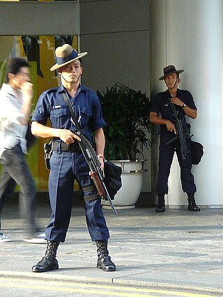
The Gurkha Contingent (GC) is a line department of the Singapore Police Force (SPF) consisting primarily of Gurkhas from Nepal, who are meticulously recruited by the British Army with the purview of the Government of Singapore. The contingent's roles are as a special guard force and counter-terrorist force.
Pulau Tekong Reservoir is a reservoir located on the north west of Pulau Tekong, an island in Singapore. It is part of the North-Eastern Islands planning area.
The Basic Military Training Centre (BMTC) is a military training facility of the Singapore Armed Forces (SAF). It comprises five schools organised into three camps, of which two are based on Pulau Tekong, an island off the northeast coast of mainland Singapore, while the third camp is in Kranji in northwest Singapore. As its name indicates, it provides basic military training for the majority of recruits enlisted in the SAF.
The Malaysia–Singapore border is an international maritime border between the Southeast Asian countries of Malaysia, which lies to the north of the border, and Singapore to the south. The boundary is formed by straight lines between maritime geographical coordinates running along or near the deepest channel of the Straits of Johor.
Changi Beach Park is a beach park located at the northern tip of Changi in the eastern region of Singapore.
Pulau Sajahat, was a small island about 1.2 hectares located off the north-eastern coast of Singapore, near Pulau Tekong. The island, together with its smaller companion Pulau Sejahat Kechil, has been subsumed by Pulau Tekong with the land reclamation works on Pulau Tekong's southern and northwestern coasts.
Singapore Island, also known as mainland Singapore, is the main constituent island of the sovereign island country and city-state of the Republic of Singapore. It is located at the southern tip of the Malay Peninsula, between the Straits of Malacca and the South China Sea. The Singapore Strait lies to the south, while the Johor Strait lies to the north.
Singapore has about 65 species of mammals, 390 species of birds, 110 species of reptiles, 30 species of amphibians, more than 300 butterfly species, 127 dragonfly species, and over 2,000 recorded species of marine wildlife.
The North-Eastern Islands is a planning area and a group of islands located within the North-East Region of Singapore. The cluster is made up of three islands, namely Pulau Tekong, Pulau Tekong Kechil and Pulau Ubin. Pulau Tekong and Pulau Tekong Kechil was formerly home to 10 villages while Pulau Ubin was home to a number of granite quarries. At present, Pulau Tekong houses the Singapore Armed Forces Basic Military Training Centre while Pulau Ubin is one of the last areas in Singapore that has been preserved from urban development, concrete buildings and tarmac roads.
Serangoon Harbour is a harbour in Singapore located between the mainland island of Singapore and Pulau Ubin.
Pulau Sekudu, or Frog Island, is an islet located just off Chek Jawa on Pulau Ubin, Singapore. It lies in the Serangoon Harbour opposite Changi. Despite its proximity, it is only reachable by boat, even at low tides. One can see the islet directly opposite the Chek Jawa Visitor Centre.
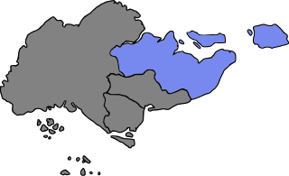
Rural East Constituency was a constituency represented in the Legislative Council of Singapore from 1948 until 1951. It elected one Legislative Council member.