The North East Line (NEL) is a high-capacity Mass Rapid Transit (MRT) line in Singapore. Operated by ComfortDelGro's SBS Transit, the 22-kilometre (14-mile) line is the MRT's shortest. It runs from HarbourFront station in southern Singapore to Punggol Coast station in the northeast, serving 17 stations via Chinatown, Little India, Serangoon and Hougang. Coloured purple on official maps, it is Singapore's third MRT line and the world's first fully-automated underground driverless heavy rail line.

Punggol is a planning area and new town situated on the Tanjong Punggol peninsula in the North-East Region of Singapore. The town directly borders Sengkang to the south and shares riverine boundaries with the planning area of Seletar to the west and Pasir Ris to the east. Bounding the town to the north and north-east is the Straits of Johor, with Coney Island included as a part of the Punggol planning area.

Pasir Ris is a planning area and residential town located in the East Region of Singapore. It is bordered by Tampines and Paya Lebar to the south, Sengkang to the southwest and Changi to the east. The planning area also shares riverine boundary with Punggol to the west, separated by the Serangoon River, as well as having a maritime boundary with the North-Eastern Islands planning area, across the Straits of Johor.
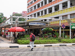
Hougang is a planning area and mature residential town located in the North-East Region of Singapore. It is the largest housing estate in Singapore based on land area, and is home to 247,528 residents as of 2018. Hougang planning area is bordered by Sengkang to the north, Geylang to the south, Bedok to the southeast, Toa Payoh to the southwest, Serangoon to the west and Paya Lebar to the east.
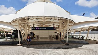
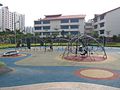
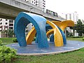
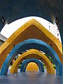
Buangkok MRT station is an underground Mass Rapid Transit (MRT) station on the North East Line (NEL) in Singapore, located near the road intersection of Sengkang Central with Compassvale Bow. The station serves the residential neighbourhood of Buangkok; the Buangkok Bus Interchange; Sengkang Grand Residence and Sengkang Grand Mall, which is a integrated commercial and residential development.
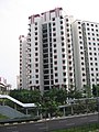
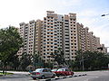
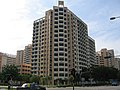
Anchorvale is a neighbourhood of Sengkang New Town in Singapore between Sungei Punggol and Compassvale. House numbers of its public apartment blocks begin with the number '3' (3xx). These housing estates were fully completed by the Housing and Development Board (HDB) in 2001.
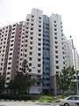
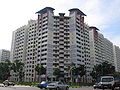
Rivervale is a neighbourhood of Sengkang New Town located between Sungei Serangoon and Compassvale. The block numbers of the public apartment blocks in Rivervale begin with the number '1' (1xx). Rivervale was the first neighbourhood of Sengkang New Town to be built, and many of the existing housing estates in Rivervale were completed by the Housing and Development Board (HDB) as early as 1997.
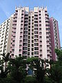
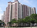
Fernvale is a neighbourhood of Sengkang New Town in Singapore. It is located between Sungei Punggol and the proposed Sengkang West Industrial Estate. The house numbers of the public apartment blocks in Fernvale begin with the number '4' (4xx). Fernvale is the newest neighbourhood in Sengkang Town to be completed by the Housing and Development Board (HDB). Seletar Mall, a new shopping amenity which houses Sengkang's first cineplex, is located within this neighbourhood. In 2017, a proposed community facility to be located next to Seletar Mall was announced, which houses a community club, childcare centre, hawker centre and wet market. The community facility which was slated to be ready by the second half of 2020, had stopped construction in April 2020 due to the COVID-19 measures set by the government. Construction of the facility has since continued in the second half of 2020 and was completed in 2022.

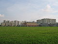
Sengkang is a planning area and residential town located in the North-East Region of Singapore. The town is the second most populous in the region, being home to 249,370 residents in 2020. Sengkang shares boundaries with Seletar and Punggol in the north, Pasir Ris and Paya Lebar in the east, Hougang and Serangoon to the south, as well as Yishun and Ang Mo Kio to the west.

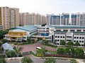
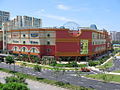
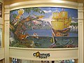
Compass One is a suburban shopping mall located in the town centre of Sengkang, Singapore. The mall was built as an integrated development together with a condominium, Compass Heights which is located adjacent to the mall. Originally opened on 1 August 2002, the mall closed for extensive renovation works on 26 October 2015 and re-opened on 1 September 2016.

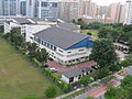
Sengkang Community Hub is an amenity centre in Sengkang, within the North-East Region of Singapore.

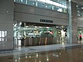
Sengkang Bus Interchange is a bus interchange located in Sengkang New Town, Singapore. Located at the ground level of Compass Heights condominium, next to Sengkang MRT/LRT station and Compass One shopping mall, it is the second air-conditioned bus interchange in Singapore and the second Integrated Transport Hub (ITH) in Singapore. It was opened on 18 January 2003.
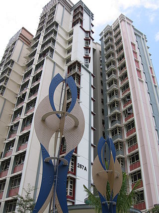
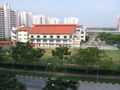
Buangkok is a neighbourhood located in north eastern Singapore. The neighbourhood roughly encompasses the Trafalgar and Compassvale subzones of the Hougang and Sengkang Planning Areas respectively, as designated by the URA.

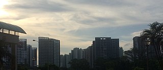
The North-East Region of Singapore is one of the five regions in the country. The region is the most densely populated and has the highest population among the five, with Sengkang being its most populous town as of 2020 and Seletar as the regional centre. Comprising 13,810 hectares, it includes seven planning areas and is largely a residential region with 217,120 homes. Housing largely consists of high-density HDB public housing estates, however private housing is also present in the region. As its name implies, it is located in the north-eastern part of Singapore.

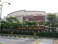
Kovan is a neighbourhood located within the town of Hougang, in Singapore. The neighbourhood today largely consists of private housing properties, where majority of the residents live in terrace homes, semi-detached houses and bungalows.

Punggol MRT/LRT station is a Mass Rapid Transit (MRT) and Light Rail Transit (LRT) interchange station in Punggol, Singapore. It is an interchange station between the North East Line (NEL) and Punggol LRT (PGLRT), and the one of the two MRT stations located within Punggol planning area. Stretching across Punggol Central, the station is situated next to Punggol Temporary Bus Interchange and the retail development of Waterway Point.

Sengkang MRT/LRT station is a Mass Rapid Transit (MRT) and Light Rail Transit (LRT) interchange station in Sengkang, Singapore. It is an interchange between the North East line (NEL) and Sengkang LRT (SKLRT). Along with Buangkok station, it is located within the Sengkang planning area.

Choa Chu Kang MRT/LRT station is an elevated Mass Rapid Transit (MRT) and Light Rail Transit (LRT) interchange station in Choa Chu Kang, Singapore. Serving the North South line (NSL) and the Bukit Panjang LRT line (BPLRT), the station is located near the Choa Chu Kang Bus Interchange and Lot One shopping centre. Other surrounding landmarks include Keat Hong Community Club and Choa Chu Kang Park.
Joo Seng is a subzone located in Toa Payoh in the Central Region of Singapore. It gets its name from Bartley Road, which stretches from the end of Braddel Road to Upper Paya Lebar Road, as part of the Outer Ring Road System. There are some condominiums and houses in the area. It is also where the Gurkha Contingent is based. There are many Gurkhas and their families living there in private flats.