Jurong is a major geographical region located at the south-westernmost point of the West Region of Singapore. Although mostly vaguely defined, the region's extent roughly covers the planning areas of Jurong East, Jurong West, Boon Lay, and Pioneer, along with Jurong Island in the Western Islands cluster and the southernmost portions of the Western Water Catchment. Should it be described at its greatest historical extent, the region can also include present-day Bukit Batok and Tuas.

Boon Lay MRT station is a Mass Rapid Transit (MRT) station on the East West line (EWL) in Jurong West, Singapore. Situated along Boon Lay Way, the station is integrated with the Boon Lay Bus Interchange and Jurong Point as part of the Boon Lay Integrated Transport Hub. Other landmarks surrounding the station include the SAFRA Clubhouse and Jurong West Public Library.

Jurong East is a planning area and residential town situated in the West Region of Singapore. It borders Jurong West and Boon Lay to the west, Clementi to the east, Tengah and Bukit Batok to the north and Selat Jurong to the south.

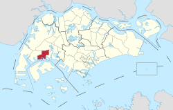
Boon Lay is a neighbourhood located in the town of Jurong West in the West Region of Singapore. Its borders very roughly correspond to the URA subzone of Boon Lay Place, situated within the Jurong West Planning Area.

Jurong West is a planning area and residential town located in the West Region of Singapore. Jurong West shares boundaries with Tengah in the north, Jurong East in the east, Boon Lay and Pioneer in the south, and Western Water Catchment in the west.

Pioneer MRT station is a Mass Rapid Transit station in Singapore. It is part of the MRT East West Line and serves the residential estate of Pioneer. The station is located along Jurong West Street 63 and provides a convenient mode of transportation for residents and visitors to the area.

Jurong East Bus Interchange is a bus interchange located in Jurong East, Singapore. An open-air single-level bus terminal, it is connected to the adjacent Jurong East MRT station via a link bridge.

The Western Water Catchment is a planning area located in the West Region of Singapore. The planning area borders Tuas and Pioneer to its south, Sungei Kadut, Choa Chu Kang and Tengah to its east, Jurong West to its southeast, Lim Chu Kang to its north and the Straits of Johor to its west. It is the largest planning area by land area, covering nearly a tenth of Singapore Island. It is also one of the two main water catchments in Singapore, the other being Central Water Catchment.

Yunnan is a sub located in the town of Jurong West in the West Region of Singapore.
Taman Jurong is a residential precinct in Jurong West, Singapore. It is one of the oldest residential precincts in Singapore and a division of Jurong GRC, with the area's HDB flats under the management of Jurong-Clementi Town Council and Shawn Huang as the area's MP.

Jurong West Central is a subzone of Jurong West, located in the West Region of Singapore. This is the town centre of Jurong West.
Teban Gardens is a residential precinct located in Jurong East, Singapore. Immediately north of Pandan Reservoir, it comprises exclusively public housing built by the JTC Corporation and Housing and Development Board.
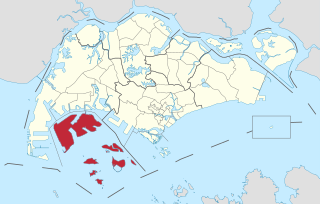
The Western Islands is a planning area located within the West Region of Singapore. It comprises a collection of islands located in the south-western waters of Singapore, namely Jurong Island, Pulau Bukom, and Sudong Islands.

The Colt Official Police is a medium frame, double-action revolver with a six-round cylinder, primarily chambered for the .38 Special cartridge, and manufactured by the Colt's Manufacturing Company. Released in 1908 as the Colt Army Special, the revolver was renamed the "Colt's Official Police" in 1927 in order to better market to law enforcement agencies. It became one of the bestselling police firearms of all time, eventually coming to exemplify typical law enforcement officer weaponry in the 1950s. The Official Police was also used by various U.S. and allied military forces during World War II.

Jurong Road was a road in western Singapore. It was the oldest road in Jurong area, having been first constructed between 1852 and 1853 during the early British colonial period to create a proper road link between the rural areas of Jurong and the rest of Singapore.
Wenya is a subzone of Jurong West, Singapore.
Yuhua is a subzone region located in the town of Jurong East, Singapore. Yuhua comprises two subzones, Yuhua East and Yuhua West. The area's HDB flats are under the management of Jurong-Clementi Town Council and the people of this precinct are represented in parliament by either Grace Fu or Rahayu Mahzam, depending on where they stay.

Pioneer is a planning area located in the West Region of Singapore, named after Pioneer Road, formerly Jalan Besi. The area is bounded by Jurong West to the north, Boon Lay to the east, Tuas to the west, the Western Water Catchment to the northwest and Selat Jurong to the south, and contains the Joo Koon, Benoi and Gul Circle industrial estates.
Jalan Boon Lay is a major road in Jurong West, Singapore. Travelling in a north-south direction, Jalan Boon Lay connects the junctions of Jurong West Avenue 4, Jurong West Avenue 2 and Jalan Bahar in the north with the junctions of Jurong Pier Road, Jurong Hill Flyover, Jalan Ahmad Ibrahim and Ayer Rajah Expressway in the south.

While the Vikings are perhaps best known for accumulating wealth by plunder, tribute, and conquest, they were also skilled and successful traders. The Vikings developed several trading centres both in Scandinavia and abroad as well as a series of long-distance trading routes during the Viking Age. Viking trading centres and trade routes would bring tremendous wealth and plenty of exotic goods such as Arab coins, Chinese silks, and Indian Gems. Vikings also established a "bullion economy" in which weighed silver, and to a lesser extent gold, was used as a means of exchange. Evidence for the centrality of trade and economy can be found in the criminal archaeological record through evidence of theft, counterfeit coins, and smuggling. The Viking economy and trade network also effectively helped rebuild the European economy after the fall of the Roman Empire The Vikings unique seafaring abilities and ships allowed them to develop expansive trade routes across continents, from North America to Asia, covering some 8,000km.