Urban renewal is a program of land redevelopment often used to address urban decay in cities. Urban renewal involves the clearing out of blighted areas in inner cities in favour of new housing, businesses, and other developments.

The Housing & Development Board, is a statutory board under the Ministry of National Development responsible for the public housing in Singapore. Established in 1960 as a result of efforts in the late 1950s to set up an authority to take over the Singapore Improvement Trust's (SIT) public housing responsibilities, the HDB focused on the construction of emergency housing and the resettlement of kampong residents into public housing in the first few years of its existence.
Clementi is a planning area and residential town located at the easternmost fringe of the West Region of Singapore. The town borders Bukit Batok to the north, Bukit Timah to the northeast, Queenstown to the east and Jurong East to the west.

Kallang is a planning area and residential zone located in the Central Region of Singapore.

Bishan, also known as Peck San, Bishan New Town or Bishan Town, is a planning area and matured residential town located at the northernmost portion of the Central Region of Singapore. Statistically, the area is ranked the 38th biggest in terms of geographical size and the 22nd most populated planning area in the country. It is located at the most Central point of Singapore, and it comprises Upper Thomson, Marymount, Shunfu, Sin Ming, Bishan North and Bishan East. There are also many private residential properties in Bishan. Bishan is ranked 15th in terms of population density. Apart from its boundary with the Central Water Catchment in the west, Bishan borders three other planning areas: Ang Mo Kio to the north, Toa Payoh to the south, and Serangoon to the east.

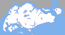
Queenstown is a planning area and satellite residential town situated on the south-westernmost fringe of the Central Region of Singapore. It borders Bukit Timah to the north, Tanglin to the northeast, Bukit Merah to the east and southeast, as well as Clementi to the northwest and west. Its southern and southwesternmost limits are bounded by the Pandan Strait.

Kwun Tong is one of the 18 districts of Hong Kong. It is located in Kowloon, and is the easternmost and southernmost district in Kowloon. It had a population of 666,500 in 2023. The district has the second highest population in Hong Kong, after Sha Tin District, while the income is below average. Kwun Tong District borders Sai Kung District to the east, Wong Tai Sin District to the north, and Kowloon City District to the west. To the south is Victoria Harbour, and the Eastern District directly across on Hong Kong Island.

Commonwealth MRT station is an above-ground Mass Rapid Transit (MRT) station on the East West line in Queenstown, Singapore, located at Commonwealth Avenue near the junction of Commonwealth Drive. The station serves the residential neighbourhoods of Commonwealth and Tanglin Halt. The station is also in the vicinity of institutions such as New Town Primary School, CHIJ Kellock, Faith Methodist Church, and Queensway Secondary School. The residential estates and station bearing the same name were named after Commonwealth Avenue built around 1963, which in turn was named after the British Commonwealth of Nations.

This article shows the notable future developments in Singapore. Most of them are currently under construction with most to be completed within the next five years.
Public housing in Singapore is subsidised, built, and managed by the government of Singapore. Starting in the 1930s, the country's first public housing was built by the Singapore Improvement Trust (SIT) in a similar fashion to contemporaneous British public housing projects, and housing for the resettlement of squatters was built from the late 1950s. In the 1960s under the SIT's successor, the Housing and Development Board (HDB), public housing consisting of small units with basic amenities was constructed as quickly and cheaply as possible at high densities and used for resettlement schemes. From the late 1960s, housing programmes focused more on quality, public housing was built in new towns, and a scheme allowing residents to lease their flats was introduced. Throughout the 1970s and 1980s, more public housing options were provided for the middle class and efforts to increase community cohesion within housing estates were made. From the 1990s, the government began portraying public housing as an asset, introducing large-scale upgrading schemes and loosening regulations on the resale of public housing while additional housing programmes for the sandwich classes and elderly residents were introduced. Rising housing prices led to public housing being seen as an investment from the 2000s, and new technologies and eco-friendly features were incorporated into housing estates.

The new towns of Singapore are planned communities located across Singapore that are designed to be self contained. Designed to house up to 300,000 residents, these new towns contain areas zoned for housing, recreation and employment, and are composed of multiple neighbourhoods, each of which is further subdivided into multiple precincts. Amenities in these new towns are provided through a multi-tiered system, and based on Housing and Development Board (HDB) guidelines. As of 2022, the country has 24 new towns.

Hillview is located in Upper Bukit Timah, Northwest Singapore. The neighbourhood overlooks Bukit Timah Hill, hence its name.
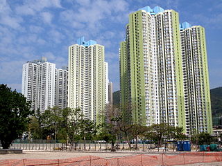
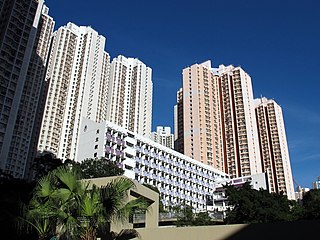
Un Chau Estate, or Un Chau Street Estate before redevelopment, is a public housing estate on the reclaimed land of Cheung Sha Wan, Kowloon, Hong Kong, located between Un Chau Street and Cheung Sha Wan Road, next to MTR Cheung Sha Wan station. It consists of 10 residential buildings completed in 1998, 1999 and 2008, which were developed into 4 phases. Phase 5 was developed on the site of the former Cheung Sha Wan Factory Estate.
Yau Tong Estate is a public housing estate in Yau Tong, Kwun Tong, Kowloon, Hong Kong, located near Yau Tong station of the MTR.

The Carpenters Estate is located in Stratford, Newham, East London, close to the Queen Elizabeth Olympic Park. The estate is formed of low rise social housing and three tower blocks. The estate has been continually earmarked for demolition and redevelopment.

My Queenstown Heritage Trail is a walking trail in Queenstown, Singapore. The trail was launched in 2010 by civic group, My Community, to promote the heritage, local culture and architectural styles in Queenstown.

Queenstown Public Library is one of the 26 public libraries established by the National Library Board of Singapore. It was the first full-time Branch Library to be built by the National Library in its plan to decentralise home reading services. It pioneered several firsts amongst Branch Libraries, including becoming the first fully air-conditioned Branch in 1978, computerising its loan services in 1987, and lending video cassettes in 1997. It was refurbished in 2003. The building plans were approved by Mrs Hedwig Anuar, the then-Director of the National Library. Building construction began in November 1968 and with its completion, the building was handed over to the National Library on 26 December 1969. It is currently the oldest library in Singapore after the original National Library at Stamford Road was torn down, the first of 26 under the National Library Board (NLB) to be preserved as announced on 25 July 2014 and was gazetted for conservation under the Urban Redevelopment Authority's Master Plan 2014, as part of the medium-term physical development of Singapore on 6 June that year.
Tanglin railway station, also known as Tanglin Halt, was a railway station on the Singapore-Johore Railway which served Tanglin, as well as Pasir Panjang, from 1932 to 1983.
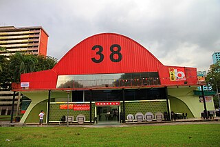
Commonwealth Avenue Wet Market, also known as Queenstown Market, is a former wet market on Commonwealth Avenue in Queenstown, Singapore. It is the only remaining market designed by the Singapore Improvement Trust.

Tanglin Shopping Centre was a shopping center on Tanglin Road in Tanglin, Singapore. Completed in 1972, the mall was the "first modern shopping mall to be established in the area and the second oldest in Singapore after People's Park Complex in Chinatown."