Siglap

Last updated
Siglap
Subzone of Bedok Planning Area &
Housing Estate
Other transcription(s)
   Malay Siglap(Rumi)
سيݢلڤ(Jawi)
   Chinese 实乞纳(Simplified)
實乞納(Traditional)
Shíqǐnà(Pinyin)
Si̍t-khit-la̍p(Hokkien POJ)
   Tamil சிக்லாப்
Ciklāp(Transliteration)
John Edmund Taylor, View along the Beach by Singlap, Singapore (1879, Wellcome V0037487).jpg
John Edmund Taylor, View along the Beach by Singlap, Singapore (1879)
CountryFlag of Singapore.svg  Singapore
Region East Region
Siglap Districts Map Siglap District Map 2018 (1).svg
Siglap Districts Map
Comparison between Joo Chiat Constituency, which contains the Siglap Districts, and Siglap Constituency Siglap District Map 2018 (2).svg
Comparison between Joo Chiat Constituency, which contains the Siglap Districts, and Siglap Constituency

Siglap is a neighbourhood located south-west of Bedok in the East Region of Singapore. The area encompasses the Frankel and Opera Estates and their names have sometimes been used interchangeably to refer to the approximate same area. The planning subzone area of Siglap, as defined by the Urban Redevelopment Authority (URA), is confusingly and inaccurately referred to as the small strip of land between Victoria Junior College and Bedok South Avenue 1.

Contents

Siglap is a residential area where a majority live in landed homes such as freehold terrace houses, semi-detached houses, and bungalows. Some of the land parcels near Siglap Centre have been redeveloped into serviced apartments and condominiums. There are also other apartments and condominiums in the Siglap area.

The few Housing and Development Board flats in Siglap have earmarked since 2015 under the Selective En bloc Redevelopment Scheme for redevelopment. The East Coast Park is also located nearby, across the East Coast Parkway.

The area will be served by the Thomson-East Coast MRT line and the Siglap MRT station when it is opened in 2024.

Etymology

The present area of Siglap was founded by Tok Lasam, the penghulu (chieftain) of Siglap. It is believed that he sailed to Singapore to escape the Dutch attack on his Sultanate of Gowa in the 1660s. According to legend, it was said that dark thunder clouds had appeared when he first landed in the area which led to the name "Si-Gelap", derived from the Malay word ‘gelap’, meaning "darkness that conceals".

Other versions of his arrival include him as a Minangkabau prince arriving from Sumatra to visit the Bugis settlements in the Tanjong Rhu area and ultimately establishing Siglap in 1809. According to historians, his arrival might have coincided with a rare full solar eclipse on 4 March 1821 and hence the darkness might have referred to the eclipse, rather than the dark clouds. [1]

Today the graves of Tok Lasam, his wife and his panglima (commander) can be found near Jalan Sempadan off Upper East Coast Road. [2]

History

Siglap in its early days had four kampongs, side by side each other along the coastline, they were from east to west starting from Jalan Hajijah, Kampong Hajijah, Kampong Goh Choo, Kampong Siglap and Kampong Lim Choo which ended near Siglap Road. [1] There were also a small community of Japanese fishermen living in the area, although by the end of World War II (WWII) they had mostly vanished. The inland areas of Siglap consisted mostly of coconut and nutmeg plantations and in 1912 the Frankels bought over these plantations. The Frankels were wealthy Jewish business people originating from Lithuania and had decided to settle in Singapore after accumulating considerable wealth from their sale of rubber, bread and even furniture in Singapore and around the region. They settled in the estate and developed the area by building roads named after famous Operas of their time including Carmen and Aida, which gave rise to the name of Opera Estate as it is known today. [1] They were influential people that welcomed distinguished guests like Albert Einstein to visit and tour the area. At the onset of WWII the Frankels left for the United States. The area as well as along the wider East Coast Stretch saw machine gun pillbox being installed by the British in anticipation of a sea-bound attack by the Japanese that never materialise. [1] During the Japanese Occupation, the coasts of Siglap and several of the nearby hills were used as execution sites in the Sook Ching operation carried out by the Japanese to clear out anti-Japanese personnel, the operation mostly targeted the Chinese population. [3] At the end of the war many mass graves had been found in the area, one of such place was near the junction of Bedok South Avenue 1 and Upper East Coast Road. In 1953 during the heydays of Singapore film making, Cathay-Keris Studio, one of two major film companies in Singapore, set up its studio along Jalan Keris and the surrounding area was commonly used for shooting scenes in the films. [3] In 1962 a huge fire broke out at Kampong Siglap when firecrackers were burnt out of control and set the village ablaze. The few HDB flats built in the area were built in the aftermath of the fire to house the homeless victims. Starting from the mid-1960s, the Government embarked on an ambitious land reclamation project that saw the coastline of the entire East Coast Region shift outwards. [1] As a result, many villagers in the area could not depend on fishing as a form of livelihood and many eventually settled away or were relocated to the neighbouring estates. The reclaimed land was then redeveloped with numerous high rise flats built and the East Coast Parkway was also constructed. The area has throughout history been home to several of Singapore's Presidents, including the first President of Singapore, Yusof Bin Ishak. [1]

Geography

The terrain of Siglap can be divided into two, the inland and the outer coastal areas, with the former considerably hilly while the latter because it had mostly been reclaimed generally flat. The uneven terrain inland can be seen with the steep descent of Fidelio Street into the lower lying areas of Opera Estate at the Fidelio Circus. This has caused frequent flooding in Opera Estate in the past whenever it rained. The Government has since, starting from 1996, improved drainage and installed Singapore's first underground water detention tank to store excess rain water from the estate that would be discharged after the rain has stopped. [4]

Amenities

Siglap is served by amenities like the Siglap Centre, Fairprice Siglap New Market, and Siglap V which are found at the junction of Siglap Road and East Coast Road. East Coast Road and Upper East Coast Road are also lined with restaurants, food courts and shops. Additionally the estate has shophouses for the convenience of residents. The Siglap Park Connector that leads to either the Bedok Reservoir Park or the East Coast Park runs west of the estate along the Siglap Canal. The Siglap Linear Park which is similar to a park connector cuts through the area too, running from Opera Estate to East Coast Park. Siglap is part of the Marine Parade Group Representation Constituency and has one community centre, the Siglap South Community Centre, it is not to be confused with the Siglap Community Centre that serves the Bedok South Estate which is part of the East Coast Group Representation Constituency. The Wisma Mendaki Headquarters is another social facility located in the estate and serves the Malay community of the greater Geylang area too.

There are various places of worship like the Bethany Evangelical Free Church, Bethesda Frankel Estate Church, Church of Our Lady of Perpetual Succour, Ean Keng Si Buddhist Temple (延庆寺), Kim San Temple (金山寺斗山宫), Masjid Kampong Siglap and The Emmanuel Assembly of God Church.

The area falls under the jurisdiction of the Siglap Neighbourhood Police Post (NPP), which is part of the Bedok Police Division, and the 2nd Singapore Civil Defence Force DIV HQ. [5]

Education

There are currently several schools in the area namely (4 of which are public government schools):

Despite the lower population density of the estate because it contains mostly landed houses, as opposed to HDB flats, the area still has a rich history of having numerous schools. Excluding the schools that have operated from the holding site campus due to PRIME initiatives by the Ministry of Education at the junction of New Upper Changi Road and Bedok South Road, these are the schools which no longer operate in the estate and all but one of which are defunct:

These are the schools that have operated from the PRIME holding site campus chronologically:

Transportation

Bus

Marine Parade Bus Terminal was operational from 5 July 1981 till 16 September 2001 when it was closed to make way for the construction of Victoria School. Most of the bus services that originated from the terminal were subsequently extended to Bedok Bus Interchange or Upper East Coast Bus Terminal further east, while other routes were cut short. [15] Today, there are still many bus services that ply along Upper East Coast Road and Marine Parade Road that run through the south of Siglap, in contrast, however the services cutting through the Frankel and Opera Estate areas are limited and these services are 32, 40, 42, 135 and 401.

MRT

Siglap is served by the Kembangan and Bedok MRT Stations, on the East West MRT line. However, in 2023 a closer station, Siglap MRT station, on the Thomson–East Coast line, will open on Marine Parade Road near Victoria School and bring greater and faster connectivity to the city or Changi Airport.

Road

The East Coast Parkway (ECP) is an expressway that lies south of Siglap. Exit 7 and 8 of the expressway lead directly into the estate. The streets in Siglap (First to Fourth Street) off Siglap Road, were numerically named in 1958.

Places of Historic Significance

The historic site of Kubur Kassim (also known to contain Keramat Sheikh Ali), an old Malay Cemetery that is nestled in the heart of Siglap is the final resting place of many Muslims in the area in the past. Several prominent people buried there include Dr Hafeezudin Sirajuddin Moonshi founder of the first Muslim Clinic in Singapore. There are even graves allocated for the mythological Orang Bunian inside. This site coupled with Masjid Kassim located in Telok Kurau originally belonged to Ahna Mohamed Kassim bin Ally Mohamed who was endowed with it in 1921. [1] Today the 2.02 hectares cemetery contains a distinctive yellow gate and is at least 90 over years old. Despite it being a cemetery it is entirely surrounded by landed houses and condominiums.

Incidents

Related Research Articles

<span class="mw-page-title-main">Changi</span> Planning Area in East Region ----, Singapore

Changi is a planning area located in the geographical region of Tanah Merah in the East Region of Singapore. Sharing borders with Pasir Ris and Tampines to the west, Changi Bay to the southeast, the South China Sea to the east and the Serangoon Harbour to the north. Changi, excluding the two water catchments and islands of Singapore, is the largest planning area by land size.

<span class="mw-page-title-main">Woodlands, Singapore</span> Planning Area and Regional Centre in North Region, Singapore

Woodlands is a planning area and residential town located in the North of Singapore. As of 2019, the town has a population of 254,733. Located approximately 25 km (16 mi) north of the central business district (CBD), it is the densest planning area and is the regional centre for the northern parts of the country.

<span class="mw-page-title-main">Clementi, Singapore</span> Planning Area and HDB Town in West Region, Singapore

Clementi is a planning area and residential town located at the easternmost fringe of the West Region of Singapore. The town borders Bukit Batok to the north, Bukit Timah to the northeast, Queenstown to the east and Jurong East to the west.

<span class="mw-page-title-main">Pasir Ris</span> Planning Area and HDB Town in East Region ----, Singapore

Pasir Ris is a planning area and residential town located in the East Region of Singapore. It is bordered by Tampines and Paya Lebar to the south, Sengkang to the southwest and Changi to the east. The planning area also shares riverine boundary with Punggol to the west, separated by the Serangoon River, as well as having a maritime boundary with the North-Eastern Islands planning area, across the Straits of Johor.

<span class="mw-page-title-main">Kallang</span> Planning Area and HDB Town in Central Region ----, Singapore

Kallang is a planning area and residential zone located in the Central Region of Singapore.

<span class="mw-page-title-main">Choa Chu Kang</span> Planning area and residential town in Singapore

Choa Chu Kang, alternatively spelt as Chua Chu Kang and often abbreviated as CCK, is a planning area and residential town located at the north-westernmost point of the West Region of Singapore. The town shares borders with Sungei Kadut to the north, Tengah to the southwest, Bukit Batok to the southeast, Bukit Panjang to the east and the Western Water Catchment to the west. Choa Chu Kang New Town is separated into two portions by the Kranji Expressway.

<span class="mw-page-title-main">Bishan, Singapore</span> Planning Area and HDB Town in Central Region, Singapore

Bishan, also known as either Bishan New Town or Bishan Town, is a planning area and matured residential town located at the northernmost portion of the Central Region of Singapore. Statistically, the area is ranked the 38th biggest in terms of geographical size and the 22nd most populated planning area in the country. It is located at the most Central point of Singapore, and it comprises Upper Thomson, Marymount, Shunfu, Sin Ming, Bishan North and Bishan East. There are also many private residential properties in Bishan. Bishan is ranked 15th in terms of population density. Apart from its boundary with the Central Water Catchment in the west, Bishan borders three other planning areas: Ang Mo Kio to the north, Toa Payoh to the south, and Serangoon to the east.

Simei is a town located in the eastern part of Singapore. The name Simei is pinyin for "Four Beauties" in Chinese. Formerly known as Tampines South, it was officially renamed to Simei in 1985.

Kembangan is a subzone and residential precinct located in the town of Bedok in the East Region of Singapore. It consists largely of private residential areas and a small public housing estate along Lengkong Tiga.

<span class="mw-page-title-main">Bedok</span> Planning Area and HDB Town in East Region ----, Singapore

Bedok is a planning area and matured residential town located in the geographical region of Tanah Merah along the south-eastern coast of the East Region of Singapore. Bedok is bounded by five other planning areas: Paya Lebar to the north, Hougang to the northwest, Tampines to the northeast and east, Geylang to the west and Marine Parade to the southwest. It also shares a maritime boundary with the Singapore Strait to the south and southeast.

<span class="mw-page-title-main">Bukit Merah</span> Planning Area and HDB Town in Central Region ----, Singapore

Bukit Merah, also known as Redhill, is a planning area and new town situated in the southernmost part of the Central Region of Singapore. the planning area borders Tanglin to the north, Queenstown to the west and the Downtown Core, Outram and Singapore River planning areas of the Central Area to the east.

<span class="mw-page-title-main">East Coast Group Representation Constituency</span>

The East Coast Group Representation Constituency is a five-member Group Representation Constituency in the eastern area of Singapore. The areas of the Group Representation Constituency consists of locations such as East Coast Park, Bedok, Changi, Simei, Siglap, Tampines, Pasir Ris, Chai Chee, Changi Airport. The GRC also covers a large portion of Singapore's eastern territorial waters. The five divisions: Bedok, Siglap, Fengshan, Changi-Simei and Kampong Chai Chee. The current MPs are from the People's Action Party (PAP) Heng Swee Keat, Maliki Osman, Tan Kiat How, Cheryl Chan and Jessica Tan.

<span class="mw-page-title-main">Tanah Merah, Singapore</span> Place in East Region, Singapore

Tanah Merah, is a geographical region located along the south-eastern coast of the East Region of Singapore. Although its boundaries are not exactly clear, it is widely accepted that the term refers to the southern coast of present-day Bedok, Tampines, Changi and Changi Bay.

<span class="mw-page-title-main">Chai Chee</span> HDB Estate in East Region, Singapore

Chai Chee, also known as Kampong Chai Chee, is a housing estate located in the town of Bedok in Singapore. The estate was named after a village known as Kampong Chai Chee which formerly occupied the vicinity. It is served by two major namesake roads, namely Chai Chee Street and Chai Chee Drive, with minor lanes of Chai Chee Road, Chai Chee Avenue and the original Jalan Chai Chee. Part of the estate today sits atop a hill that overlooks neighbouring Kembangan and Opera Estate.

<span class="mw-page-title-main">Kampong Ubi</span> Subzone of Geylang Planning Area

Kampong Ubi, also known as Ubi Estate, is a subzone located in the planning area of Geylang in the Central Region of Singapore. It lies within a somewhat rhombic piece of land bounded by Airport Road at the north, the Pan-Island Expressway at the south, Eunos Link at the east and Paya Lebar Road at the west. The area was formerly a Malay village.

Teban Gardens is a residential precinct located in Jurong East, Singapore. Immediately north of Pandan Reservoir, it comprises exclusively public housing built by the JTC Corporation and Housing and Development Board.

<span class="mw-page-title-main">Tengah, Singapore</span> Planning Area and future HDB town in West Region ----, Singapore

Tengah is a planning area and future HDB town located within the West Region of Singapore. It is bound by Choa Chu Kang to the northeast, Jurong East and Jurong West to the south, Bukit Batok to the east and the Western Water Catchment to its west and north.

<span class="mw-page-title-main">Bukit Ho Swee</span> Subzone of Bukit Merah Planning Area in Central Region, Singapore

Bukit Ho Swee is a subzone within the planning area of Bukit Merah, Singapore, as defined by the Urban Redevelopment Authority (URA). Its boundary is made up of the Alexandra Canal in the north; Kim Seng Road and Outram Road in the east; Zion Road and Jalan Bukit Ho Swee in the south; Delta Road and Lower Delta Road in the west.

<span class="mw-page-title-main">Kaki Bukit, Singapore</span> Subzone of Bedok Planning Area in East Region, Singapore

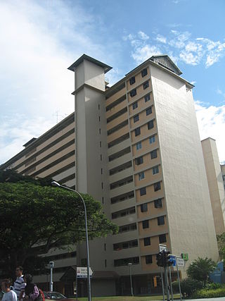
Kaki Bukit is an industrial area located in Bedok in the East Region of Singapore. It is home to many high tech industrial companies and warehouses. There used to be a prison complex called Kaki Bukit Centre, which was converted to a prison school in 2000, however it has since moved to Tanah Merah and the Acacia Welfare Home now stands in its place. On the south of Kaki Bukit is Jalan Tenaga and Jalan Damai neighbourhoods of Bedok Reservoir Road. Redevelopments are in the pipeline for Kaki Bukit beyond 2030 when Paya Lebar Airbase located just north of the estate relocates to Changi. Not only would land be freed up for use but building height restrictions, that are currently in place for safety reasons because the estate is directly aligned with the airbase runway, would also be lifted. Kaki Bukit is classified by Urban Redevelopment Authority (URA) as a subzone under the planning area of Bedok, its boundaries differ from the constituency boundaries used by the Singapore Parliament.

References

  1. 1 2 3 4 5 6 7 "Bedok Trail Roots" (PDF). 2016. Retrieved 20 March 2018.
  2. "Tok Lasam burial plot". 2010.
  3. 1 2 "From ghosts and mass graves to Einstein 10 stories we bet you didn't know about Siglap". 8 April 2017. Retrieved 20 March 2018.
  4. "Opening Address for Completion of Opera Estate Drainage Scheme". 9 February 2002. Retrieved 20 March 2018.
  5. "SCDF Organisation Structure". 2017. Archived from the original on 13 March 2018. Retrieved 22 March 2018.
  6. "Home". St. Andrew's Autism Centre. Retrieved 21 April 2023.
  7. "鐘南學校搜集標本". 27 July 1939. Retrieved 24 March 2018.
  8. "钟南校旗不再随风飘扬". 30 October 1981. Retrieved 24 March 2018.
  9. "CHIJ Opera Estate off Siglap Road". 2009. Retrieved 20 March 2018.
  10. "Minister's call to businessmen to help in schools". 30 September 1984. Retrieved 20 March 2018.
  11. "Government to build 12 new schools". 8 February 1957. Retrieved 20 March 2018.
  12. "My school, my school". 19 November 1983. Retrieved 20 March 2018.
  13. "Transfer of pupils to Siglap Primary School". 1956. Retrieved 20 March 2018.
  14. "Siglap Secondary School: A school that feels like home". 12 November 2013. Retrieved 20 March 2018.
  15. "Work on Marine Parade terminal underway". 15 February 1981. Retrieved 20 March 2018.
  16. "Kampong Siglap Mosque Fire". 9 December 2009. Retrieved 20 March 2018.
  17. "Two houses damaged by toppled crane in Siglap". 3 October 2016. Retrieved 20 March 2018.

Coordinates: 1°18′50″N103°56′10″E / 1.314°N 103.936°E / 1.314; 103.936