Mountbatten, Singapore

Last updated

Mountbatten
Subzone of Marine Parade Planning Area
Name transcription(s)
   Chinese 蒙巴登
   Pinyin Méngbādēng
   Malay Mountbatten
   Tamil மவுண்ட்பேட்டன்
Coordinates: 1°18′51″N103°49′44″E / 1.3142°N 103.8288°E / 1.3142; 103.8288
Country Singapore

Mountbatten (also known as Mountbatten Estate) [1] is a neighbourhood located in the planning area of Marine Parade, Singapore.
Contents

History

The neighbourhood is named after Lord Louis Mountbatten, the Supreme Allied Commander of the South East Asia Command, Governor General of India and British Military Administrator of Malaya from 1945 to 1946.

Layout

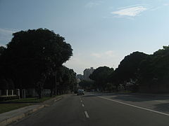
Mountbatten Road is a major thoroughfare that stretches all the way from the junction with Nicoll Highway, Guillemard Road and Sims Way (where Kallang Airport Way branches out from Sims Way) in Kallang to Haig Road in Katong where it continues eastward as East Coast Road. [2] [3]

Points of interest

Transportation

Mountbatten is served by Mountbatten MRT station and Dakota MRT station on the Circle MRT line. Both stations are situated under Old Airport Road.

Related Research Articles

<span class="mw-page-title-main">Katong</span> Neighbourhood in Central Region, Singapore

Katong is a residential neighbourhood in the eastern portion of the Central Region of Singapore, within the Marine Parade planning area. Katong district stretches from Fort Road area to Joo Chiat area. It used to be located by the sea, before land reclamation towards the south to East Coast Park was created for housing and recreational purposes beginning in the 1960s to 1970s.

<span class="mw-page-title-main">Geylang</span> Planning Area and HDB town in Central Region, Singapore

Geylang is a planning area and township located on the eastern fringe of the Central Region of Singapore, bordering Hougang and Toa Payoh in the north, Marine Parade in the south, Bedok in the east, and Kallang in the west.

<span class="mw-page-title-main">East Coast Parkway</span> Expressway in Singapore

The East Coast Parkway is an expressway that runs along the southeastern coast of Singapore. It is approximately 20 kilometres (12 mi) in length. As of July 2022, it is Singapore's third-longest expressway.

<span class="mw-page-title-main">Kallang</span> Planning Area and HDB Town in Central Region ----, Singapore

Kallang is a planning area and residential zone located in the Central Region of Singapore.

<span class="mw-page-title-main">Paya Lebar MRT station</span> Mass Rapid Transit station in Singapore

Paya Lebar MRT station is a Mass Rapid Transit (MRT) interchange station on the East West line (EWL) and Circle line (CCL) in Geylang, Singapore. Despite the name, this station is not located in Paya Lebar but rather along Paya Lebar Road, near the junction with Sims Avenue. It is located among the developments of the Paya Lebar Central commercial hub and near the Geylang Serai district.

<span class="mw-page-title-main">Serangoon MRT station</span> Mass Rapid Transit station in Singapore

Serangoon MRT station is an underground Mass Rapid Transit (MRT) interchange station on the North East (NEL) and Circle (CCL) lines. Situated in Serangoon, Singapore along Upper Serangoon Road and Serangoon Central, the station is integrated with the Nex shopping complex and the Serangoon Bus Interchange. The station is near the Serangoon Neighbourhood Police Centre and Braddell Heights Community Hub and serves various residential estates in the area.

<span class="mw-page-title-main">Promenade MRT station</span> Mass Rapid Transit station in Singapore

Promenade MRT station is an underground Mass Rapid Transit (MRT) interchange station on the Downtown (DTL) and Circle (CCL) lines in Downtown Core, Singapore. Located underneath Temasek Avenue and adjacent to Millenia Tower, the station serves several key attractions and locations such as Suntec City and the Marina Promenade, which the station is named after. The station is at the junction of the Dhoby Ghaut and Marina Bay branches of the CCL.

<span class="mw-page-title-main">Nicoll Highway collapse</span> 2004 construction accident in Singapore

The Nicoll Highway collapse occurred in Singapore on 20 April 2004 at 3:30 pm local time when a Mass Rapid Transit (MRT) tunnel construction site caved in, leading to the collapse of the Nicoll Highway near the Merdeka Bridge. Four workers were killed and three were injured, delaying the construction of the Circle Line (CCL).

<span class="mw-page-title-main">Stadium MRT station</span> Mass Rapid Transit station in Singapore

Stadium MRT station is an underground Mass Rapid Transit (MRT) station on the Circle Line (CCL). Located in the area of Kallang, Central Region, Singapore, the station serves the Singapore Sports Hub and its facilities including the National Stadium, Indoor Stadium, Kallang Theatre and Leisure Park Kallang. It is operated by SMRT Trains.

<span class="mw-page-title-main">Mountbatten MRT station</span> Mass Rapid Transit station in Singapore

Mountbatten MRT station is an underground Mass Rapid Transit (MRT) station on the Circle line, located on the boundary of Kallang, Geylang and Marine Parade, Singapore.

<span class="mw-page-title-main">Dakota MRT station</span> Mass Rapid Transit station in Singapore

Dakota MRT station is an underground Mass Rapid Transit (MRT) station on the Circle line in Geylang planning area, Singapore, next to Geylang River.

<span class="mw-page-title-main">Tanjong Rhu</span> Subzone of Kallang Planning Area in Central Region

Tanjong Rhu, is a subzone within the planning area of Kallang, Singapore, as defined by the Urban Redevelopment Authority (URA). The perimeter of Tanjong Rhu is made up of Nicoll Highway in the north; Mountbatten Road and Fort Road in the east; East Coast Parkway (ECP) in the south; as well as Marina Channel and Kallang Basin in the west. Tanjong Rhu is the largest in terms of physical area among the nine subzones that make up Kallang.

<span class="mw-page-title-main">Central Sikh Temple</span> Gurdwara in Singapore

Central Sikh Temple is the first Sikh gurdwara in Singapore. Established in 1912, the temple had relocated several times before moving to its current site at Towner Road at the junction of Serangoon Road in Kallang in 1986 near Boon Keng MRT station.

<span class="mw-page-title-main">Nicoll Highway</span> Major arterial road in Singapore

Nicoll Highway is a major arterial road in Singapore which links the junctions of Guillemard Road, Sims Way and Mountbatten Road in Kallang to the junctions of Esplanade Drive, Raffles Avenue and Stamford Road in the city. En route, it passes through the areas of Kallang, Kampong Glam and Marina Centre.

<span class="mw-page-title-main">Old Airport Road, Singapore</span>

Old Airport Road is a two-way road in Singapore, connecting Dunman Road in the east to the junction with Stadium Boulevard and Mountbatten Road in the west.

<span class="mw-page-title-main">Kallang Riverside Park</span> Park in Kallang, Singapore

Kallang Riverside Park is a riverine park in Kallang, Singapore. It sits on the confluence of the Kallang River and Rochor River, north of the Kallang Basin.

Kallang Bahru is a subzone within the planning area of Kallang, Singapore, as defined by the Urban Redevelopment Authority (URA). This subzone is bounded by Bendemeer Road and Sungei Whampoa in the north; the Kallang River in the east; Kallang Road and Sims Avenue in the south; and Lavender Street in the west.

<span class="mw-page-title-main">Katong Park</span> Park in Katong, Singapore

Katong Park is neighborhood park located in Katong, Singapore at the junction of Meyer Road and Fort Road. Built in the 1930s above the buried remains of Fort Tanjong Katong, it was one of Singapore’s oldest parks with the first public bathing pagar and was highly popular with families during the weekends. After the coastal reclamation works in the 1970s, the park lost its sea frontage and declined greatly in popularity. It now remains as a small community park serving nearby residents.

References

  1. "Mountbatten Estate | Infopedia". eresources.nlb.gov.sg. Retrieved 26 March 2021.
  2. 1 2 Singapore, Remember (6 September 2016). "The Old World Charm of Mountbatten". Remember Singapore. Retrieved 26 March 2021.
  3. Singapore Guide and Street Directory. University of Michigan. 1972.
  4. "Goodman Arts Centre (former Laselle College of the Arts)". www.roots.gov.sg. Retrieved 26 March 2021.
  5. "onePA - Katong CC". onePA. Retrieved 26 March 2021.
  6. "Singapore Sindhi Association". Roots.gov.sg.