![]() ![]() ![]() Circle Line | |
---|---|
![]() | |
![]() | |
Overview | |
Native name | Malay: Laluan MRT Circle Chinese :地铁环线 Tamil: இணைப்பு எம்ஆர்டி வழி |
Status | Operational Under construction (Stage 6) |
Owner | Land Transport Authority |
Locale | Singapore |
Termini | |
Stations | 30 (operational) 3 (under construction) |
Service | |
Type | Rapid transit Light metro |
System | Mass Rapid Transit (Singapore) |
Services | 3 |
Operator(s) | SMRT Trains Ltd (SMRT Corporation) |
Depot(s) | Kim Chuan |
Rolling stock | Alstom Metropolis C830 Alstom Metropolis C830C Alstom Metropolis C851E (future) |
Daily ridership | 450,000 (2023) [1] |
History | |
Planned opening | 2026 | (Stage 6)
Opened | 28 May 2009 (Stage 3) 17 April 2010 (Stages 1 and 2) 8 October 2011 (Stages 4 and 5) 14 January 2012 (Circle Line extension) |
Technical | |
Line length | 35.5 km (22.1 mi) (operational) 4 km (2.5 mi) (under construction) |
Character | Fully underground |
Track gauge | 1,435 mm (4 ft 8+1⁄2 in) standard gauge |
Electrification | 750 V DC third rail |
Operating speed | limit of 78 km/h (48 mph) |
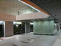
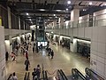
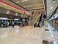
The Circle Line (CCL) is a medium-capacity Mass Rapid Transit (MRT) line in Singapore. It runs in a loop from Dhoby Ghaut station in the city-centre to HarbourFront station in the south via Bishan station in the centre of the country. It also has a branch to Marina Bay station from Promenade station, which will be extended to HarbourFront station from 2026 to form a complete loop. Coloured orange on the rail map, the fully-underground line is approximately 35.5 kilometres (22.1 mi) long with 30 stations. Travelling from one end of the line to the other takes about an hour.
The line was the fourth MRT line to be opened on the network, with the first stage, from Bartley to Marymount station, commencing operations on 28 May 2009. The next stage to Dhoby Ghaut was completed on 17 April 2010 and the next stage to HarbourFront opened on 8 October 2011. A two-station extension to Marina Bay station was opened on 14 January 2012. The last stage of the line from HarbourFront to Marina Bay with stations at Keppel, Cantonment, and Prince Edward Road will be completed in 2026, completing the loop.
It is the second line in Singapore after the North East Line to be completely automated and driverless and is among the world's longest driverless rapid transit lines. [2] It is also the first medium capacity line in Singapore, with each Circle Line train, the Alstom Metropolis C830 and C830C, having a three-car configuration.
The Circle Line dates back to 1989, when then-Minister for Communications and Information, Yeo Ning Hong, stated that such a system would be "feasible when the population reaches four million", noting the slow population growth and demand. [3]
Feasibility studies for the proposed line commenced on 11 October 1994. The line, then named the Marina Line, was first announced on 16 October 1997. The line would serve Marina Centre and the new downtown at Marina South, with multiple branches to Chinatown and Dhoby Ghaut via the National Stadium to either Kallang or Paya Lebar stations. The line was planned to have 18 stations, with a possible extension to Tanjong Pagar station. [4] Plans for the line were confirmed and approved by the government on 12 June 1998. [5] However, due to the high costs and lack of development in Marina South, the Chinatown branch was later removed in November 1999 and the line was reduced to 6 stations from the Dhoby Ghaut to Stadium stations. [6] [7] [8] A part of the removed leg later became part of the Downtown Line. [9] On the other hand, a further extension towards Upper Paya Lebar was announced on 28 April 2001. [10]
The Marina Line was eventually merged with a planned Light Rail Transit line that went from Paya Lebar to Buona Vista via Serangoon and Bishan to form Circle Line Stage 3 on 20 January 2003, [11] and subsequently Circle Line Stage 4 and 5 on 12 December 2003 when Stage 4 was extended from Buona Vista to World Trade Centre to close up the link and to provide connectivity from the west to Sentosa, becoming the Circle Line. [12] [13] On 8 August 2001, SMRT won the bid and was appointed the operator of the Circle Line. [14] Names for the stations for the first three stages of the Circle Line were finalised in July 2005 after the Land Transport Authority (LTA) conducted a public consultation exercise on the naming of stations. [15] [16] In November 2005, the names of the stations in Stages 4 and 5 were finalised. [17] [18] [19]
Construction started on 13 March 2002 for Stage 1, 5 September 2002 for Stage 2, May 2003 for Stage 3, and January 2005 for Stages 4 and 5. Initially planned to be opened in stages from 2006 to 2010, at an estimated cost of S$6.7 billion, the Nicoll Highway collapse delayed the opening of the first stage to 2009. When the line fully opened on 8 October 2011, the cost of construction had risen to nearly S$10 billion. [20] [21] Due to the collapse, the station was relocated to a new site two-thirds the size of the original 100 metres (330 ft) away. [22] Three stations on the Circle Line were initially designed as 'shell stations', but the decision was made to open two of them, Caldecott and Haw Par Villa (previously Thomson and West Coast respectively), leaving Bukit Brown as the only unopened station on the line. [20]
The first section of the line, Stage 3, a 5 kilometres (3.1 mi) five-station segment stretching from Bartley to Marymount, opened on 28 May 2009. [23] [24] Initial ridership on this section was lower than estimated, at 32,000 passengers per day (ppd) instead of the estimated 55,000 ppd. [25] Tunneling works for the entire line were completed on 17 August 2009. [26] Stages 1 and 2 started operations on 17 April 2010, [27] [28] followed by Stages 4 and 5 (from the Marymount to HarbourFront stations) on 8 October 2011. [29] [30] [31] [32] A two-station extension to Marina Bay opened on 14 January 2012. [33] [34] [35] [36]
On 17 January 2013, then-Minister for Transport, Lui Tuck Yew, announced Circle Line Stage 6 which would "close the circle", set to be completed by 2025. [37] The 4 km extension will run between Marina Bay and HarbourFront. [38] [39] The extension will connect commuters between the HarbourFront to Marina Bay stations and expand the rail network to the southern edge of the Central Business District. On 29 October 2015, LTA announced the station locations for Stage 6, with the working names of the stations being Keppel, Cantonment, and Prince Edward. Tenders were called for construction between 2016 and 2017. [40] [41] [42]
On 15 May 2017, the LTA invited the public to send in suggestions for names of the three MRT stations or propose to keep their current names. [43] [44] The Keppel and Cantonment stations kept their names, while Prince Edward station was changed to Prince Edward Road station. [45]
Construction of Stage 6 commenced in late 2017. A joint venture – by China State Construction Engineering (The Singapore branch) and Nishimatsu Construction – won the contract to build the new Keppel station and its associated tunnels. [46] [47]
Stage 6 of the line is now expected to be completed by 2026 instead due to delays caused by the COVID-19 pandemic. [48] Tunnelling works for the CCL6 were completed on 12 January 2022, with a final tunnel breakthrough from Prince Edward Road station into Cantonment station. [49] The tunnels between Cantonment station and the adjacent Prince Edward Road station were constructed only 6.7 metres (22 ft) below the former Tanjong Pagar Railway Station. Prior to the tunnelling works, an extensive survey was conducted to ensure that the tunnels do not cross through the building's foundations. Structures were erected to protect the railway station's facade and interior, and monitoring instruments were installed to watch out for any building settlement. [50] To construct the tunnels to Keppel station, the Keppel viaduct had to be closely monitored while underpinning the viaduct with new micro piles. Three bored piles were removed for the tunnelling works. [51]
On 6 December 2024, it was announced that Stage 6 will commence operation in the first half of 2026. [52]
On 20 April 2004, a section of the tunnel being built for the Circle Line collapsed, when a retaining wall used in the tunnel's construction gave way. This incident occurred near the proposed site of the Nicoll Highway station, not far from the Merdeka Bridge. The accident left a collapse zone that was 150 metres (490 ft) wide, 100 metres (330 ft) long, and 30 metres (98 ft) deep. Four workers were killed, and three were injured. [53]
A criminal inquiry found the main contractor Nishimatsu Construction Company and joint venture partner firm Lum Chang Construction Company and their officers, as well as key Land Transport Authority officers responsible for the collapse. Several other officers and subcontractors were reprimanded and issued warnings in connection with the accident. [53]
As a result of this accident, the first phase of the Circle Line, previously scheduled to open in 2008, was completed in 2009 instead. The affected station has been shifted about 100 metres (330 ft) away from the accident site and is now located at Republic Avenue.
This accident also resulted in stricter safety regulations for the construction of all future MRT lines. The shifting of the Nicoll Highway station also meant it can no longer serve as a terminus for the Bukit Timah Line, partially influencing the creation of the current Downtown line. [54]
On 16 August 2007, the Building and Construction Authority (BCA) issued a stop-work order and revoked the contractor's tunnelling permit after a 7-metre (23 ft) stretch of two lanes close to the junction of Telok Blangah Road and Alexandra Road sank about 20 centimetres (7.9 in) that evening. [55]
A section of the road above a construction site near Holland Road caved in on the morning of 24 May 2008, creating a hole. The hole, directly in front of two private houses along Cornwall Gardens, measured 8 by 7 metres and was 3 metres deep. No one was injured, but the road was temporarily closed to traffic. [56]
On 20 September 2011, a power fault disrupted train services at all 16 stations on the Circle Line. The four-hour delay left thousands of commuters stranded during rush-hour. It was reported that leaks and a damaged electrical cable along the Circle Line were the cause of the disruption. [57] The disruption started at about 5.30am. Train services were gradually restored from 8am and all services were restored just before 10am. Dakota and Mountbatten stations were the last two to resume operations. [58] Investigations were carried out, and the fault was traced back to a faulty cable beneath the platform level at Dakota station. [59] 27,000 passengers were affected by the disruption during the four hour delay, with bus bridging services plying the Circle Line route. [60]
In late August 2016, intermittent signal interference led to a five-day series of train disruptions. The issue reappeared in November. [61] [62] A team of data scientists explored the data and discovered via a Marey chart visualization that it was caused by hardware problems, sending errant signals from a "rogue" train, PV46. [63]
On 30 September 2023, due to the discovery of a crack on the rails near Promenade station, delays of about 30 minutes occurred between Dhoby Ghaut, Marina Bay, and Stadium stations for 14 hours. [64]
On 17 September 2024, at 5.50pm, a power outage on the Circle Line disrupted services along the entire line, with 11 trains stalled in the tunnels. Power was restored by 6.05pm, and SMRT staff had to manually drive the stalled trains to their next stations, causing delays of about 30 minutes,. Normal train services fully resumed by 7.40pm. [65] [66] Investigations show that the disruption was first caused by a circuit breaker that tripped in the Traction Safety Shutdown System (TSSS) cubicle. After SMRT's maintenance team reset the circuit breaker, they had concerns that the fault might reoccur and decided to replace the main circuit breaker that had also tripped. They powered down the TSSS cubicle as a safety precaution, but caused another circuit breaker to trip, which led to the loss of power on the entire line. The maintenance team had failed to seek clearance from the head of CCL operations before proceeding with the maintenance, and such maintenance work should have been done during engineering hours while trains were not running. [67]
On 18 September 2024, at around 8pm, a fire in the Traction Safety Shutdown System (TSSS) cubicle was detected, triggering a power shutdown along the entire line as part of a safety feature. This comes one day after a power fault that affected the entire line as well. The fire was extinguished, and traction power was restored within 10 minutes. Full train services resumed at 8.15pm. After the incident, SMRT said that the procurement of a replacement TSSS cubicle with enhanced features, is being expedited. Systemic improvements will also be made, including enhancements to the Circle Line's signalling and PA systems, as well as fail-safe and fail-soft features. [67]
The Circle Line is the second line in Singapore to be completely automated and driverless, following the North East line, and is among the world's longest driverless rapid transit lines. [2] It is also the first medium capacity line in Singapore.[ citation needed ]
The 35.5-kilometre (22.1-mile) Circle Line forms an incomplete loop from Dhoby Ghaut in the Central Region of Singapore, north to Serangoon and Bishan, and south to HarbourFront, with a branch from Promenade to Marina Bay station which will be extended to HarbourFront in 2026. The fully-underground circular route also makes several links with the other MRT lines. [69] The line begins at Dhoby Ghaut station, which has an interchange with the North–South and North East lines, going eastwards and paralleling Bras Basah Road and Raffles Boulevard, before joining the Circle Line extension at Promenade station, which also interchanges with the Downtown line. From Promenade station, the line goes northwards and towards the east, passing beneath the Kallang Basin. Between the Stadium and Dakota stations, the line parallels Stadium Boulevard and Old Airport Road, then the line continues northwards and follows the route of Paya Lebar Road and Upper Paya Lebar Road between the Paya Lebar (which interchanges with the East–West Line) and Tai Seng stations.
The line curves and continues westwards between the Bartley and Marymount stations, also interchanging with the North East and North–South lines at Serangoon and Bishan stations respectively, and then it continues in a general southwest direction between Caldecott and Kent Ridge, the former having an interchange with the Thomson East-Coast line, passing through Bukit Brown Cemetery between the Caldecott and Botanic Gardens stations. The line also interchanges with the Downtown line at Botanic Gardens station and the East–West Line at Buona Vista station. After Kent Ridge station, the line curves eastwards, paralleling the West Coast Highway and then terminating at HarbourFront station, where it interchanges with the North East Line.
From 2026, upon the completion of Stage 6, the Circle Line will continue eastwards from HarbourFront, paralleling Keppel Road and Ayer Rajah Expressway, and joins the Circle Line extension at Marina Bay station. The Circle Line extension from Marina Bay to Promenade station generally parallels the Downtown Line and Bayfront Avenue, also passing underneath Marina Bay Sands at Bayfront station, which it serves and has cross-platform interchange with the Downtown Line.
Station codes for the line are orange, corresponding to the line's colour on the system map. [70] All stations have island platforms, with the exception of Promenade and future infill station Bukit Brown.
Date | Project | Description |
---|---|---|
28 May 2009 | Stage 3 | Bartley – Marymount |
17 April 2010 | Stage 1 & 2 | Bartley – Dhoby Ghaut |
8 October 2011 | Stage 4 & 5 | Marymount – HarbourFront |
14 January 2012 | Circle Line Extension | Promenade – Marina Bay |
2026 | Stage 6 | HarbourFront – Marina Bay |
Future | Future stations between existing stations | Bukit Brown station between Caldecott and Botanic Gardens |
Legend
![]() Elevated | ![]() ![]() Line terminus | ![]() Transfer outside paid area |
![]() Ground-level | ![]() Wheelchair accessible | ![]() Bus interchange |
![]() Underground | ![]() Civil Defence Shelter | ![]() ![]() ![]() ![]() ![]() ![]() Other transportation modes |
List
Station code | Station name | Images | Interchange; Adjacent transportation | Opening | Cost |
---|---|---|---|---|---|
![]() CC1 NS24 NE6 ![]() ![]() | Dhoby Ghaut | | ![]() ![]() | 17 April 2010; 14 years ago | S$343.94 million [71] [72] [73] [note 1] [note 2] |
CC2 ![]() ![]() | Bras Basah | | — | ||
CC3 ![]() ![]() | Esplanade | | |||
CC4 DT15 ![]() ![]() | Promenade | | ![]() ― ![]() | ||
CC5 ![]() ![]() | Nicoll Highway | | — | S$573 million [74] [75] [note 3] [note 4] | |
CC6 ![]() ![]() | Stadium | ![]() | |||
CC7 ![]() ![]() ![]() | Mountbatten | | S$322 million [76] [77] [78] [79] [note 5] [note 6] | ||
CC8 ![]() ![]() ![]() | Dakota | | |||
CC9 EW8 ![]() ![]() | Paya Lebar | | ![]() | ||
CC10 DT26 ![]() ![]() ![]() | MacPherson | | ![]() | S$356.1 million [80] [81] [82] [note 7] [note 8] | |
CC11 ![]() ![]() | Tai Seng | ![]() | — | ||
CC12 ![]() ![]() ![]() | Bartley | ![]() | 28 May 2009; 15 years ago | S$63.5 million [83] [84] | |
CC13 NE12 ![]() ![]() ![]() | Serangoon | ![]() | ![]() ― ![]() | S$155.95 million [85] | |
CC14 ![]() ![]() ![]() | Lorong Chuan | ![]() | — | S$65.0 million [86] [87] | |
CC15 NS17 ![]() ![]() ![]() | Bishan | ![]() | ![]() ― ![]() | S$82.2 million [87] [84] [88] | |
CC16 ![]() ![]() | Marymount | ![]() | — | S$167.7 million | |
CC17 TE9 ![]() ![]() ![]() | Caldecott | ![]() | ![]() | 8 October 2011; 13 years ago | S$391.59 million [89] [note 9] [note 10] |
CC18 Infill station ![]() ![]() | Bukit Brown | ![]() | — | TBA | |
CC19 DT9 ![]() ![]() ![]() | Botanic Gardens | ![]() | ![]() | 8 October 2011; 13 years ago | |
CC20 ![]() ![]() | Farrer Road | ![]() | — | ||
CC21 ![]() ![]() | Holland Village | ![]() | S$399.91 million [90] [91] [note 11] [note 12] | ||
CC22 EW21 ![]() ![]() ![]() | Buona Vista | ![]() | ![]() ― ![]() ![]() | ||
CC23 ![]() ![]() | one-north | ![]() | — | ||
CC24 ![]() ![]() | Kent Ridge | ![]() | |||
CC25 ![]() ![]() ![]() | Haw Par Villa | ![]() | S$335 million [92] [note 13] [note 14] | ||
CC26 ![]() ![]() | Pasir Panjang | ![]() | |||
CC27 ![]() ![]() ![]() | Labrador Park | ![]() | |||
CC28 ![]() ![]() | Telok Blangah | ![]() | |||
![]() ![]() CC29 NE1 ![]() ![]() ![]() | HarbourFront | ![]() | ![]() ― ![]() ― ![]() ![]() ![]() ![]() ![]() ![]() | ||
Stage 6 (under construction, to be ready by 2026) | |||||
CC30 ![]() ![]() | Keppel | ![]() | — | 2026; 1 year's time | S$313.8 million [93] [94] [95] [note 15] |
CC31 ![]() ![]() ![]() | Cantonment | ![]() | S$205 million [96] [97] [98] [note 16] | ||
CC32 ![]() ![]() | Prince Edward Road | ![]() | ![]() | S$310.8 million [99] [100] [note 17] | |
Circle Line extension | |||||
CE1 DT16 ![]() ![]() | Bayfront | ![]() | ![]() | 14 January 2012; 13 years ago | S$463 million [note 18] |
![]() CE2 NS27 TE20 ![]() ![]() ![]() | Marina Bay | ![]() | ![]() ![]() | S$348.4 million [101] [102] [103] [note 19] |
The Circle Line's numbering scheme reserves station code "CC18" for future use.
Number | Depot name; Lines | Location | Images | Line-specific stabling capacity | Cost | Opening |
---|---|---|---|---|---|---|
1 | ![]() | Hougang | ![]() | 70 trains (until 2026) 133 trains (from 2026) | S$1.507 billion [104] [105] [106] [93] [94] [b] | 4 March 2009; 15 years ago |
The rolling stock for the Circle Line uses electric multiple unit (EMU) trains operating in a three-car configuration, with four doors per side on each carriage and can accommodate of up to 931 passengers in each trainsets. [107] It consists of 40 first-generation Alstom Metropolis trains were supplied under contract C830. [108] [109] They are built in France by Alstom between 2006 and 2008. [107] They are stabled at Kim Chuan Depot, which was the world's largest underground depot when it opened in 2009. [110] To increase the capacity of the Circle Line, an additional 24 second-generation Alstom Metropolis trains were supplied under contract C830C, a similar in design to the first-generation trains, were delivered to Singapore from July 2014. [111] [112] They are also built in Shanghai, China by Alstom between 2014 and 2016. [107] To facilitate the extension of the line with the construction of Stage 6, a tender for additional trains for the line was published on 31 March 2017. [113] To increase the capacity of the Circle Line for Circle Line Stage 6, an additional 23 third-generation Alstom Metropolis trains were supplied under contract C851E with the first train set arrived in Singapore on 11 March 2022. [114]
The automated CBTC system on board relies on "continuous two-way digital communication" between each controlled train and the control centre.
The Circle Line is equipped with Alstom Urbalis 300 Communications-based train control (CBTC) moving block signalling system on the MASTRIA system with Automatic train control (ATC) under Automatic train operation (ATO) GoA 4 (UTO). [115] [116] The subsystems consist of Automatic train protection (ATP) to govern train speed, Iconis Automatic Train Supervision (ATS) to track and schedule trains and Smartlock Computer-based interlocking (CBI) system that prevents incorrect signal and track points to be set.
Train Data Management System (TDMS) which concentrate and dispatch the rolling stock information with fixed equipment. The IAGO Waveguide communications network has the capability to transmit video and is almost maintenance-free. Base stations are located within the signalling equipment room.
Automatic platform screen doors supplied by Westinghouse provide safety for commuters, offering protection from arriving and departing trains. [117]
The Mass Rapid Transit system, locally known by the initialism MRT, is a rapid transit system in Singapore and the island country's principal mode of railway transportation. After two decades of planning the system commenced operations in November 1987 with an initial 6 km (3.7 mi) stretch consisting of five stations. The network has since grown to span the length and breadth of the country's main island – with the exception of the forested core and the rural northwestern region – in accordance with Singapore's aim of developing a comprehensive rail network as the backbone of the country's public transportation system, averaging a daily ridership of 3.45 million in 2023.
The North East Line (NEL) is a high-capacity Mass Rapid Transit (MRT) line in Singapore. Operated by ComfortDelGro's SBS Transit, the 22-kilometre (14-mile) line is the MRT's shortest. It runs from HarbourFront station in southern Singapore to Punggol Coast station in the northeast, serving 17 stations via Chinatown, Little India, Serangoon and Hougang. Coloured purple on official maps, it is Singapore's third MRT line and the world's first fully-automated underground driverless heavy rail line.
The North–South Line (NSL) is a high-capacity Mass Rapid Transit (MRT) line in Singapore, operated by SMRT Corporation. Coloured red on the Singapore rail map, the line is 45 kilometres (28 mi) long and serves 27 stations, 11 of which, between the Braddell and Marina South Pier stations, are underground. It runs from Jurong East station, located in Western Singapore, to Marina South Pier station in the Central Area, via Woodlands station in northern Singapore. The line operates for almost 20 hours a day, with headways of 1 to 2 minutes during peak hours and 5 to 6 minutes during off-peak hours. All the trains on the North–South Line run with a six-car formation.
Outram Park MRT station is an underground Mass Rapid Transit (MRT) interchange station in Singapore. The station is on the East–West, North East and Thomson–East Coast lines, and is located near the junction of Outram Road, Eu Tong Sen Street and New Bridge Road on the boundary of Bukit Merah and Outram planning areas. It is the closest MRT station to Singapore General Hospital, the Police Cantonment Complex, Outram Community Hospital and the Health Promotion Board. The station was included in the early plans of the MRT network in 1982; it was constructed as part of the Phase I MRT segment from Novena, and was completed in December 1987.
Dhoby Ghaut MRT station is an underground Mass Rapid Transit (MRT) interchange station on the North South, North East and Circle lines in Singapore. Located beneath the eastern end of Orchard Road shopping belt in Dhoby Ghaut, Museum Planning Area, the station is integrated with the commercial development The Atrium@Orchard. The station is near landmarks such as The Istana, the MacDonald House, Plaza Singapura and Dhoby Ghaut Green.
HarbourFront MRT station is an underground Mass Rapid Transit (MRT) interchange station in Singapore. The termini of the North East line (NEL) and Circle line (CCL), the station serves the HarbourFront area and Sentosa. Surrounding retail and commercial developments include VivoCity and HarbourFront Centre, and the station is near HarbourFront Bus Interchange and the Singapore Cruise Centre.
Paya Lebar MRT station is a Mass Rapid Transit (MRT) interchange station on the East West line (EWL) and Circle line (CCL) in Geylang, Singapore. Despite the name, this station is not located in Paya Lebar but rather along Paya Lebar Road, near the junction with Sims Avenue. It is located among the developments of the Paya Lebar Central commercial hub and near the Geylang Serai district.
Bishan MRT station is a Mass Rapid Transit (MRT) interchange station on the North–South (NSL) and Circle (CCL) lines in Bishan, Singapore. The station is located along Bishan Road within the town centre; it is integrated with Junction 8 shopping centre and is close to Bishan Bus Interchange. Nearby schools include Raffles Institution, Catholic High School, and Kuo Chuan Presbyterian Primary and Secondary Schools.
Marina Bay MRT station is an underground Mass Rapid Transit (MRT) interchange station on the North South (NSL), Circle (CCL) and Thomson–East Coast (TEL) lines in Singapore. Located in the Downtown Core district near Marina Bay, the station serves the Marina One Residences, Marina Bay Suites and the Marina Bay Financial Centre.
MacPherson MRT station is an underground Mass Rapid Transit (MRT) interchange station on the Downtown line and Circle line in Geylang planning area, Singapore, located underneath Paya Lebar Road at the junction with Circuit Link and Ubi Avenue 2.
Promenade MRT station is an underground Mass Rapid Transit (MRT) interchange station on the Downtown (DTL) and Circle (CCL) lines in Downtown Core, Singapore. Located underneath Temasek Avenue and adjacent to Millenia Tower, the station serves several key attractions and locations such as Suntec City and the Marina Promenade, which the station is named after. The station is at the junction of the Dhoby Ghaut and Marina Bay branches of the CCL.
Nicoll Highway MRT station is an underground Mass Rapid Transit (MRT) station on the Circle Line (CCL) in Singapore. Located in the Downtown Core underneath Republic Avenue near the Kallang River, the station serves commercial and residential developments along Nicoll Highway, such as the Golden Mile Complex and The Concourse. The station is operated by SMRT Trains.
Stadium MRT station is an underground Mass Rapid Transit (MRT) station on the Circle Line (CCL). Located in the area of Kallang, Central Region, Singapore, the station serves the Singapore Sports Hub and its facilities including the National Stadium, Indoor Stadium, Kallang Theatre and Leisure Park Kallang. It is operated by SMRT Trains.
Bartley MRT station is an underground Mass Rapid Transit (MRT) station on the Stage 3 of the Circle line, located on the boundary of Serangoon and Toa Payoh planning areas, Singapore.
Bras Basah MRT station is an underground Mass Rapid Transit (MRT) station on the Circle line (CCL) located in the Museum planning area, Singapore. It is underneath Bras Basah Road, bordering Waterloo Street and Queen Street. Located next to the Singapore Management University (SMU), this station is in proximity to the National Museum of Singapore, the Singapore Art Museum, Peranakan Museum and the Singapore School of the Arts. The station is connected to the nearby Bencoolen station on the Downtown line (DTL) via an unpaid link.
Esplanade MRT station is an underground Mass Rapid Transit (MRT) station on the Circle Line (CCL) in Singapore. Situated in the Downtown Core, it is at the junction of Bras Basah Road, Raffles Boulevard and Nicoll Highway. As the name suggests, the station serves the Esplanade performing arts centre, alongside various developments such as War Memorial Park, Suntec City Mall and the Suntec Singapore Convention and Exhibition Centre. Esplanade station is linked to the nearby City Hall station via CityLink Mall, an underground retail development.
The Thomson–East Coast Line (TEL) is a high-capacity Mass Rapid Transit (MRT) line in Singapore. Coloured brown on the rail map, it is fully underground. When fully completed, the sixth line on the country's MRT network will serve 32 stations around 43 kilometres (27 mi) in length, becoming one of the world's longest driverless rapid transit lines. It runs along a combined north–south and east–west corridor, starting in the north at Woodlands town, passing through Upper Thomson and the towns of Ang Mo Kio and Bishan, heading south to the city-centre at Orchard Road and Marina Bay, subsequently heading eastwards along the eastern coast of the country through Kallang, Marine Parade and southern Bedok before ending at Upper East Coast.
Marina South Pier MRT station is an underground Mass Rapid Transit (MRT) station in Straits View, Singapore, which is operated by SMRT Trains. Built as part of the 1-kilometre (0.62-mile) North South line (NSL) Extension, it is the southern terminus of the line. As the name suggests, the station is next to Marina South Pier and about a 5 minute walk from Marina Bay Cruise Centre Singapore.
The Alstom Metropolis C830C is the second generation of communication-based train control (CBTC) electric multiple unit rolling stock in operation on the Circle line of Singapore's Mass Rapid Transit (MRT) system. 24 trainsets of three cars were manufactured by Shanghai Alstom Transport Co Ltd, with deliveries from end June 2014.
The proposed 12-kilometre (7.5-mile) Marina line... is likely to start from Kallang MRT station,... (joining) People's Park (Chinatown) station (and) there will be a branch running from Marina Centre to the Dhoby Ghaut MRT station.