Farrer Park | |
|---|---|
Subzone of Rochor Planning Area | |
| Name transcription(s) | |
| • Chinese | 花拉公园 |
| • Pinyin | Huālā gōngyuán |
| • Malay | Taman Farrer |
| • Tamil | ஃபேரர் பார்க் |
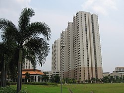 Farrer Park in 2006 | |
| Country | Singapore |

Farrer Park is a subzone of the Rochor planning area in the Central Region of Singapore, as defined by the Urban Redevelopment Authority bounded by Serangoon Road, Rangoon Road, Race Course Road, Northumberland Road, Tekka Lane and Bukit Timah Road.
Contents
The name "Farrer Park" historically referred to an open field situated to the west of this subzone, now commonly known as Farrer Park Field, located within Kallang planning area.