This article has multiple issues. Please help improve it or discuss these issues on the talk page . (Learn how and when to remove these messages)
|
Bugis | |
---|---|
Subzone of Downtown Core Planning Area | |
Name transcription(s) | |
• Chinese | 武吉士 |
• Pinyin | Wǔjíshì |
• Malay | Kampong Bugis كامڤوڠ بوڬيس |
• Tamil | பூகிஸ் |
Coordinates: 1°17′57″N103°51′22″E / 1.29921°N 103.85618°E | |
Country | Singapore |
Planning region | Central Region |
Planning area | Downtown Core |
Bugis (Kampong Bugis in Malay) is an area in Singapore that covers Bugis Street, now located within the Bugis Junction shopping mall. [1] [2] Bugis Street was renowned internationally from the 1950s to the 1980s for its nightly gathering of transvestites and transsexuals, a phenomenon which made it one of Singapore's most notable attractions for foreign visitors at the time. [3] [4]
In the mid-1980s, Bugis Street underwent major urban redevelopment into a retail complex of modern shopping malls, restaurants and nightspots mixed with regulated back-alley roadside vendors. Underground digging to construct the Bugis MRT station prior to that also caused the upheaval and termination of the nightly transgender sex bazaar culture, marking the end of a colourful and unique era in Singapore's history.
Today, the original Bugis Street is now a cobblestoned, relatively wide avenue sandwiched between the buildings of the Bugis Junction shopping complex. On the other hand, the lane presently touted as "Bugis Street" by the Singapore Tourist Promotion Board is actually developed from New Bugis Street, formerly Albert Street, and is billed as "the largest street-shopping location in Singapore". An attempt by the Singapore Tourist Promotion Board to bring back the former exotic atmosphere was unsuccessful.[ citation needed ] Although the street is now not a well-known tourist destination, it is frequented by many Singaporeans.
Bugis Street lies in an extensive area which was commonly referred to Xiao Po (小坡; 'little slope') by the Chinese-speaking community in the past. The latter stretched all the way from Tanjong Pagar, through Singapore's Chinatown, to Jalan Sultan. Its length was thriving and crammed with merchants and traders, making it one of the most vibrant economic zones of old Singapore.
Before the arrival of the British, there used to be a large canal which ran through the area where the Bugis, a seafaring people from South Sulawesi province in Indonesia, could sail up, moor their boats and trade. It was these people after whom the thoroughfare was named. The Bugis, or Buginese, also put their sailing skills to less benign uses and gained a reputation in the region as pirates. [5] A large influx of them migrated to the present area from Tanjungpinang in January 1820 fleeing a battle between 400 Buginese and Dutch artillery soldiers in retaliation for the death of a chieftain murdered in a violent scuffle that ensued due to the Dutch captain apprehending several Bugis men opening shots celebrating a wedding of said chieftain's cousin. [5] [6]
During the early colonial era, there also used to be low mounds of whitish sand in the area, earning the street the familiar Hokkien (Min Nan) moniker of Peh Soa Pu or Bai Sha Fu in Mandarin (白沙浮; 'white sand mounds'). The Cantonese, however, referred to the street as Hak Gaai or Hei Jie in Mandarin (黑街; 'black street') as there were many clubs catering to the Japanese in the 1940s. During the first half of the 20th century, commuters could travel from Bugis Street to anywhere else in Xiao Po via a tram service which ran along North Bridge Road, which was referred to by the Chinese-educated as Xiao Po Da Ma Lu (小坡大马路; 'little slope main road').
Prior to the second world war, Bugis had a high proportion of Japanese prostitutes; Karayuki-san. [7] At its peak, there were 633 Karauki-san to 109 brothels, with a high concentration within the area of Bugis Street, Malabar Street, and Hylam Street. [8] Due to the lack of space in the early-style, two storey, shophouse, overcrowding and hygiene issues became problematic. With many people using the same latrines and drinking water sources, disease spread with a cholera outbreak occurring in Bugis, Malabar, and Hylam Streets. [9] This led to them being zoned off. The bad hygiene and poor ventilation due to overcrowding of the sites led to the Singapore Improvement Trust trying to demolish those buildings and rebuild. This led to the infamous "Bugis Street Case" which over the course of multiple courts decisions, decided that it was not legal to commandeer a building and only pay the price of the land, which had been going on previously and the decision was made by 1937, that new houses should be built to alleviate overcrowding and problems that are associated instead of tearing it down and rebuilding, expecting change to occur. [10] [11] This established a new form of slum clearance in Singapore that was more closely tied to the rights of the citizen and the owner.
After World War II, hawkers gathered there to sell food and goods. There was initially also a small number of outdoor bars set up beside rat-infested drains.[ citation needed ]
When transvestites began to rendezvous in the area in the 1950s, they attracted increasing numbers of Western tourists who came for the booze, the food, the pasar malam shopping and the "girls". Business boomed and Bugis Street became a lively and bustling area, forming the heart of Xiao Po. It was one of Singapore's most famous tourist areas from the 1950s to the 1980s, renowned internationally for its nightly parade of flamboyantly-dressed transvestites and it attracted hordes of Western gawkers who had never before witnessed Asian queens in full regalia. [7]
There was an adage amongst Westerners that one could easily tell a transvestite woman from a woman: the transvestites and trans women were drop-dead gorgeous, while the rest were, in their view, ordinary women.[ citation needed ] The amount of revenue that the trans communities of Bugis Street raked in was considerable, providing a booster shot in the arm for the tourism industry. The street was popularly called Boogie Street by British servicemen.[ citation needed ]
Veterans recall that the notorious drinking section began from Victoria Street west to Queen Street. Halfway between Victoria and Queen Streets, there was an intersecting lane parallel to the main roads, also lined with al fresco bars. There was a well-patronised public toilet with a flat roof of which there are archival photos, complete with jubilant rooftop transvestites. [12]
One of the "hallowed traditions" bestowed upon the area by sojourning sailors (usually from Britain, Australia, and New Zealand), was the ritualistic "dance of the flaming arseholes" on top of the toilet's roof. Compatriots on the ground would chant the signature "Haul 'em down you Zulu warrior" song whilst the sailors performed their act. [13]
While many were concerned about the public image and embarrassment that went along with it, the global concern of HIV/AIDS became more prevalent, a growing suspicion of the activities that took place. The HIV scare in Singapore can draw parallels with the English syphilis scare. Bugis Street was demolished as a way of not only controlling the population to become more orderly and normative, but also to prevent an HIV epidemic. [14] With fears also being present that through homosexuality, the society and culture would denigrate and would limit the island's growth, especially post independence. By allowing a site like Bugis Street would go against the idea of Singapore's nuclear family and is, therefore, "othered" this othering scares the Singaporean authorities as it can be seen as dissenting. [14] By using an HIV scare and the economic benefits of inserting an MRT station and eventually a mall, the amount of resistance from most Singaporeans would be minimal.
The earliest published description of Bugis Street found by Yawning Bread as a place of great gender diversity was in the book "Eastern Windows" by F.D. Ommaney, 1960. [15] Ommaney did not date specifically his description of the street but his book made clear that he was in Singapore from 1955 to 1960. A first-person account of Bugis Street in the 1950s is by "Bob", a visiting Australian sailor is given here. [16]
In the mid-1980s, Bugis Street underwent major urban redevelopment into a retail complex of modern shopping malls, restaurants and nightspots mixed with regulated back-alley roadside vendors. Underground digging to construct the Bugis MRT station prior to that also caused the upheaval and termination of the nightly transgender sex bazaar culture[ citation needed ], marking the end of a colourful and unique era in Singapore's history.
Tourist and local lamentation of the loss sparked attempts by the Singapore Tourist Promotion Board (STPB) to attempt to recreate some of the old sleazy splendour by staging contrived "Ah Qua shows" on wooden platforms, but these artificial performances fell flat on their faces and failed to pull in the crowds. They were abandoned after a short time.
The trans women of Bugis Street were immortalised in an English-language film made by a Hong Kong film company which did employ some local talent in its production. [17] (For more details, see Bugis Street (Film) and Singapore gay films: Bugis Street).
Another famous movie about Bugis street is Saint Jack , made by the American director Peter Bogdanovich in 1979. However, the movie is controversial because it was banned by the authority for depicting Singapore as a “haven for pimps and whores”. [18]
The fame of the original Bugis Street has spawned many namesakes eager to capitalise on the brand, even though many tourists, as well as some young Singaporeans, have no inkling as to the reasons for its erstwhile "glamour". This has been inherited to the Bugis Junction, Bugis+ and Bugis MRT station.
The original Bugis Street became part of the Bugis Village, where shops such as Alice, RUSH, Covet and NAVI are also there, it also inherits the same style as Far East Plaza.
Queen Street Bus Terminal also known as Ban San Bus Terminal, is a bus terminal in Singapore. Queen Street Bus Terminal serves as the terminal for cross-border bus and taxi services to Johor Bahru, Malaysia.
Pasir Ris is a planning area and residential town located in the East Region of Singapore. It is bordered by Tampines and Paya Lebar to the south, Sengkang to the southwest and Changi to the east. The planning area also shares riverine boundary with Punggol to the west, separated by the Serangoon River, as well as having a maritime boundary with the North-Eastern Islands planning area, across the Straits of Johor.
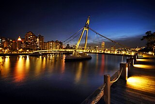
Kallang is a planning area and residential zone located in the Central Region of Singapore.
Simei is an estate located in Tampines Town in the Eastern Region of Singapore. The name Simei is pinyin for "Four Beauties" in Chinese. Formerly known as Tampines South, it was officially renamed to Simei in 1985.
Chinatown is a subzone and ethnic enclave located within the Outram district in the Central Area of Singapore. Featuring distinctly Chinese cultural elements, Chinatown has had a historically concentrated ethnic Chinese population.
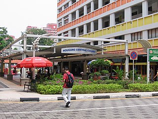
Hougang is a planning area and mature residential town located in the North-East Region of Singapore. It is the largest housing estate in Singapore based on land area, and is home to 247,528 residents as of 2018. Hougang planning area is bordered by Sengkang to the north, Geylang to the south, Bedok to the southeast, Toa Payoh to the southwest, Serangoon to the west and Paya Lebar to the east.
Holland Village, often abbreviated as Holland V, is a neighbourhood located along the boundary between the planning areas of Bukit Timah and Queenstown in the Central Region of Singapore.
Jurong East is a planning area and residential town situated in the West Region of Singapore. It borders Jurong West and Boon Lay to the west, Clementi to the east, Tengah and Bukit Batok to the north and Selat Jurong to the south.
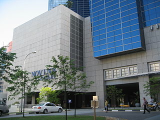
Novena is a planning area located within the Central Region of Singapore. Novena is bounded by Toa Payoh to the north, Bukit Timah to the west, Tanglin to the south and Kallang to the east. While Novena is not classified as a "new town" by the Housing and Development Board (HDB), the estate of Whampoa within the subzone of Balestier constitutes part of the Kallang/Whampoa New Town.
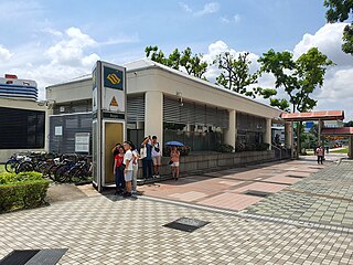
Bugis MRT station is an underground Mass Rapid Transit (MRT) interchange station on the East–West (EWL) and Downtown (DTL) lines, in Bugis, Singapore. The station is located underneath the junction of Rochor Road and Victoria Street. Various developments surrounding the station include Bugis Junction, Raffles Hospital and the National Library. The station is also close to Kampung Glam.
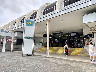
Kallang MRT station is an above-ground Mass Rapid Transit (MRT) station on the East West line in Kallang, Singapore. It is located next to the Kallang River and along Sims Avenue at the junction of Lorong 1 Geylang. Kallang station served as the nearest MRT station to the National Stadium and Singapore Indoor Stadium, until Stadium MRT station on the Circle line opened on 17 April 2010. However, the station is still linked to the Singapore Sports Hub via a sheltered walkway.
Bugis Junction, formerly known as Parco Bugis Junction is an integrated development located at Victoria Street, Middle Road and North Bridge Road in Bugis, Downtown Core in Singapore. The development consists of a shopping mall, an office tower and the InterContinental Singapore Hotel.
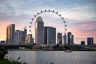
This article shows the notable future developments in Singapore. Most of them are currently under construction with most to be completed within the next five years.
Tanglin is a planning area located within the Central Region of Singapore. Tanglin is located west of Newton, Orchard, River Valley and Singapore River, south of Novena, east of Bukit Timah, northeast of Queenstown and north of Bukit Merah.
Hougang Mall, previously known as NTUC Hougang Mall, is a suburban shopping mall in Hougang, Singapore. It is near Hougang Central Bus Interchange, as well as Hougang MRT station.
Middle Road is a road in the Central Area of Singapore, stretching along the Downtown Core and Rochor planning areas. It starts from its junction with Selegie Road and ends at its junction with Nicoll Highway. Middle Road was already in existence in early Singapore, appearing in George Drumgoole Coleman's Map of Singapore in 1836. The area around Middle Road was the original settlement of the Hainanese immigrant community, a community noted for its active role in the food and beverage history of Singapore. From the late 19th century until the Second World War, the area around Middle Road, Hylam Street and Malay Street was also a bustling Japanese enclave known for its brothels of Karayuki-san and traditional shops run by the Japanese immigrants.
Prostitution in Singapore in itself is not illegal, but various prostitution-related activities are criminalized. This includes public solicitation, living on the earnings of a prostitute and maintaining a brothel. In practice, police unofficially tolerate and monitor a limited number of brothels. Prostitutes in such establishments are required to undergo periodic health checks and must carry a health card.
Bugis+, formerly Iluma, is a 10-storey shopping mall located 5 minutes from Bugis MRT station. It is located within the Bugis district of Singapore and opened on 28 March 2009.
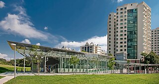
Lorong Chuan is a subzone and a precinct located in the town of Serangoon in the North-East Region of Singapore.
Bugis Street (妖街皇后) is a 1995 Hong Kong-Singapore co-production directed by Yonfan, about the lives of Singaporean transvestites in a bygone era. It was a minor hit at the box office with a sexually-explicit R(A) rating, male full-frontal nudity and its nostalgic evocation of a seedy but colourful aspect of Singaporean culture, prior to the redevelopment of Bugis Street into a modern shopping district and the eradication of transvestite activities in the area.
Bidadari is a housing estate and a subzone of Toa Payoh planning area, in the Central Region of Singapore.