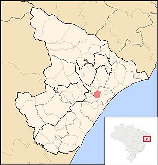
| Japaratuba River | |
|---|---|
| Location | |
| Country | Brazil |
| Physical characteristics | |
| Source | |
| • location | Sergipe state |
The Japaratuba River is a river of Sergipe state in northeastern Brazil.
| Japaratuba River | |
|---|---|
| Location | |
| Country | Brazil |
| Physical characteristics | |
| Source | |
| • location | Sergipe state |
The Japaratuba River is a river of Sergipe state in northeastern Brazil.

Sergipe, officially State of Sergipe, is a state of Brazil. Located in the Northeast Region along the Atlantic coast of the country, Sergipe is the smallest state in Brazil by geographical area at 21,910 square kilometres (8,460 sq mi), larger only than the Federal District. Sergipe borders Bahia to the south and west and Alagoas to the north. Aracaju is the capital and the largest city in the state; the state is divided into 75 municipalities. The state has 1.1% of the Brazilian population and produces only 0.6% of the Brazilian GDP.

Aracaju is the capital of the state of Sergipe, Brazil, located in the northeastern part of the country on the coast, about 350 km (217 mi) north of Salvador. According to the 2020 estimate, the city has 664,908 inhabitants, which represents approximately 33% of the state population. Adding to the populations of the municipalities forming the Metropolitan area: Barra dos Coqueiros, Nossa Senhora do Socorro and São Cristóvão. Its Metropolitan Cathedral Nossa Senhora da Conceiçao, dedicated to Our Lady of Immaculate Conception, is the archiepiscopal see of the Roman Catholic Archdiocese of Aracaju.
Amparo de São Francisco is a municipality located in the Brazilian state of Sergipe. Its population was 2,380 (2020) and its area is 35 km².

Japaratuba is a municipality located in the Brazilian state of Sergipe. Its population was 18,907 (2020) and its area is 360 km².
Malhada dos Bois is a municipality located in the Brazilian state of Sergipe. Its population was 3,699 (2020) and its area is 62 km².

Maruim is a municipality located in the Brazilian state of Sergipe. Its population was 17,271 (2020) and covers 95.55 km2 (36.89 sq mi). Maruim has a population density of 180 inhabitants per square kilometer. It is located 30 km (19 mi) from the state capital of Sergipe, Aracaju. Maruim borders the municipalities of Laranjeiras, Rosário do Catete, and Santo Amaro das Brotas, all within the state of Sergipe.
Muribeca is a municipality located in the Brazilian state of Sergipe. Its population was 7,639 (2020) and its area is 79 km².
Neópolis is a municipality located in the Brazilian state of Sergipe. Its population was 18,703 (2020) and its area is 259 km².
Nossa Senhora de Lourdes is a municipality located in the Brazilian state of Sergipe. Its population was 6,496 (2020) and its area is 80 km².

Propriá is a municipality located in the Brazilian state of Sergipe. Its population was 29,692 (2020) and its area is 95 km².
Santana do São Francisco is a municipality located in the Brazilian state of Sergipe. Its population was 7,844 (2020) and its area is 46 km2.
São Francisco is a municipality located in the Brazilian state of Sergipe. Its population was 3,781 (2020) and its area is 83 km².
Telha is a municipality in the Brazilian state of Sergipe. Its population was 3,249 (2020) and its area is 49 km2 (19 sq mi).
The Betume River is a river of Sergipe state in northeastern Brazil.
The Jacarecica River is a river of Sergipe state in northeastern Brazil.
The Pomonga River is a river of Sergipe state in northeastern Brazil.

The Poxim River is a river of Sergipe state in northeastern Brazil. The river runs through the sertão region of Sergipe. Its upper reaches are occupied by sugarcane farms (50%) and pastures (35%) and its mouth by an industrial zone. Almost all vegetation in the basin of the river and its tributaries has been removed, resulting in little diversity of flora and fauna in the region.
The Siriri River is a river of Sergipe state in northeastern Brazil.
The Auaiá-Miçu River is a river located in the Mato Grosso state of western Brazil.
The Itu River is a river of Rio Grande do Sul state in southern Brazil. It is a tributary of the Ibicuí River, which in turn is a tributary of the Uruguay River.
Coordinates: 10°44′30″S36°51′02″W / 10.74167°S 36.85056°W