The Balkans, also known as the Balkan Peninsula, is a geographic area in southeastern Europe with various definitions and meanings, including geopolitical and historical. The region takes its name from the Balkan Mountains that stretch throughout the whole of Bulgaria from the Serbian-Bulgarian border to the Black Sea coast. The Balkan Peninsula is bordered by the Adriatic Sea on the northwest, the Ionian Sea on the southwest, the Aegean Sea in the south and southeast, and the Black Sea on the east and northeast. The northern border of the peninsula is variously defined. The highest point of the Balkans is Mount Musala, 2,925 metres (9,596 ft), in the Rila mountain range.

The Carpathian Mountains or Carpathians are a mountain range system forming an arc roughly 1,500 km (932 mi) long across Central and Eastern Europe, making them the third-longest mountain range in Europe after the Ural Mountains with 2,500 km (1,553 mi) and Scandinavian Mountains with 1,700 km (1,056 mi).

Serbia is a sovereign state situated at the crossroads of Central and Southeast Europe, covering the far southern edges of the Pannonian Plain (Vojvodina) and the central Balkans. It shares borders with Bosnia-Herzegovina, Bulgaria, Croatia, Hungary, North Macedonia, Montenegro, Romania and Albania through the disputed territory of Kosovo. It is landlocked, although access to the Adriatic Sea is available through Montenegro, and the Danube River provides shipping access to inland Europe and the Black Sea.

The Balkan mountain range is a mountain range in the eastern part of the Balkan Peninsula. The Balkan range runs 560 km from the Vrashka Chuka Peak on the border between Bulgaria and Serbia eastward through central Bulgaria to Cape Emine on the Black Sea. The highest peaks of the Balkan Mountains are in central Bulgaria. The highest peak is Botev at 2,376 m, which makes the mountain range the third highest in the country, after Rila and Pirin. The mountains are the source of the name of the Balkan Peninsula.
The Ibar, also known as the Ibër and Ibri, is a river that flows through eastern Montenegro, Serbia and Kosovo, with a total length of 272 km (169 mi). The river begins in the Hajla mountain, in Rožaje, eastern Montenegro, passes through Kosovo and flows into the West Morava river near Kraljevo, Central Serbia.

The Šar Mountains or Sharr Mountains, form a mountain range in the Balkans that extends from Kosovo and the northwest of North Macedonia, to northeastern Albania. The mountain is colloquially called Šara and forms part of a national park in Kosovo.
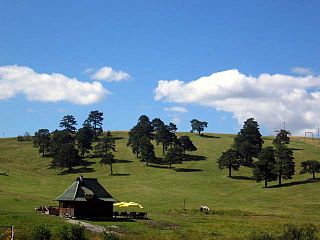
Zlatibor is a mountainous region situated in the western part of Serbia.

The Pannonian Basin, or Carpathian Basin, is a large basin in Central Europe. The geomorphological term Pannonian Plain is more widely used for roughly the same region though with a somewhat different sense, with only the lowlands, the plain that remained when the Pliocene Epoch Pannonian Sea dried out.

Fruška Gora is a mountain in north Srem. Most of it is in Syrmia, Serbia, but a small part on its western side overlaps into Croatia. Sometimes it is also referred to as jewel of Serbia due to its beautiful landscape protection area, nature and its picturesque countryside.

Kopaonik is a mountain located in Kosovo and Serbia. It is the largest mountain range in Serbia. The highest point is the Pančić's Peak with 2,017 m (6,617 ft). The central part of the Kopaonik plateau was declared a national park in 1981 which today covers an area of 121.06 km2 (46.74 sq mi).

Nova Varoš is a town and municipality located in the Zlatibor District of southwestern Serbia. The municipality of Nova Varoš has a population of 16,638, while the town of Nova Varoš itself has a population of 8,795 inhabitants.
Midzhur or Midžor is a peak in the Balkan Mountains, situated on the border between Bulgaria and Serbia. At 2,169 metres (7,116 ft), it is the highest peak of the Western Balkan Mountains, as well as the highest of Serbia outside Kosovo. Midžor is the 12th highest peak in the Balkan Mountains.

Đeravica or Gjeravica is the second-highest mountain peak in the Prokletije mountain range and the Dinaric Alps chain, after Maja Jezercë. It is the highest mountain in Kosovo, and, according to the view held by the government of Serbia that Kosovo is part of Serbia, the highest mountain of Serbia. It has an elevation of 2,656 m (8,714 ft) above sea level. Đeravica is in the western part of Kosovo, in the municipality of Junik. Before the 20th century, Đeravica used to be called Kaluđerovica.

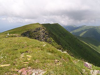
Golija (Srbija) is a mountain in southwestern Serbia, between towns of Ivanjica and Novi Pazar. It is part of the Dinaric mountain range. The mountain is heavily forested with significant biodiversity. It contains the Golija-Studenica Biosphere Reserve, the first UNESCO-MAB registered biosphere reserve in Serbia. It is also a small ski resort, with several historical monuments and monasteries. The highest peak is Jankov kamen at 1,833 m.
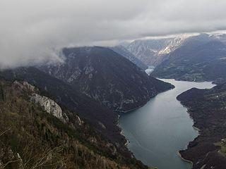
The Drina is a 346 km (215 mi) long international river, which forms a large portion of the border between Bosnia and Herzegovina and Serbia. It is the longest tributary of the Sava River and the longest karst river in the Dinaric Alps which belongs to the Danube river watershed. Its name is derived from the Latin name of the river which in turn is derived from Greek.

Skopska Crna Gora, often called and only as Crna Gora, also historically known as Karadağ, is a mountain range largely in North Macedonia, with smaller part in Kosovo. It lies between the cities of Kaçanik and Skopje. The highest peak is Ramno in North Macedonia. The largest town on the mountain is Kučevište in North Macedonia.

Rtanj is a mountain situated in eastern Serbia, approximately 200 km southeast of Belgrade, between towns of Boljevac on north and Sokobanja on south. It belongs to the Serbian Carpathians. Its highest peak is Šiljak, a natural phenomenon of karst terrain.

The regional geology of Serbia describes the geologic structure and history inside the borders of Serbia.