
Molesworth Station is a high country cattle station. It is located behind the Inland Kaikōura Mountain range in the South Island's Marlborough District. It is New Zealand's largest farm, at over 1,800 square kilometres and supports the country's biggest herd of cattle. It also hosts government science programs, such as research into bovine tuberculosis and related research into possums. The station helps rabbit population reduction.

The Conway River is part of the traditional boundary between the Canterbury and Marlborough regions in the South Island of New Zealand.
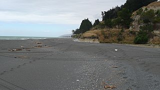
The Hundalee Hills are located close to the borders of Hurunui District and Kaikōura District in Canterbury in the South Island of New Zealand.
The Alma River is in Marlborough, New Zealand. It flows through rugged inland terrain before meeting the Severn River shortly before the Severn flows into the Acheron River.
The Charwell River is a river in the northeast of New Zealand's South Island. Its headwaters are in the Seaward Kaikōura Ranges and it feeds into the Conway River, the traditional boundary between Marlborough and Canterbury. Sheep farming has taken place in the Charwell River's valley.
Hundalee is a rural locality in the Hurunui District of the Canterbury region of New Zealand's South Island. It straddles the Conway River, the traditional boundary between Canterbury and Marlborough and is in the Hundalee Hills.

The Hurunui River is the fourth largest of the four principal rivers in north Canterbury, New Zealand, with a catchment area of 2,670 square kilometres (1,030 sq mi). The river flows from the eastern side of the Southern Alps, to the Pacific Ocean.
The Greta River is a river in the Hurunui District of New Zealand. It flows north-east into the Hurunui River, which runs into the Pacific Ocean south of Cheviot, New Zealand. State Highway 1 follows the river for part of its route between Cheviot and Waipara. The locality of Greta Valley is to the east of the Greta River on the banks of the Waikari River. The river was named by local runholders Sir Charles Clifford and Sir Frederick Weld in the 1850s after the Greta River in Yorkshire.
The Kaiwara River is a river of the northern South Island of New Zealand. The river is a tributary of the Hurunui River, its outflow being 17 kilometres (11 mi) southwest of Cheviot. The river flows initially east before turning southwest, twisting through a valley in the Lowry Peaks Range which lies between Cheviot and Culverden.

The Kowhai River is a river of the northeast of New Zealand's South Island. It flows south from the slopes of Manakau in the Seaward Kaikōura Range, turning southeast as it reaches its narrow coastal plain. The Kowhai River flows to the ocean to the west of the Kaikōura Peninsula, three kilometres west of the town of Kaikōura.
The Little Lottery River is a river of the northeast of New Zealand's South Island. It flows southwest through the Amuri Range, flowing into the Lottery River, part of the Waiau River system.
The McRae River is a river of the Marlborough Region of New Zealand's South Island. It flows north from its sources in the Inland Kaikoura Range to meet the Awatere River 40 kilometres (25 mi) southwest of Seddon.

The Oaro River is a river of the north Canterbury region of New Zealand's South Island. It flows south from its sources in the Hundalee Hills, turning east shortly before reaching the coast at Oaro, 15 kilometres (9 mi) southwest of Kaikōura.
The Rotowhenua River is a river of the Northland Region of New Zealand's North Island. A short, broad river, it flows into the Awaroa River to form a northern arm of the Whangape Harbour.
The Stanton River is a river of the Canterbury region of New Zealand's South Island. IUt flows southeast through the Hundalee Hills, turning southwest to reach the Waiau Uwha River 7 kilometres (4 mi) east of Waiau.
The Te Putaaraukai River is a river of the Northland Region of New Zealand's North Island. It flows north to reach the Rangaunu Harbour to the northeast of Awanui.
The Tinline River is a river of the Marlborough Region of New Zealand's South Island. It flows generally south from its sources at the northern end of the Bryant Range to reach the Pelorus River seven kilometres west of Pelorus Bridge. The river is named after the 19th-century Scots-born New Zealand surveyor and philanthropist John Tinline and commemorates the discovery of a route from Nelson to the Wairau.
The Gelt River is a river in the Canterbury region of New Zealand. It arises near Mount Peter in the Black Hills and flows south, then east and north-east into Conway River.
The 1901 Cheviot earthquake occurred at 07:47 NZT on 16 November 1901 with an estimated magnitude of 6.9, centred near the township of Cheviot in the Canterbury region of New Zealand.
The Waikari River is a river of the northern Canterbury region of New Zealand's South Island. It flows generally east through a broad strath from its sources south of Hawarden, gradually veering northeast to reach the Hurunui 20 kilometres (12 mi) southwest of Cheviot. The name Waikari comes from the Māori word wai meaning "water" and kari meaning "dig".

