Allegany County is located in the northwestern part of the U.S. state of Maryland. As of the 2020 census, the population was 68,106. Its county seat is Cumberland. The name Allegany may come from a local Lenape word, welhik hane or oolikhanna, which means 'best flowing river of the hills' or 'beautiful stream'. A number of counties and a river in the Appalachian region of the US are named Allegany, Allegheny, or Alleghany.

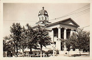
Hampshire County is a county in the U.S. state of West Virginia. As of the 2010 census, the population was 23,964. Its county seat is Romney, West Virginia's oldest town (1762). The county was created by the Virginia General Assembly in 1754, from parts of Frederick and Augusta Counties (Virginia) and is the state's oldest county. The county lies in both West Virginia's Eastern Panhandle and Potomac Highlands regions.

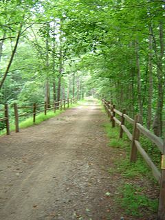
The East Coast Greenway is a 3,000-mile (4,800 km) rail trail linking the major cities of the Atlantic coast of the United States, from Calais, Maine, to Key West, Florida. The spine route and branching complementary routes are for non-motorized human transportation, including bicyclists, walkers, runners, inline skaters, horseback riders, wheelchair users, and cross-country skiers. In 2020 the greenway received over 50 million visits.

The South Branch Potomac River has its headwaters in northwestern Highland County, Virginia near Hightown along the eastern edge of the Allegheny Front. After a river distance of 139 miles (224 km), the mouth of the South Branch lies east of Green Spring in Hampshire County, West Virginia where it meets the North Branch Potomac River to form the Potomac.
The Northwestern Turnpike is a historic road in West Virginia, important for being historically one of the major roads crossing the Appalachians, financed by the Virginia Board of Public Works in the 1830s. In modern times, west of Winchester, Virginia, U.S. Route 50 follows the path of the Northwestern Turnpike into West Virginia, whose major Corridor D project follows the western section of the original Northwestern Turnpike.

U.S. Route 220 (US 220) is a spur route of US 20. It runs in a north–south layout in the eastern United States, unlike its parent which runs east-west. US 220 extends for 678 miles (1,091 km) from an intersection with US 1 in Rockingham, North Carolina, to its interchange with the Southern Tier Expressway in South Waverly, Pennsylvania. Some sections of the route are part of the Appalachian Development Highway System's Corridor O as well as I-73 in North Carolina. US 220 is designated as a spur route of US 20 but the route doesn't intersect US 20 or connect to other spurs of US 20.

Springfield is a census-designated place (CDP) in northwestern Hampshire County in the U.S. state of West Virginia. As of the 2010 census, Springfield had a population of 477. Springfield is located north of Romney along West Virginia Route 28 at its junction with Green Spring Road and Springfield Pike. It is currently considering incorporation.

Three Churches is an unincorporated community in Hampshire County in the U.S. state of West Virginia. The town is located north of Romney along Jersey Mountain Road at a crossroads with Three Churches Hollow Road. Originally known as Jersey Mountain, Three Churches was renamed for the three historic white wooden churches located there: Mount Bethel Church, Mount Bethel Primitive Baptist Church, and Branch Mountain United Methodist Church. The Three Churches Post Office is no longer in service.

Levels is an unincorporated community in Hampshire County in the U.S. state of West Virginia. According to the 2000 census, the Levels community has a population of 147. It is home to John J. Cornwell Elementary School.

Points is an unincorporated community in Hampshire County in the U.S. state of West Virginia. According to the 2000 census, the Points community has a population of 478.

South Branch Mountain is a mountain ridge that runs southwest to northeast through Hampshire and Hardy counties in the Eastern Panhandle of the U.S. state of West Virginia, rising to its greatest elevation of 3,028 feet above sea-level in the Nathaniel Mountain Wildlife Management Area. South Branch Mountain is among the largest and most prominent of the mountains in the Ridge-and-valley Appalachians of the Eastern Panhandle region. It forms the eastern edge of the South Branch Potomac River Valley from Springfield to Moorefield. The mountain was originally named Jersey Mountain by colonial settlers in the eighteenth century after Jersey.
The Bloomery Pike is a north–south named route that runs from the North Frederick Pike in Frederick County, Virginia, United States to the Northwestern Turnpike near Augusta in Hampshire County, West Virginia. The Bloomery Pike was named for the community of Bloomery and the bloomeries that operated there.

Mill Creek is a 14.0-mile-long (22.5 km) tributary stream of the South Branch Potomac River, belonging to the Potomac River and Chesapeake Bay watersheds. The stream is located in Hampshire County in West Virginia's Eastern Panhandle. Mill Creek flows into the South Branch west of Romney Bridge near Vanderlip along the Northwestern Turnpike.
Mill Branch is a 9.1-mile-long (14.6 km) tributary stream of the Cacapon River, belonging to the Potomac River and Chesapeake Bay watersheds. The stream is located in eastern Hampshire County in West Virginia's Eastern Panhandle.

Big Run is a 4.4-mile-long (7.1 km) tributary stream of the South Branch Potomac River, belonging to the Potomac River and Chesapeake Bay watersheds. Big Run flows through the city of Romney and the campus of the West Virginia Schools for the Deaf and Blind in Hampshire County, West Virginia. The stream is known by local residents as Town Run and Town Creek.

U.S. Route 50 in West Virginia runs from the border with Ohio to Virginia, passing briefly through Garrett County, Maryland, and following the Northwestern Turnpike. Prior to the U.S. Highway System it was West Virginia Route 1 and in the 1930s, the road was not finished in Maryland. Today the section of US 50 from Clarksburg to Parkersburg on the Ohio River is part of Corridor D of the Appalachian Development Highway System.
U.S. Route 322 is a spur of US 22, running from Cleveland, Ohio east to Atlantic City, New Jersey. In the U.S. state of Pennsylvania, the route runs from the Ohio border in West Shenango Township southeast to the Commodore Barry Bridge over the Delaware River in Chester, at which point the route crosses into New Jersey. The route passes near several cities, including DuBois, State College, and Harrisburg. US 322 in Pennsylvania is named the 28th Division Highway in honor of the 28th Infantry Division.

The Capon Lake Whipple Truss Bridge, formerly known as South Branch Bridge or Romney Bridge, is a historic Whipple truss bridge in Capon Lake, West Virginia. It is located off Carpers Pike and crosses the Cacapon River. The bridge formerly carried Capon Springs Road over the river, connecting Capon Springs and Capon Lake.


