Related Research Articles

Lycoming County is a county located in the U.S. Commonwealth of Pennsylvania. As of the 2010 census, the population was 116,111. Its county seat is Williamsport.

Jersey Shore is a borough in Lycoming County, Pennsylvania, United States. It is on the West Branch Susquehanna River, 15 miles (24 km) west by south of Williamsport. It is part of the Williamsport, Pennsylvania Metropolitan Statistical Area. In the past, Jersey Shore held farms, railroad shops, cigar factories, a foundry, and a large silk mill. The population was 4,361 at the 2010 census. The community is actually over 100 miles from New Jersey.

Washington Township is a township in Lycoming County, Pennsylvania, United States. The population was 1,613 at the 2000 census. It is part of the Williamsport, Pennsylvania Metropolitan Statistical Area.

Lycoming Creek is a 37.5-mile-long (60.4 km) tributary of the West Branch Susquehanna River located in Tioga and Lycoming counties in Pennsylvania in the United States.

The Line of Property is the name commonly given to the line dividing Indian from British Colonial lands established in the 1768 Treaty of Fort Stanwix between the British officials and the Indian tribes. In western Pennsylvania it is referred to as the Purchase line.

Larrys Creek is a 22.9-mile-long (36.9 km) tributary of the West Branch Susquehanna River in Lycoming County in the U.S. state of Pennsylvania. A part of the Chesapeake Bay drainage basin, its watershed drains 89.1 square miles (231 km2) in six townships and a borough. The creek flows south from the dissected Allegheny Plateau to the Ridge-and-valley Appalachians through sandstone, limestone, and shale from the Devonian, Mississippian, and Pennsylvanian periods.
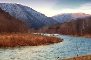
Pine Creek is a tributary of the West Branch Susquehanna River in Potter, Tioga, Lycoming, and Clinton counties in Pennsylvania in the United States. The creek is 87.2 miles (140.3 km) long. Within Tioga County, 23.25 miles (37.42 km) of Pine Creek are designated as a Pennsylvania Scenic River.

Loyalsock Creek is a 64-mile-long (103 km) tributary of the West Branch Susquehanna River located chiefly in Sullivan and Lycoming counties in Pennsylvania in the United States. As the crow flies, Lycoming County is about 130 miles (209 km) northwest of Philadelphia and 165 miles (266 km) east-northeast of Pittsburgh.

The Lycoming Valley Railroad is a short line that operates 38 miles (61 km) of track in Lycoming and Clinton counties in Pennsylvania in the United States. It is part of the North Shore Railroad System.

The Wellsboro and Corning Railroad is a 35-mile (56 km) shortline railroad that operates between Wellsboro, Pennsylvania and Corning, New York, passing through Tioga, and Lawrenceville. It parallels PA Route 287 and U.S. Route 15, following the valleys of Marsh Creek, Crooked Creek, and the Tioga River. The railroad connects with Norfolk Southern Railway's Southern Tier Line at Corning.

Little Pine State Park is a Pennsylvania state park on 2,158 acres (873 ha) in Cummings Township, Lycoming County, Pennsylvania in the United States. Little Pine State park is along 4.2 miles (6.8 km) of Little Pine Creek, a tributary of Pine Creek, in the midst of the Tiadaghton State Forest. A dam on the creek has created a lake covering 94 acres (38 ha) for fishing, boating, and swimming. The park is on Pennsylvania Route 4001, 4 miles (6.4 km) northeast of the unincorporated village of Waterville or 8 miles (13 km) southwest of the village of English Center. The nearest borough is Jersey Shore, Pennsylvania, about 15 miles (24 km) south at the mouth of Pine Creek on the West Branch Susquehanna River.
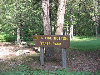
Upper Pine Bottom State Park is a 5-acre (2.0 ha) Pennsylvania state park in Lycoming County, Pennsylvania in the United States. The park is in Cummings Township on Pennsylvania Route 44 and is surrounded by the Tiadaghton State Forest. It is on Upper Pine Bottom Run, which gave the park its name and is a tributary of Pine Creek. Upper Pine Bottom State Park is in the Pine Creek Gorge, where the streams have cut through five major rock formations from the Devonian and Carboniferous periods.
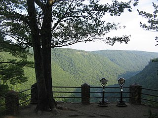
Colton Point State Park is a 368-acre (149 ha) Pennsylvania state park in Tioga County, Pennsylvania, in the United States. It is on the west side of the Pine Creek Gorge, also known as the Grand Canyon of Pennsylvania, which is 800 feet (240 m) deep and nearly 4,000 feet (1,200 m) across at this location. The park extends from the creek in the bottom of the gorge up to the rim and across part of the plateau to the west. Colton Point State Park is known for its views of the Pine Creek Gorge, and offers opportunities for picnicking, hiking, fishing and hunting, whitewater boating, and camping. Colton Point is surrounded by Tioga State Forest and its sister park, Leonard Harrison State Park, on the east rim. The park is on a state forest road in Shippen Township 5 miles (8 km) south of U.S. Route 6.
The Jersey Shore, Pine Creek and Buffalo Railway was a railroad built in the early 1880s to give the New York Central and Hudson River Railroad access to the coal regions around Clearfield, Pennsylvania, United States. It was originally planned as part of a connecting line between the East Coast of the United States and Buffalo, New York.

The West Branch Susquehanna Valley of central Pennsylvania, United States, in the Ridge-and-valley Appalachians, is the low-lying area draining into the West Branch Susquehanna River southeast of the Allegheny Front, northeast of the Bald Eagle Valley, southwest of the Wyoming Valley and north of the water gap formed between Shamokin Mountain and Montour Ridge.

The Pine Creek Rail Trail is a rail trail in the Appalachian Mountains of north-central Pennsylvania.
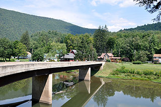
Cedar Run is an unincorporated community in Brown Township, Lycoming County, Pennsylvania, United States. Cedar Run, a stream with the same name as the community, enters Pine Creek at Cedar Run, in the Pine Creek Gorge. The stream is one of a half-dozen tributaries entering from the western side of Pine Creek, along with nearby Slate Run. The Pine Creek Rail Trail passes through Cedar Run. The village is linked to Pennsylvania Route 414 by a spur road crossing a bridge over Pine Creek.

The Pine Creek Path was a major Native American trail in the U.S. State of Pennsylvania that ran north along Pine Creek from the West Branch Susquehanna River near Long Island to the headwaters of the Genesee River.

Pennsylvania Route 287 is a 63.9-mile-long (102.8 km) state highway in the Tioga Valley of Pennsylvania. Route 287 begins at an intersection with U.S. Route 220 in the community of Larrys Creek in Piatt Township, Lycoming County to an intersection with Pennsylvania Route 49 just south of the New York state line in Lawrenceville, Tioga County. The route follows Larrys Creek through several isolated communities, including Salladasburg and English Center, before working its way towards Hoytville, where it meets Pennsylvania Route 414. The route ends up in Wellsboro, where it meets U.S. Route 6, and reaches Tioga.
References
- Leeson, Michael A. (1890). History of the Counties of McKean, Elk, Cameron and Potter, Pennsylvania. Chicago: J.H. Beers & Co.
- Meginness, John Franklin, ed. (1892). History of Lycoming County, Pennsylvania. Chicago: Brown, Runk & Co.
- Taber, Thomas T. III (1987). Railroads of Pennsylvania Encyclopedia and Atlas. Thomas T. Taber III. ISBN 0-9603398-5-X.