Prigrevica is a village located in the Apatin municipality, in the West Bačka District of Serbia. It is situated in the Autonomous Province of Vojvodina. The village is located 9 km east from Apatin. Population of Prigrevica counts about 3,964 people, mostly ethnic Serbs.

Palilula is one of five city municipalities which constitute the city of Niš. It has a population of 71,707 inhabitants. It was formed on 6 June 2002.
Pantelej is one of five city municipalities which constitute the city of Niš. The municipality has a population of 79,290 inhabitants, according to the 2011 census results.
Stari Grad or Stara Varoš, was one of five city municipalities which constituted the City of Kragujevac. It was the central cityn municipality and the most populous. The municipality was formed in May 2002, only to be dissolved in March 2008.

Ljukovo is a village in Serbia. It is situated in the Inđija municipality, in the Srem District, Vojvodina province. The village has a Serb ethnic majority and its population numbering 1,604 people. Ljukovo became famous for its "Club of Liar's"(Клуб Лажова),whose president is Mirko Bera.
Azanja is a village in Central Serbia, in the municipality of Smederevska Palanka. It lies in the region of Great Morava valley, on rivers of Jezava and Jasenica. Azanja is 160 meters above mean sea level. With 4,014 residents, it is one of largest villages in Central Serbia.

Semeteš is a town in Serbia. It is part of the municipality and district of Raška in south-western Serbia.
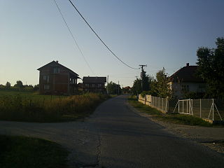
Brzan is a village in the municipality of Batočina, Serbia. According to the 2011 census, the village has a population of 1754 people.
Crni Kao is a village in the municipality of Batočina, Serbia. According to the 2011 census, the village has a population of 410 people.

Dobrovodica is a village in the municipality of Batočina, Serbia. According to the 2011 census, the village has a population of 381 people.

Gradac is a village in the municipality of Batočina, Serbia. According to the 2011 census, the village has a population of 206 people. The Gradac Cave located in the village is part of the Cultural Heritage of Serbia list, inscribed in 1979.

Kijevo is a village in the municipality of Batočina, Serbia. According to the 2011 census, the village has a population of 482 people.

Nikšić is a village in the municipality of Batočina, Serbia. According to the 2011 census, the village had a population of 176 people.

Prnjavor is a village in the municipality of Batočina, Serbia. According to the 2011 census, the village has a population of 166 people.
Čokonjar is a village in the municipality of Zaječar, Serbia. According to the 2002 census, the village has a population of 173 people.
Nevade is a village in the municipality of Gornji Milanovac, Serbia. At the 2011 census, the village had a population of 627 people.

Velika Popina is a village in Croatia. The settlement is administered as a part of Gračac municipality, Zadar County.

Gođevići is a village in the municipality of Srebrenica, Bosnia and Herzegovina.
Drača is a village in the municipality of Stanovo, Serbia. According to the preliminary results of the 2011 census, the village has a population of 911 people. In the domain of the village, cca 7 kilometres from the centre of the city of Kragujevac, the geographical centre of Serbia is located.

Kamenica is a village in the administrative area of city of Kragujevac, Serbia. According to the 2011 census, the village has a population of 329 people.