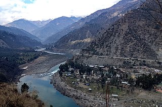
The Chenab River is a major river that flows in India and Pakistan, and is one of the 5 major rivers of the Punjab region. It is formed by the union of two headwaters, Chandra and Bhaga, which rise in the upper Himalayas in the Lahaul region of Himachal Pradesh, India. The Chenab flows through the Jammu region of in the Indian-administered Kashmir into the plains of Punjab, Pakistan, before ultimately flowing into the Indus River. The Battle of Chenab was fought between Sikhs and Afghans on the bank of the river.
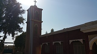
Toba Tek Singh District is a district of Faisalabad Division in the Punjab province of Pakistan. It is located between 30°33' to 31°2' Degree north latitudes and 72°08' to 72°48' Degree longitudes. It became a separate district in 1982.

Jhang is the capital city of Jhang District in central Punjab, Pakistan. Situated on the east bank of the Chenab river, it is the 18th largest city of Pakistan by population.
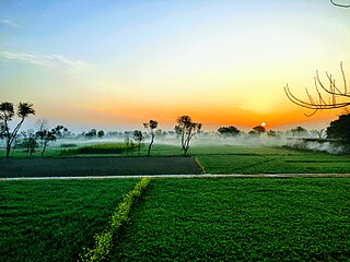
Jhang District is a district of Faisalabad division in the Punjab province, Pakistan. Jhang city is the capital and administrative seat of district.

Chak, a Punjabi word, is the land revenue settlement/assessment circle marking a contiguous block of land. The word Chak comes from Chakar referring to a wheel in Punjabi, specifically a wheel associated with a water well. Historically there was one water well allotted per village and every village number allotted as per water-well wheel. Now the individual chak circles have come to be associated with the name of the village founded within the revenue circle. Chak circles are based on the British Raj era revenue collection system. To enhance the government revenue during the British Raj, new canals were built to bring the barani (rainfed) areas under cultivation by introducing the irrigation to the bangar (upland) areas of Punjab region. Block of contiguous land irrigated by the specific Rajwaha were given a unique chak number each. The migrant farmers were brought in to settle into those newly irrigated areas around the core of new villages [which started out as dhanis]. Those new villages were called by the same name as their corresponding irrigation circle chak number. Government left it to those residents to give "chaks" a proper village name later. In due time, the term "chak" became synonymous with the term "village".

Sheikhan town is situated in Chiniot Tehsil and in District Chiniot in Punjab province of Pakistan.
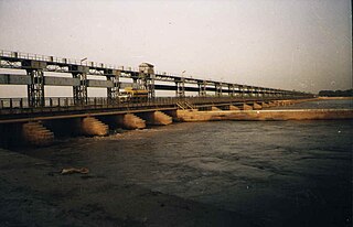
Trimmu Barrage is a barrage on the River Chenab in the Jhang District of the Punjab province of Pakistan. It is situated downstream of the confluence of the River Jhelum and River Chenab. It is situated some 25 km from the city of Jhang near the city of Atharan Hazari where the River Jhelum flows into the River Chenab. It was one of the 7 link canals to be built under the Indus Water Plan of Pakistan. Pakistan created this plan after Indus Water Treaty

The Bar Region, or the Bars, is an area in Punjab, now part of the Punjab Province of Pakistan. The area consists of agricultural land that was cleared in the nineteenth century for the then 'new' canal irrigation system that the British were developing at the time. The soil of the Bar Region is fertile. The plains of fertile land have been created by the stream deposits driven by the many rivers flowing from the Himalayas.
The Rakh Branch Canal originates from the Lower Chenab Canal. The main areas to which it supplies water is Hafizabad, Nankana Sahib and Faisalabad in Punjab province of Pakistan. A total of 283 Villages situated and their subsequent land is irrigated through Rakh Branch.
Khanki Headworks is a headworks situated on the River Chenab in Gujranwala District of the Punjab province of Pakistan. The construction of this headworks was completed in 1889 and was one of the oldest headworks in Pakistan.
The Lower Chenab Canal is a canal in Pakistan. It was dug in 1892 and originates from Khanki Headworks, on the River Chenab in Gujranwala District.
The Gugera Branch Canal originates from the Lower Chenab Canal. The canal supplies water mainly to the agriculture lands in Toba Tek Singh and Faisalabad districts of Punjab province in Pakistan. The 137-km long canal is named after Gogera, which was the administrative seat of the district when the canal was being developed.
Awagat is a town of Jaranwala Tehsil in the Faisalabad District, Punjab, Pakistan, 12 km from Jaranwala and 25 km from Faisalabad. Its history goes back to the construction of the extensive canal irrigation system in Punjab around the 1860s. A rest house was constructed at Awagat to look after construction and maintenance of the Awagat Distributory, a branch emerging from the Upper Gogera Canal at Punj Pulla near Buchiana. It is located at 31°9'0N 73°16'0E with an altitude of 175 metres. Awagat Adda is situated at the junction of four villages – Chak 66GB, 65GB, 64GB and 63GB – located in two union councils of Tehsil Jaranwala. It is situated in two Provincial Assembly and National Assembly constituencies that are NA 76 and NA 77.
Burj Mandi is a village in Chak Jhumra town in Faisalabad district in Pakistan's Punjab province. The village has a railway station on the Faisalabad Sargodha Railway.
Samundri Tehsil is an administrative subdivision of Faisalabad District in the Punjab province of Pakistan. Samundri is the city and headquarters of the tehsil. Samundri Tehsil farms are irrigated by Gugera Branch Canal and Burala Branch Canal.
Mouza Talib is a village in District Chiniot on Chak Jhumra Road, Punjab, Pakistan. It is in Tehsil Chiniot's Union Council # 13 and is 8 km away from the Faisalabad to Pindi Bhattian Motorway M3 Sahianwala Interchange. Its latitude is 31° 41' 28.08"N, and longitude is 73° 0' 59.49"E. Via M3, Talib is 140 kilometers from Lahore and 30 kilometers from Faisalabad. Nearby towns are Chak Jhumra, Chiniot, Sargodha, Lalian, Bhawana, Rabwah, Faisalabad and Pindi Bhattian. By road, Talib is connected to Barnala, Chak Jhumra, and Chiniot. The most famous things in Talib are Darbar Baba gard Ali, Canal Bridge, Government Primary school for Boys Girls and Government Middle school for girls.
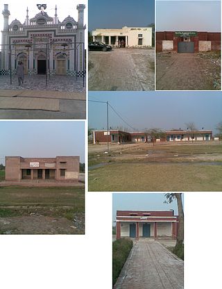
Khichian is a village in the Faisalabad District, on Chiniot, Chak Jhumra road, Punjab, Pakistan. It is in Tehsil Chak Jhumra's Union Council # 04 and is 4 km away from the Faisalabad to Pindi Bhattian Motorway M4 Deputy Wala Interchange. Its Latitude is 31° 36' 27.83"N, and Longitude is 73° 07' 31.35"E. The people of Khichian use the M3 to commute, as it is 140 kilometers away from Lahore and 24 kilometers away from Faisalabad. Nearby towns are Faisalabad, Chak Jhumra, Chiniot, Pindi Bhattian. By road, Khichian is connected to Faisalabad, Barnala, Chak Jhumra, and Chiniot. By Hassan Raza Khichi @hassanrazakhichi
The Punjab Canal Colonies is the name given to parts of western Punjab which were brought under cultivation through the construction of canals and agricultural colonisation during the British Raj. The Punjab underwent an agricultural revolution, with arid subsistence production getting replaced by commerce-oriented production of huge amounts of wheat, cotton and sugar. Between 1885 and 1940, nine canal colonies were created in the inter-fluvial tracts west of the Beas and Sutlej and east of the Jhelum rivers. In total, over one million Punjabis settled in the new colonies, relieving demographic pressures in central Punjab.

The Punjab Irrigation Department is a provincial government department responsible for irrigation in the Punjab province of Pakistan. It irrigates 21 million acres (8,500,000 ha) of the agricultural land in the province.
Village Balloki, located in Tehsil Pattoki, District Kasur, has a rich and diverse history spanning centuries. Here's a brief overview


