Related Research Articles

Jamalpur District is a district in Bangladesh, part of the Mymensingh Division. It was established in 1978. It has its headquarters in Jamalpur.

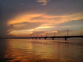
The Jamuna River is one of the three main rivers of Bangladesh. The two other major rivers in Bangladesh are the Padma and the Meghna. The Jamuna is the lower stream of the Brahmaputra River, which originates in Tibet as Yarlung Tsangpo, before flowing through India and then southwest into Bangladesh. The Jamuna flows south and joins the Padma River, near Goalundo Ghat, before meeting the Meghna River near Chandpur. The Meghna then flows into the Bay of Bengal.

Kushtia District is a district in the Khulna administrative division of western Bangladesh. Kushtia is the second largest municipality in Bangladesh and the eleventh largest city in the country. Kushtia has existed as a separate district since the partition of India. Prior to that, Kushtia was name of a subdivision of Nadia district. Kushtia is the birthplace of many historical figures including Mir Mosharraf Hossain (1847–1912), Bagha Jatin (1879–1915) and Lalon (1774–1890). Nobel laureate poet Rabindranath Tagore lived his early life at Shelaidaha, a village in the district.

Manikganj District is a district in central Bangladesh and part of the Dhaka Division. It was established in 1845 as a subdivision of Faridpur District, then in 1953, it was transferred to Dhaka District for administrative purposes. Finally in 1984, Manikganj was declared a full district.

Sirajganj District is a district in the North Bengal region of Bangladesh, located in the Rajshahi Division. It is the 25th largest district by area and 9th largest district by population in Bangladesh. It is known as the gateway to North Bengal.

Sarishabari is an upazila of Jamalpur District in the Division of Mymensingh, Bangladesh.

Bhuyanpur is an upazila of Tangail District in the Division of Dhaka, Bangladesh.

Kalihati is an upazila of Tangail District, Dhaka Division, Bangladesh.

Chauhali is an upazila, or sub-district of Sirajganj District, located in Rajshahi Division, Bangladesh.

The Bangshi is an important river in central Bangladesh. It originates in Jamalpur, from the course of the old Brahmaputra and flows past the Madhupur tract. It flows through Tangail and meets the Tongi in Ghazipur. It passes near Jatiyo Smriti Soudho in Savar and falls into the Dhaleshwari. About 238 kilometres (148 mi) long, it is not navigable for most of the year except when swelled by the monsoon rains. Louhajang River is a tributary of the Bangshi. Dhamrai on the banks of the Bangshi is famous for its muslin weaving.

Louhajang River is located in central Bangladesh. It branches off from the Jamuna near Gabsain at Bhuapur, Tangail District. Thereafter it bifurcates before the two parts meet up again. It flows past Tangail city, Karotia and Jamurki before joining the Bangshi. The Louhajang is linked with the Dhaleshwari.
Kalindi River is a tidal estuarine river in and around the Sundarbans in North 24 Parganas district in the Indian state of West Bengal, bordering on Satkhira District of Bangladesh.
The Chiknai River, also known as the Dangha, is located in Bangladesh in the beels west of Chatmohor in Pabna District.
Kazipur River flows through Kazipur Upazila in Sirajganj District, Bangladesh. It then flows south and joins the Ichamati River.
Nagar River begins in the Bogra District of Bangladesh and ends in Natore District.

The Narayanganj–Bahadurabad Ghat line is a railway line connecting Narayanganj and Bahadurabad Ghat in Bangladesh. There are branch lines to Jagannathganj Ghat and Netrakona-Mohanganj. This track is under the jurisdiction of Bangladesh Railway.

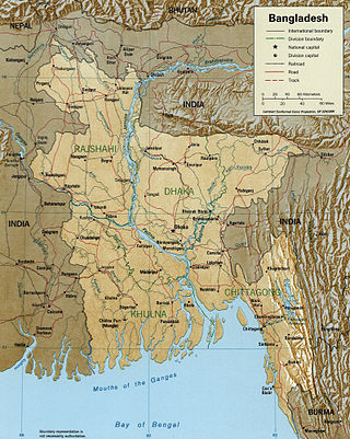
The divisions of Bangladesh are further divided into districts or zilas. The headquarters of a district is called the district seat. There are 64 districts in Bangladesh. The districts are further subdivided into 495 subdistricts or upazilas.
The Betna River is located in Bangladesh. It originates in Jessore District, flows through Satkhira and Khulna, where it is called Kalia River, and forms a branch called Dalua River. The Kalia is a tributary of the Kobadak River. The Betna changes its name to Arpangachhia River when it reaches the Sundarbans, and changes it again to the Malancha before flowing into the Bay of Bengal.
The Haringhata River is located in Bangladesh. It is one of the large coastal rivers of the Ganges-Padma system south of the confluence of the Bhola and the Baleshwar, and sets part of the boundary between Bagerhat District and Barguna District before emptying into the Bay of Bengal. The Haringhata flows between Sarankhola Upazila in Bagerhat district, and Patharghata Upazila of Barguna district.
The Hurasagar River, or Hoorsagar, is a major river of Bangladesh that formerly flowed into the Ganges, but now joins the Jamuna. It receives water from the Baral, the Phuljhar.
References
- ↑ Pal, Samar (2012). "Jamalpur District". In Islam, Sirajul; Jamal, Ahmed A. (eds.). Banglapedia: National Encyclopedia of Bangladesh (Second ed.). Asiatic Society of Bangladesh. map shows the Jhenai River.
- ↑ Islam, Arifa (2012). "Tangail District". In Islam, Sirajul; Jamal, Ahmed A. (eds.). Banglapedia: National Encyclopedia of Bangladesh (Second ed.). Asiatic Society of Bangladesh. map shows the Jhenai River.
24°38′45″N89°51′01″E / 24.6458°N 89.8504°E