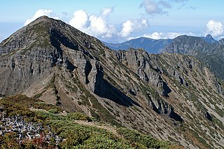
Jiguan Cave is located at Luoyang city in Henan province, China. This cave is on the medium of Jiguan mountain, a branch of Funiu mountain, at an altitude of 1201 meters. According to experts' research, Jiguan Cave formed about 600 million years ago. Jiguan Cave was found in the Qianlong period of the Qing dynasty. In August 1992, Jiguan Cave was developed, completed on March 31, 1993, and it opened up in April 1993.
Jiguan Cave belongs to the limestone cave, mainly consists of stalactites and stalagmites. It is geologically described as a karst landform. This cave reaches a length of meters, the vertical stratification is five, and it drops 138 meters. There are 1800 meters, and 2300 square meters for travelling. The cave keeps 18°C in all the seasons, which is known as "natural air conditioning". The formation of Jiguan cave involves physics, chemistry, geography, meteorology, nature and other factors, and is one of the precious heritages.
In April 1993, the original Xinhua President Muqing to title the Jiguan cave "The First Cave of North". In July 2013, China geological society of grotto research association professor Zhu Xuewen evaluated Jiguan cave: "This landscape is a spectacular, the first cave of all the north; and its origin is unique, for this Jiguan cave is the foremost dragon temple of China."
A pika is a small, mountain-dwelling mammal native to Asia and North America. With short limbs, a very round body, an even coat of fur, and no external tail, they resemble their close relative, the rabbit, but with short, rounded ears. The large-eared pika of the Himalayas and nearby mountains lives at elevations of more than 6,000 m (20,000 ft).
A loess is a clastic, predominantly silt-sized sediment that is formed by the accumulation of wind-blown dust. Ten percent of Earth's land area is covered by loesses or similar deposits.
Arsia Mons is the southernmost of three volcanoes on the Tharsis bulge near the equator of the planet Mars. To its north is Pavonis Mons, and north of that is Ascraeus Mons. The tallest volcano in the Solar System, Olympus Mons, is to its northwest. Its name comes from a corresponding albedo feature on a map by Giovanni Schiaparelli, which he named in turn after the legendary Roman forest of Arsia Silva. Historically, it was known as Nodus Gordii before being renamed.
Phong Nha-Kẻ Bàng is a national park and UNESCO World Heritage Site in the Bố Trạch and Minh Hóa districts of central Quảng Bình Province in the North Central Coast region of Vietnam, about 500 km south of Hanoi. The park borders the Hin Namno National Park in Khammouane Province, Laos to the west and 42 km east of the East sea from its borderline point. Phong Nha-Kẻ Bàng National Park is in a limestone zone of 2,000 km2 in Vietnamese territory and borders another limestone zone of 2,000 km2 of Hin Namno in Laotian territory. The core zone of this national park covers 857.54 km2 and a buffer zone of 1,954 km2.
The Wuyi Mountains or Wuyishan are a mountain range located in the prefecture of Nanping, in northern Fujian province near the border with Jiangxi province, China. The highest peak in the area is Mount Huanggang at 2,158 metres (7,080 ft) on the border of Fujian and Jiangxi, making it the highest point of both provinces; the lowest altitudes are around 200 metres (660 ft). Many oolong and black teas are produced in the Wuyi Mountains, including Da Hong Pao and lapsang souchong, and are sold as Wuyi tea. The mountain range is known worldwide for its status as a refugium for several rare and endemic plant species, its dramatic river valleys, and the abundance of important temples and archeological sites in the region, and is a UNESCO World Heritage Site.
Shei-Pa National Park is a national park located in the central part of Taiwan around the peaks of Hsuehshan and Dabajian Mountain, with an area of 768.5 km2 (296.7 sq mi), covering the area of Hsinchu County, Miaoli County and Taichung City. High mountain ecology, geology, topography, rivers, creek valleys, rare animals and plants, and plentiful variety of forest types are some important resources for conservation.
The North Hungarian Mountains, sometimes also referred to as the Northeast Hungarian Mountains, Northeast Mountains, North Hungarian Highlands, North Hungarian Mid-Mountains or North Hungarian Range, is the northern, mountainous part of Hungary. It forms a geographical unity with the Mátra-Slanec Area, the adjacent parts of Slovakia. It is a separate geomorphological area within the Western Carpathians.
Songzi is a city in the southwest of Hubei province, People's Republic of China, located in the middle reach and southern bank of the Yangtze River. It is a county-level city under the administration of the prefecture-level city of Jingzhou, and controls 16 townships and 2 development zones, 235,000 households and a population of 765,911. It is a long-historied but young and robust city.
Al Hamra is a 400-year-old town in the region Ad Dakhiliyah, in northeastern Oman. As a province (wilayat), it is home to a number of villages including the mountainside village of Misfat Al Abryeen, with the village of Ghul to the northwest of the town, and Bimah to the north-northeast. The town and province lie on the southern slopes of the Akhdar Mountains.
Pei Wenzhong, or W. C. Pei, was a Chinese paleontologist, archaeologist and anthropologist born in Fengnan. He is considered a founding figure of Chinese anthropology.
Fort Rock–Christmas Lake Valley is a basin of a former inland sea that existed in that region from Pliocene through late Pleistocene time.
Rugova Canyon or Rugova Gorge is a river canyon near Peja in western Kosovo. The canyon is located in the Albanian Alps, close to the border with Montenegro. With a length of 25 km (16 mi) and a depth up to 1,000 meters, Rugova is considered to be one of Europe's longest and deepest canyons. It was created by water erosion and the retreat of the Peja glacier. The Lumbardhi i Pejës river cuts through the canyon.
Flagstaff Mountain is a foothill on the eastern flank of the Front Range of the Rocky Mountains of North America, located in the Flatirons region. The 6,983-foot (2,128 m) peak is located in Boulder Mountain Park in Boulder County, Colorado, United States.
Dust Cave is a Paleoindian archaeology site located in northern Alabama. It is in the Highland Rim in the limestone bluffs that overlook Coffee Slough, a tributary of the Tennessee River. The site was occupied during the Pleistocene and early Holocene eras. 1LU496, another name for Dust Cave, was occupied seasonally for 7,000 years. The cave was discovered in 1984 by Dr. Richard Cobb and initially excavated in 1989 under Dr. Boyce Driskell from the University of Alabama.
Yandang Mountains or Yandangshan refers, in the broad sense, to a coastal mountain range in southeastern Zhejiang province in eastern China, covering much of the prefecture-level city of Wenzhou and extending to the county-level city of Wenling in Taizhou prefecture. The mountain range is divided in two by the Oujiang River, the two parts being the North Yandang and South Yandang. More narrowly, Yandangshan is also used to refer to Mount Yandang, a specific part of the North Yandang around an ancient caldera near a small town of the same name. The highest peaks of North Yandang are located here, and this is also the main tourist spot. In this article, name "Yandang Mountains" is used to refer the mountain range and "Mt. Yandang" to refer to the caldera.
Buzeyir cave – is an archaeological site and Paleolithic place of human habitation. The cave is located on the left bank of the Zuvandchay River, at the top of Delikli-Dash Mountain, 3 km (1.9 mi) at an altitude of 1,640 m (5,380 ft) above sea level and to the east of Büzeyir village in Lerik Rayon, Azerbaijan.
Zengpiyan is a Neolithic cave site in southern China. It is located in the Guilin region on the south-western fringes of the Dushan Mountain in the autonomous region Guangxi and is considered to be one of the most important cave sites of the Neolithic in China as it is one of the many independent centers for the introduction of animal domestication and pottery.
Mount Laojun is a mountain in Henan Province, China.
The Zhongfeng Cave, or Zhongfeng Dong, known as "underground karst museum", is a large limestone cave located in Nuoshui River Town, Tongjiang County, Bazhong City, Sichuan Province. In 2000, it was referred to as the "first cave in the all under heaven" by Zhu Xuejian, the then president of the Cave Research Society of China.
The Lingxiao Rock, or Lingxiaoyan, also known as Lingxiao Cave, is a karst cave located in Helang Town, Yangchun, Yangjiang. Characterized by the karst topography, it is about 60 meters high and 30 meters wide.
This page is based on this Wikipedia article Text is available under the CC BY-SA 4.0 license; additional terms may apply. Images, videos and audio are available under their respective licenses.