Skookumchuck is a locality in the East Kootenay region of the province of British Columbia, Canada, along British Columbia highway 93/95 at the junction of the Kootenay and Lussier Rivers.

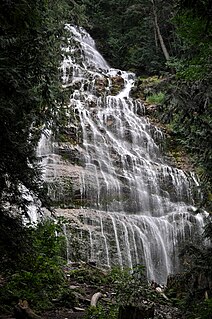
Bridal Veil Falls Provincial Park is located on the Trans-Canada Highway just east of Rosedale, British Columbia, Canada, part of the City of Chilliwack. The community of Bridal Falls is located adjacent to the falls and park was well as the interchange between the Trans-Canada and BC Highway 9 and has a variety of highway-based tourism services.

Hedley is an unincorporated town in southern British Columbia, Canada, named after Robert R. Hedley, the manager of the Hall Smelter in Nelson. Hedley is located at the foot of Nickel Plate Mountain in the Similkameen. The town had a population of approximately 242 as of 2016. In the early 1900s, Hedley's population peaked over 1,000 people, primarily due to the gold mining industry. The Hedley Museum and the Mascot Mine Museum display artifacts and photographs from this era.
Arrow Lakes Provincial Park is a provincial park in British Columbia, Canada.
Beaver Creek Provincial Park is a provincial park in British Columbia, Canada.
Boundary Creek Provincial Park is a provincial park in British Columbia, Canada located northeast of the city of Grand Forks in that province's Boundary Country, adjacent to BC Highway 3. The eponymous Boundary Creek flows through the park.
Blanket Creek Provincial Park is a provincial park in British Columbia, Canada. It hosts one of the nearest campgrounds for visitors going to the Mount Revelstoke National Park.
Christina Lake Provincial Park is a provincial park in British Columbia, Canada. The lake it's on, Christina Lake, is renowned as the warmest tree-lined lake in British Columbia.
Gladstone Provincial Park is a provincial park in British Columbia, Canada, surrounding and north of the north end of Christina Lake in that province's Boundary Country.
Jewel Lake Provincial Park is a provincial park in British Columbia, Canada, located at the northeast end of Jewel Lake, which lies north of Greenwood and northwest of Grand Forks in that province's Boundary Country.
Kingfisher Creek Provincial Park is a provincial park in British Columbia, Canada, located 15 km southeast of Sicamous and west of Mabel Lake, in the Monashee Mountains. The park is 440 ha. in size and was created to enhance the viability of the Kingfisher Creek Ecological Preserve.
Roberts Creek Provincial Park is a provincial park in British Columbia, Canada, located northwest of the community of Roberts Creek, between Gibsons and Sechelt. First created in 1947 with an area of 100 acres (0.40 km2), it was modified in size in 2000 to approximately 40 ha.

Greenwood is a city in south central British Columbia. It was incorporated in 1897 and was formerly one of the principal cities of the Boundary Country smelting and mining district. It was incorporated as a city originally and has retained that title despite the population decline following the closure of the area's industries.
Burrell Creek is a creek just north of Grand Forks, British Columbia, in the Similkameen Division, Yale Land District, in an area known as the Boundary Country. It flows south into the Granby River, of which it is a tributary.
Tonquin Pass, 1948 m (6393 ft), is a mountain pass in the Canadian Rockies, linking Tonquin Valley in Jasper National Park, Alberta, to Mount Robson Provincial Park and adjoining areas of British Columbia. It is at the headwaters of Tonquin Creek, which flows into British Columbia. Located on the interprovincial boundary, it is on the Continental Divide.
Collins Gulch is a creek in the Similkameen region of British Columbia. Collins Gulch is a stream which flows into the Tulameen River from the south side. The creek is about 1.5 miles (2.4 km) east of the village of Tulameen, British Columbia. Collins Gulch was discovered in 1885. It was mined by both Europeans and Chinese for gold. Early mining efforts were successful although diggings were exhausted quite rapidly.
Jolly Creek is a creek located in the Boundary Country region of British Columbia. The creek is south of Conkle Lake. Jolly Creek flows into Rock Creek. It was discovered in 1860 and has been mined for gold. The Creek was named after local prospector Jolly Jack Thornton.
Skeff Creek is a creek in the Boundary Country region of British Columbia. The creek flows east into July Creek, west of Smelter Lake, Similkameen Division Yale Land District. Skeff Creek used to be called Taylor Creek. The creek has been mined.

Jolly Jack's Lost Mine is a legend about a hidden placer mine supposed to be located in the Boundary Country of British Columbia. The mine has been written about by local historians and various magazines. Many have searched for the lost placer mine of Jolly Jack. It is a local legend in the Boundary Country.

Cascade Falls Regional Park is a regional park under the administration of the Fraser Valley Regional District in the Lower Mainland region of British Columbia, Canada. The park was originally 9.5 hectares in area but was expanded to a current 22 hectares. It has picnic tables and pit toilets, with various hiking trails and a walkway leading to a viewing platform over a large waterfall 30m in vertical drop, which is 15 minutes from the park's parking lot. It is located in the McConnell Creek area northeast of Mission, which gets its name from the former name of Cascade Creek, McConnell Creek, which was named for a logger in the area called Jack McConnell. Cascade Creek's outfall is into the southeast end of Stave Lake near Davis Lake Provincial Park.


