Related Research Articles

Bahia is one of the 26 states of Brazil, located in the Northeast Region of the country. It is the fourth-largest Brazilian state by population and the 5th-largest by area. Bahia's capital is the city of Salvador, on a spit of land separating the Bay of All Saints from the Atlantic. Once a monarchial stronghold dominated by agricultural, slaving, and ranching interests, Bahia is now a predominantly working-class industrial and agricultural state. The state is home to 7% of the Brazilian population and produces 4.2% of the country's GDP.

The São Francisco River is a large river in Brazil. With a length of 2,914 kilometres (1,811 mi), it is the longest river that runs entirely in Brazilian territory, and the fourth longest in South America and overall in Brazil. It used to be known as the Opara by the indigenous people before colonisation, and is today also known as "Velho Chico".

Caculé is a Brazilian municipality located in the state of Bahia, which possesses 23,291 inhabitants as of 2020, according to IBGE. It is situated 750 kilometers southwest from Salvador. Its economy is based mostly on agriculture. The climate in Caculé is warm and dry during the day, being cooler at night, at about 15 °C. The "Rio Antônio" crosses the city. Although it presently has no operational railroad station, Caculé is midpoint on the Ferrovia Centro Atlântica railroad route connecting Montes Claros to Salvador, Bahia.

Miraí is a Brazilian municipality located in the state of Minas Gerais. The city belongs to the mesoregion of Zona da Mata and to the microregion of Muriaé.

São João do Paraíso is a city in the northeast of the Brazilian state of Minas Gerais. In 2020 its population was estimated to be 23,709 in a total area of 1,921 km².
The Catolé Grande River is a river of Bahia state in eastern Brazil.
Santa Maria da Boa Vista is a municipality in the state of Pernambuco, Brazil. The population in 2020, according with IBGE was 42,100 and the area is 3000.77 km².

Brotas de Macaúbas is a municipality in the state of Bahia in the North-East region of Brazil.
Ibipitanga is a municipality in the state of Bahia in the North-East region of Brazil.
Ibitiara is a municipality in the state of Bahia in the North-East region of Brazil.
Novo Horizonte, Bahia is a municipality in the state of Bahia in the North-East region of Brazil.
Oliveira dos Brejinhos is a municipality in the state of Bahia in the North-East region of Brazil.

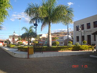
Guanambi bahia, is a municipality in the state of Bahia in the North-East region of Brazil.

Urandi is a municipality in the state of Bahia in the North-East region of Brazil.
Érico Cardoso is a municipality in the state of Bahia in the North-East region of Brazil.

Tabocas do Brejo Velho is a municipality in the state of Bahia in the North-East region of Brazil.
José Raydan is a municipality in the state of Minas Gerais in the Southeast region of Brazil.
Joaquim Távora is a municipality in the state of Paraná in the Southern Region of Brazil.

Chapada Diamantina is a region of Bahia state, in the Northeast of Brazil. This mountain range is known as “Serra do Espinhaço,” in Minas Gerais state, south of Bahia.

Uibaí is a municipality in the state of Bahia in the North-East region of Brazil. It is located about 508 kilometres (316 mi) byroad northwest of Salvador. It lies to the northeast of Gentio do Ouro and about 30 kilometres (19 mi) south-southwest of Irecê, the nearest city. Xique-Xique and the São Francisco River is to the northwest.
References
Coordinates: 12°29′56″S42°38′23″W / 12.4989°S 42.6398°W