
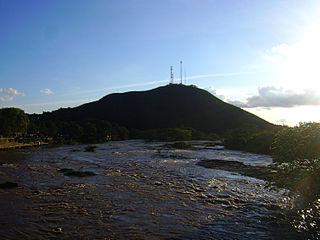
The São Francisco River is a large river in Brazil. With a length of 2,914 kilometres (1,811 mi), it is the longest river that runs entirely in Brazilian territory, and the fourth longest in South America and overall in Brazil. It used to be known as the Opara by the indigenous people before colonisation, and is today also known as "Velho Chico".

The Jequitinhonha River flows mainly through the Brazilian state of Minas Gerais. Its source lies near Diamantina in the Espinhaço Mountains at an elevation of 1,200 metres (3,900 ft), after which it flows northward and then east-northeastward across the uplands. At Salto da Divisa, it is interrupted by the Cachoeira (falls) do Salto Grande, 43 metres (141 ft) high. The river descends to the coastal plain at the city of Jequitinhonha, beyond which it is also called Rio Grande do Belmonte, and empties into the Atlantic Ocean at Belmonte in Bahia state after a course of approximately 1,090 kilometres (680 mi). The main tributaries are the Araçuaí River, Piauí, São Miguel, Itacambiruçu, Salinas, São Pedro, and São Francisco.

The Maxakalían languages were first classified into the Jê languages. It was only in 1931 that Čestmír Loukotka separated them from the Jê family. Alfred Métraux and Curt Nimuendajú considered the Maxakalían family isolated from others. John Alden Mason suggests a connection with the Macro-Jê stock, confirmed by Aryon Rodrigues.

Vriesea is a genus of flowering plants in the botanical family Bromeliaceae, subfamily Tillandsioideae. The genus name is for Willem Hendrik de Vriese, Dutch botanist, physician (1806–1862). Its species are widespread over Mexico, Central America, South America and the West Indies.

Dyckia is a genus of plants in the family Bromeliaceae, subfamily Pitcairnioideae.

Mining in Brazil is centered on the extraction of iron, copper, gold, aluminum, manganese, tin, niobium, and nickel. About gemstones, Brazil is the world's largest producer of amethyst, topaz, agate and is a big producer of tourmaline, emerald, aquamarine, garnet and opal.

Jordânia is a Brazilian municipality located in the northeast of the state of Minas Gerais. The city belongs to the mesoregion of Jequitinhonha and to the microregion of Almenara. As of 2020 the population was 10,842 in a total area of 549 km².

Capitão Enéas is a municipality in the north of the Brazilian state of Minas Gerais. As of 2020 the population was 15,313 in a total area of 970 km2.

Juvenília is a municipality in the north of the state of Minas Gerais in Brazil. As of 2020 the population was 5,715 in an area of 1,065 km².

The Carinhanha River is a river of Bahia and Minas Gerais states in eastern Brazil.
The Mucuri River is a river of Bahia and Minas Gerais states in eastern Brazil.

The Pardo River is a river of Bahia and Minas Gerais states in eastern Brazil.
Rio Verde Grande is a river of Minas Gerais state in eastern Brazil, that forms the boundary with Bahia state in its lowest reaches. It is a tributary of the São Francisco River.
Rio Verde Pequeno It is a tributary of the Rio Verde, it demarcates the border between the States of Minas Gerais and Bahia in eastern Brazil.

Carinhanha is a municipality in the state of Bahia in the North-East region of Brazil. Carinhanha covers 2,529.45 km2 (976.63 sq mi), and has a population of 29,070 with a population density of 12 inhabitants per square kilometer. It is located on the banks of the Rio São Francisco and the Carinhanha River, which also forms the border of the state of Minas Gerais.

Feira da Mata is a municipality in the state of Bahia in the North-East region of Brazil. Feira da Mata covers 1,176.105 km2 (454.097 sq mi), and has a population of 5,661 with a population density of 5 inhabitants per square kilometer. It was originally part of Carinhanha, but became an independent municipality in 1989.

The Kamakã languages are a small family of extinct Macro-Jê languages of Bahía, northeastern Brazil. The attested Kamakã languages are:

Vellozia is a plant genus in the family Velloziaceae, established in 1788.

Subtropical Storm Ubá was the fourth tropical or subtropical cyclone to form in the South Atlantic Ocean in 2021. Ubá originated from an area of low pressure that formed off the coast of Rio de Janeiro and evolved into a subtropical cyclone on 10 December. The cyclone lingered for two days, before weakening back to a low-pressure area and dissipating on 13 December. Together with the South Atlantic Convergence Zone (SACZ), Ubá caused heavy rains in Minas Gerais, in Espírito Santo and mainly in Bahia. The storm became the deadliest South Atlantic (sub)tropical cyclone, with a death toll of 15.
