Junga Thapachaur जुँगा थापाचौर | |
|---|---|
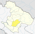
 Junga Thapachaur Location in Nepal | |
| Coordinates: 28°42′N81°58′E / 28.70°N 81.96°E | |
| Country | |
| Zone | Bheri Zone |
| District | Jajarkot District |
| Population (1991) | |
• Total | 3,510 |
| Time zone | UTC+5:45 (Nepal Time) |
Junga Thapachaur is a former village development committee in Jajarkot District in the Karnali Province of Nepal. At the time of the 1991 Nepal census it had a population of 3,510 living in 608 individual households. [1]