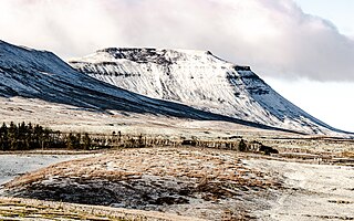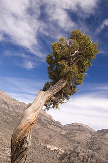
Junipers are coniferous plants in the genus Juniperus of the cypress family Cupressaceae. Depending on taxonomic viewpoint, between 50 and 67 species of junipers are widely distributed throughout the Northern Hemisphere, from the Arctic, south to tropical Africa, from Ziarat, Pakistan, east to eastern Tibet in the Old World, and in the mountains of Central America. The highest-known juniper forest occurs at an altitude of 16,000 ft (4,900 m) in southeastern Tibet and the northern Himalayas, creating one of the highest tree-lines on earth.

Aksi is an Estonian island in the Gulf of Finland with an area of 59 hectares. Coordinates are 59°35′59″N25°05′23″E It forms an archipelago with nearby islands of Prangli and Keri. Aksi belongs to Idaotsa village in Viimsi Parish, Harju County.

Juniperus virginiana, known as red cedar, eastern redcedar, Virginian juniper, eastern juniper, red juniper, pencil cedar, and aromatic cedar, is a species of juniper native to eastern North America from southeastern Canada to the Gulf of Mexico and east of the Great Plains. Further west it is replaced by the related Juniperus scopulorum and to the southwest by Juniperus ashei.

Juniper Networks, Inc. is an American multinational corporation headquartered in Sunnyvale, California, that develops and markets networking products. Its products include routers, switches, network management software, network security products and software-defined networking technology.

Chatyr-Dah is a mountainous massif in Crimea, near Simferopol-Alushta highway. In the Crimean Tatar language çatır means tent and dağ means mountain.

Gila Cliff Dwellings National Monument is a U.S. National Monument created to protect Mogollon cliff dwellings in the Gila Wilderness on the headwaters of the Gila River in southwest New Mexico. The 533-acre (2.16 km2) national monument was established by President Theodore Roosevelt through executive proclamation on November 16, 1907. It is located in the extreme southern portion of Catron County. Visitors can access the Monument by traveling northbound from Silver City, New Mexico approximately 37 miles on NM 15.

A juniper berry is the female seed cone produced by the various species of junipers. It is not a true berry but a cone with unusually fleshy and merged scales, which give it a berry-like appearance. The cones from a handful of species, especially Juniperus communis, are used as a spice, particularly in European cuisine, and also give gin its distinctive flavour. Juniper berries may be the only spice derived from conifers.

Vahase is a 65.52 ha Estonian islet in the Gulf of Riga. It's located about 200 m (660 ft) west of the island of Abruka. Administratively Vahase belongs to the Abruka village in Lääne-Saare Parish, Saare County.

Juniper Springs, located in the Ocala National Forest east of Ocala, Florida, is a natural spring that forms the headwaters of Juniper Creek that winds its way to Lake George in the Saint Johns River.

USCGC Juniper (WLB-201) is the lead ship of the U.S. Coast Guard's seagoing buoy tenders. She is outfitted with some of the most advanced technological and navigational capabilities currently available.

Grand Gulf State Park is a state-operated, privately owned and publicly accessible, geologic preserve near Thayer, Missouri, encompassing a forked canyon that is the remnant of an ancient collapsed dolomite cave system. The land that is now the park was acquired by conservationist Leo Drey (1917–2015) before becoming part of the Missouri state parks system. The 322-acre (130 ha) state park has been operated by the Missouri Department of Natural Resources under a lease agreement with the L-A-D Foundation since 1984. Grand Gulf was declared a National Natural Landmark in 1971 as an excellent example of karst topography and underground stream piracy. A 60-acre (24 ha) portion of the park was designated by the state as the Grand Gulf Natural Area in 1986.
Calatañazor is a municipality located in the province of Soria, Castile and León, Spain. According to the 2010 census (INE), the municipality has a population of 70 inhabitants. The municipality is named after the tiny fortified city on top of a hill.

Scott's Gulf is a canyon situated along the Caney Fork in White County, Tennessee, in the southeastern United States. The canyon stretches for approximately 18 miles (29 km) as the Caney Fork drops from the top of the Cumberland Plateau down to the eastern Highland Rim. This remote section of the river is home to a wilderness area consisting of a largely undisturbed deciduous forest, numerous waterfalls, caves and other geological formations, and Class IV and Class V whitewater rapids.
Goshute Canyon Wilderness is a 42,544-acre (17,217 ha) wilderness area in northern White Pine County in the U.S. state of Nevada. Located in the Cherry Creek Range north of the town of Mcgill, the Wilderness was created by the "White Pine County Conservation, Recreation and Development Act of 2006" and is administered by the U.S. Bureau of Land Management.

Hayatullah Khan Durrani, PP is a Pakistani caver, mountaineer, environmentalist, organizer, and a rescuer. He is also a part-time sports anchor actor on Pakistani television. He played a significant role in the promotion of mountaineering, rock climbing, caving, canoeing, and, kayaking as adventure sports in Pakistan. He is naturalist and early advocate of preservation of Juniper forests Juniperus macropoda wilderness in Ziarat and adjacent areas in Balochistan. He is the founder and President of the Pakistan Cave Research & Caving Federation (PCRCF) and the Director of the Asian Canoe Confederation (ACC).
Garlyk Sanctuary is a sanctuary (zakaznik) of Turkmenistan.
Chiltan Adventurers Association Balochistan is a non-profit government adventure sports association in Balochistan, Pakistan. It consists of young boys and girls dedicated to the promotion of mountain adventure, sports climbing and associated sports. Its goals are to protect the new generation from dangerous drug abuse, by providing them with healthy sporting opportunities, organizing training camps, and national and provincial level event expeditions. 95% of all the players receiving training from CAAB are students of schools and colleges in Balochistan. The activities of the CAAB are financed by self-help, donations, and subscriptions of members and annual grant-in-aid from Balochistan Sports Control Board (BSCB) Quetta.
Öakse is an island in the Baltic Sea belonging to the country of Estonia.
Võrkrahu is a small islet belonging to the country of Estonia off the west coast of the larger island of Saaremaa in the Kuusnõmme Gulf of the Baltic Sea. It is administered by Lääne-Saare Parish. Võrkrahu lies in an oblong North-South direction and is covered in pine and junipers. It covers an area of 6.07618 hectares and a circumference of 1.32628 kilometers and is part of Vilsandi National Park.