| Kajin Sara | |
|---|---|
| Location | Manang district, Nepal |
| Coordinates | 28°29′48.7″N84°15′22.2″E / 28.496861°N 84.256167°E |
| Type | lake |
 | |
Kajin Sara is a lake in the Manang district of Nepal. [1] [2]
| Kajin Sara | |
|---|---|
| Location | Manang district, Nepal |
| Coordinates | 28°29′48.7″N84°15′22.2″E / 28.496861°N 84.256167°E |
| Type | lake |
 | |
Kajin Sara is a lake in the Manang district of Nepal. [1] [2]
A group of mountaineers discovered the Kajin Sara lake in early 2019. The lake is situated in Chame rural municipality of Manang district, Nepal. The lake is 1,500 meters long and 600 meters wide in its dimensions. [3] The Lake is one of the highest altitude lake in the world, 5002 m above sea level. [4] It is considered sacred by Buddhists, Sikhs and Hindus[ citation needed ]. It will be highest altitude lake replacing Tilicho Lake, which is now the highest lake in the world. [5]
The visitors can reach Chame of Manang District via jeep from Besisahar, Lamjung. The trekking Starts from Chame, Nepal situated at 2650 m altitude.
The First-day trek is about a 5-6 hour walk uphill up to 3760 m to stay at Lamjung Himal Base Camp. The trail starts with motor roads and follows along the forest filled with pine trees. The path dips up and down until you reach Lamjung Himal Base Camp. There are some Sheds and a new shelter for accommodation, where trekkers can spend overnight free of cost, however, you have to carry your food and sleeping equipment.
The next day's trek is of 6–10 hours to high camp at 4750m depending upon weather condition. There is a place to stay at high camp. Low camp is still under construction at 4200m, which upon completion will make this trekking route much easier for the tourists.
Day 3 is a 2 hours walk uphill from high camp to Kajin Sara at 5020 m and return to High camp (2hours) or Lamjung base camp(6–8 hours).
Day 4 from Lamjung Base camp to Chame rural municipality.
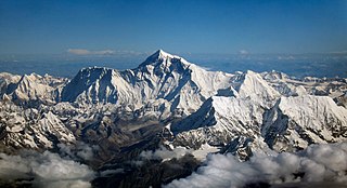
Mount Everest is Earth's highest mountain above sea level, located in the Mahalangur Himal sub-range of the Himalayas. The China–Nepal border runs across its summit point. Its elevation of 8,848.86 m was most recently established in 2020 by the Chinese and Nepali authorities.

Manaslu is the eighth-highest mountain in the world at 8,163 metres (26,781 ft) above sea level. It is in the Mansiri Himal, part of the Nepalese Himalayas, in west-central Nepal. Manaslu means "mountain of the spirit" and the word is derived from the Sanskrit word manasa, meaning "intellect" or "soul". Manaslu was first climbed on May 9, 1956, by Toshio Imanishi and Gyalzen Norbu, members of a Japanese expedition. It is said that, given the many unsuccessful attempts by the British to climb Everest before Nepali Tenzing Norgay and New Zealander Edmund Hillary, "just as the British consider Everest their mountain, Manaslu has always been a Japanese mountain".

Kala Patthar is a notable landmark located on the south ridge of Pumori in the Nepali Himalayas above Gorakshep. Although not a proper mountain, with a prominence of only 10 m (33 ft), the ascent of Kala Patthar is very popular with trekkers in the region of Mount Everest since it provides the most accessible closeup view of Everest. Due to the structure of the Everest Massif, its high summit is blocked by Nuptse from much of the surrounding region.

Gorak Shep, also spelled Gorakshep, is a settlement nestled on the periphery of a frozen lakebed blanketed with sand in Nepal, sharing its name with the locale. Situated at an elevation of 5,164 meters near Mount Everest, it remains uninhabited for most of the year, reopening only for the Mount Everest trekking season.
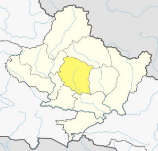
Kaski District, a part of Gandaki Province, is one of the seventy-seven districts of Nepal. The name is disambiguated from Kaskikot, the ancient Kaski Kingdom.

Thorong La or Thorung La is a mountain pass with an elevation of 5,416 metres (17,769 ft) above sea level in the Damodar Himal, north of the Annapurna Himal, in central Nepal. Thorong Ri is on the slope of Khatung Kang and Yakawa Kang are the mountains forming Thorong La. The pass is located on a trail that connects the village of Manang in the Manang District to the east, with the temple of Muktinath and the nearby village of Ranipauwa, in the Mustang District to the west. Thorong La is the highest point on the Annapurna Circuit, a 300 km (190 mi) route around the Annapurna mountain range. In addition to trekkers, the pass is regularly used by local traders.

Tilicho Lake is a glacial lake located in the Manang district of Nepal, 55 kilometres (34 mi) as the crow flies from the city of Pokhara. It is situated at an altitude of 4,919 metres (16,138 ft) in the Annapurna range of the Himalayas. Another source lists the altitude of Lake Tilicho as being 4,949 metres (16,237 ft) above mean sea level. According to the Nepali Department of Hydrology & Meteorology (2003), no aquatic organism has been recorded in the lake.

Stok Kangri is the highest mountain in the Stok Range of the Zazkar Mountains a Trans-Himalayan mountain in the Ladakh region of north India. The peak is located in Hemis National Park, 12 km southwest of the trailhead in the village of Stok and around 15 km southwest of the city of Leh, the capital of Ladakh.

Gokyo Peak is a 5,357 m (17,575 ft)-high peak in the Khumbu region of the Nepal Himalayas. It is located on the west side of the Ngozumpa glacier, which is the largest glacier in Nepal and reputed to be the largest in the whole Himalayas. Gokyo, at the base of Gokyo Ri, is a small hamlet of a few stone houses and one of the highest settlements in the world. From the summit of Gokyo Ri it is possible to see four 8,000-metre peaks: Mount Everest, Lhotse, Makalu and Cho Oyu. The Gokyo Lakes are in the area. Other mountains, such as Pumori and Nuptse are also visible from the top, along with five tranquil glacier lakes named together as gokyo lakes. The Gokyo-Ri summit is a 3-hour hike from the nearest village.

Jomsom, also known as Dzongsam, is the centre of Gharapjhong rural municipality in Mustang district and a former independent village development committee situated at an altitude of about 2,700 metres (8,900 ft) in Gandaki Province of western Nepal. The soaring peaks of Dhaulagiri and Nilgiri form a backdrop to the town straddling the Kali Gandaki River, which flows right through the centre of Jomsom. Along the banks of the Kali Gandaki, black fossilised stones called shaligram, considered as an iconic symbol and reminder of the god Vishnu in the Hindu culture, can be found. Such stones are believed to be found only in the Kali Gandaki, and are considered holy by Hindus.

Manang is a town in the Manang District of Nepal. It is located at 28°40'0N 84°1'0E with an elevation of 3,519 metres (11,545 ft). According to the preliminary results of the 2011 Nepal census, the district has a population of 6,527 people living in 1,495 individual households. Its population density is 3 persons/km2.
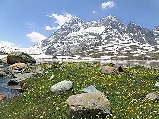
Mt Harmukh is a mountain with a peak elevation of 5,142 metres (16,870 ft), in Ganderbal district of Jammu and Kashmir in India. Harmukh is part of the Himalayas Range and is located between Sind River in the south and Kishanganga River in the north, rising above Gangabal Lake in the vicinity of Kashmir valley. It is mostly climbed from the northwestern side of Arin, via Kudara, Bandipore. Harmukh is considered sacred in Hinduism.

Annapurna Conservation Area is Nepal's largest protected area covering 7,629 km2 (2,946 sq mi) in the Annapurna range of the Himalayas. It ranges in elevation from 790 m (2,590 ft) to the peak of Annapurna I at 8,091 m (26,545 ft). The conservation area stretches across Manang, Mustang, Kaski, Myagdi, and Lamjung Districts. Annapurna Conservation Area encompasses Annapurna Sanctuary and is known for several trekking routes including the Annapurna Circuit.
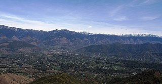
Joginder Nagar Valley is a valley in the Indian state of Himachal Pradesh. The valley contains the town of Joginder Nagar, Bir-Billing, Chauntra and various other hill resorts surrounded by mountains on all sides. The valley falls in the mid-hill zone of the Dhauladhar mountain range in the foothills of the Indian Himalayas. Geographically, the valley starts near Ghatta at its westernmost point and stretches south-eastwards up to Ghatasani, 15 kilometres from the main town. On an average, the valley is stretched 20 kilometres in length and 10 kilometers in width.

The Great Himalaya Trail is a route across the Himalayas from east to west. The original concept was to establish a single long distance trekking trail from the east end to the west end of Nepal that includes a total of roughly 1,700 kilometres (1,100 mi) of path. There is a proposed trail of more than 4,500 kilometres (2,800 mi) stretching the length of the Greater Himalaya range from Nanga Parbat in Pakistan to Namche Barwa in Tibet thus passing through, India, Nepal, Bhutan and Tibet. Although an actual continuous route is currently only a concept, if completed it would be the longest and highest alpine hiking track in the world.

The Annapurna Circuit is a trek within the mountain ranges of central Nepal. The total length of the route varies between 160–230 km, depending on where motor transportation is used and where the trek is ended. This trek crosses two different river valleys and encircles the Annapurna Massif. The path reaches its highest point at Thorung La pass, reaching the edge of the Tibetan plateau. Most trekkers hike the route anticlockwise, as this way the daily altitude gain is slower, and crossing the high Thorong La pass is easier and safer.

The Marshyangdi is a mountain river in Nepal. Its length is about 150 kilometres.
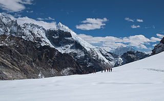
Cho La is a summit pass located 5,420 metres (17,782 ft) above sea level in the Solukhumbu District in northeastern Nepal. It connects the village of Dzongla to the east and the village of Thagnak to the west.

The Mount Everest climbing season of 2017 began in spring with the first climbers reaching the top on May 11, from the north side. The first team on the south side reached the top on May 15. By early June, reports from Nepal indicated that 445 people had made it to the summit from the Nepali side. Reports indicate 160–200 summits on the north side, with 600–660 summiters overall for early 2017. This year had a roughly 50% success rate on that side for visiting climbers, which was down from other years. By 2018, the figure for the number of summiters of Everest was refined to 648. This includes 449 which summited via Nepal and 120 from Chinese Tibet.
Siddhi Mishra is the youngest girl in the world and the youngest person from India to have climbed the Everest Base Camp (EBC) in Nepal, which is situated at an altitude of 5364 meters above sea level. Expedition Himalaya awarded her a certificate, and her name was featured in the 2024 India Book of Records.