Gulmi District, a part of Lumbini Province, is one of the seventy-seven districts of Nepal. The district, with Tamghas as its headquarters, covers an area of 1,149 km2 (444 sq mi), had a population of 296,654 in 2001, 280,160 in 2011 and 268,597 in 2016.

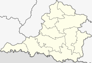
Syangja District, a part of Gandaki Province, is one of the seventy-seven districts of Nepal. The district, with Syangja bazaar as its district headquarters, covers an area of 1,164 km2 (449 sq mi) and had a population of 289,148 It lies in the hilly region at an altitude ranging from about 300 meters along the banks of Kaligandaki river up to a couple of thousands meters above the sea level. It lies at about latitude 28°4'60 North and longitude 83°52'0 East.

Baglung is a municipality in western Nepal, 275 km (171 mi) west of Kathmandu. It is the administrative headquarters of Baglung District and Dhaulagiri Zone. Baglung serves as the major center for business, finance, education, service and healthcare for the people of mid-Kali Gandaki valley that encompass Beni, Jaljala, Baglung, Kushma, Kathekhola, Galkot, Phalewas and Jaimuni local bodies. The city is located at the cross-section of Kaligandaki corridor highway and midhill highway that transverse Nepal in north–south and east–west directions respectively.

Situated on the bank of Kaligandaki river, Khadgakot is a town and Village Development Committee, in Gulmi District in the Lumbini Zone of central Nepal. At the time of the 1991 Nepal census it had a population of 4297 persons living in 808 individual households.
Arjun Chaupari is a rural municipality in Syangja District in Gandaki Pradesh, central Nepal. In 12 March 2017, the government of Nepal implemented a new local administrative structure consisting of 744 local units. With the implementation of the new local administrative structure, VDCs have been replaced with municipal & village councils. Arjun Chaupari is one of these 744 local units. Arjun Chaupari is created by merging Rapakot, Aruchaur, Sataudarau & (3,7) Wards of Panchamul.
Chapakot is a municipality in the southeastern part of Syangja District in Gandaki Pradesh of central Nepal. The new municipality was formed by merging three existing villages—Ratnapur, Kuwakot and Chapakot—on 18 May 2014. In 12 March 2017 The government implemented the new local administrative structure consisting of 744 local units. With the implementation of this new local administrative structure, the old structure will no longer be in existence. According to the new structure, VDCs will be replaced with village councils. Newly merged VDCs are Sankhar, Sekham, Ward no. 8 of Pakbadi & Ward no. of Malengkot. The office of the municipality is that of the former Chapakot Municipality.
Manakamana was a village development committee in Syangja District in the Gandaki Zone of central Nepal. At the time of the 2011 Nepal census it had a population of 4385 people living in 997 individual households. It is now merged to Biruwa Rural Municipality after the government of Nepal implemented a new local administrative structure in 12 March 2017.

Rampur is a municipality in Palpa District in Lumbini Province of West southern Nepal. According to hindu mythology, Maharishi Vasistha taught Yogavasistha to lord Rama in the cave of Rampur. Rampur is 65 km northeast from the headquarter city Tansen. The valley is bounded by Syangja District in the north, Tanahun District in the northeast, and Nawalparasi District in the east. The popular religious river Kaligandaki disconnects the boundary in the northern part.
Galkot is a municipality in Baglung district of Gandaki province of Nepal. It consists of several VDCs. Nearby cities include Gulmi and Pokhara. Its geographic coordinates are 28°13'24"N 83°25'29"E.
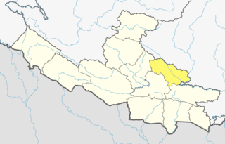
Gandaki Province is one of the seven federal provinces established by the current constitution of Nepal which was promulgated on 20 September 2015. Pokhara is the province's capital city. It borders the Tibet Autonomous Region of China to the north, Bagmati Province to the east, Karnali Province to the west, and Lumbini Province and Bihar of India to the south. The total area of the province is 21,504 km² - about 14.57% of the country's total area. According to the latest census, the population of the province was 2,403,757. The newly elected Provincial Assembly adopted Gandaki Province as the permanent name by replacing its initial name Province no. 4 in July 2018. Krishna Chandra Nepali is the present chief minister of Gandaki province
Galyang is a Municipality in Syangja District in Gandaki Pradesh, central Nepal. In 12 March 2017, The government of Nepal implemented the new local administrative structure consisting of 744 local units. With the implementation of this new local administrative structure, VDCs have been replaced with village councils. Galyang is one of these 744 local municipal units. Galyang is created by merging Malunga, Jagatradevi, (1-6,9) Wards of Pakwadi, (1,6-9) Wards of Tindobate, Tulsibhanjyang, Nibuwakharka, PindikholaBatuwa & (1-4,7-9) Wards of Pelakot.
Kaligandaki is a Village council in Syangja District in Gandaki Pradesh, central Nepal. In 12 March 2017, the government of Nepal implemented a new local administrative structure consisting of 744 local units. With the implementation of the new local administrative structure, VDCs have been replaced with municipal & village councils. Kaligandaki is one of these 744 local units. Kaligandaki is created by merging Alamdevi, Birgha Archale, Chandibhanjyang & Shreekrishna Gandaki.
Ajingare Nepali: अजिंगरे is a City of Sankhar in Chapakot of Syangja District of Gandaki Pradesh in Nepal. According to the 2011 Nepal census, it had a total population of 450.
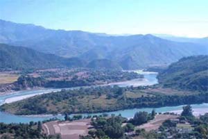
Ruru Kshetra ,also known as Ridi, is a religious and cultural place situated on the confluence of Ridi Khola and Kaligandaki river in Nepal. It is also tri-junction of Gulmi, Palpa and Syangja districts. It is one of the Char Dhams in Nepal.

Syangja 1 is one of two parliamentary constituencies of Syangja District in Nepal. This constituency came into existence on the Constituency Delimitation Commission (CDC) report submitted on 31 August 2017.

Syangja 2 is one of two parliamentary constituencies of Syangja District in Nepal. This constituency came into existence on the Constituency Delimitation Commission (CDC) report submitted on 31 August 2017.

Gulmi 1 one of two parliamentary constituencies of Gulmi District in Nepal. This constituency came into existence on the Constituency Delimitation Commission (CDC) report submitted on 31 August 2017.

Kaligandaki is a Rural municipality located within the Gulmi District of the Lumbini Province of Nepal. The rural municipality spans 101.04 square kilometres (39.01 sq mi) of area, with a total population of 18,876 according to a 2011 Nepal census.