Kamoike Ballpark

Last updated
Kamoike Ballpark
Kamoike140511-03.JPG
Location map Kagoshima2.jpg
Red pog.svg
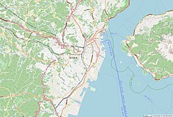
Kamoike Ballpark
Location within Kagoshima, Kagoshima
Kagoshima geolocalisation relief.svg
Red pog.svg
Kamoike Ballpark
Kamoike Ballpark (Kagoshima Prefecture)
Japan natural location map with side map of the Ryukyu Islands.jpg
Red pog.svg
Kamoike Ballpark
Kamoike Ballpark (Japan)
Full nameKamoike Kagoshima Prefectural Baseball Stadium
Location Kagoshima, Japan
Capacity 21,000
Opened1970

Kamoike Ballpark, also known as Kamoike Kagoshima Prefectural Baseball Stadium, is a multi-purpose stadium in Kagoshima, Japan. It is currently used mostly for baseball matches. The stadium was originally opened in 1970 and has a capacity of 21,000 spectators. [1]

Related Research Articles

Kagoshima Prefecture Prefecture of Japan

Kagoshima Prefecture is a prefecture of Japan located on the island of Kyushu and the Ryukyu Islands. Kagoshima Prefecture has a population of 1,599,779 and has a geographic area of 9,187 km2. Kagoshima Prefecture borders Kumamoto Prefecture to the north and Miyazaki Prefecture to the northeast.

Hakata Station Major railway and metro station in Fukuoka, Japan

Hakata Station is a major railway station in Hakata-ku, Fukuoka, Japan. It is the largest and busiest railway terminal in Kyushu, and is a gateway to other cities in Kyushu for travelers coming from Honshu by rail travel. The San'yō Shinkansen from Osaka ends at this station.

Kokura Station Railway station in Kitakyushu, Japan

Kokura Station in Kokurakita-ku is the main railway station in Kitakyushu, Japan. It is part of the JR Kyushu network and the San'yō Shinkansen stops here. It is the second largest station in Kyushu with 120,000 users daily. In the late 1990s, the Kokura station area was expanded and remodelled.

Kagoshima Station Railway station in Kagoshima, Kagoshima Prefecture, Japan

Kagoshima Station (鹿児島駅) is a railway station in Kagoshima, Kagoshima Prefecture. It is the notional southern terminus of the Kyushu Railway Company's Kagoshima and Nippo Main Lines, although services on both lines in fact start and terminate at the neighboring Kagoshima-Chūō Station.

Global Arena

The Global Arena is a sports venue in Munakata, Fukuoka, Kyūshū, Japan. The 10,000-capacity Sanix Global Arena Stadium is the main stadium at the Global Arena sports complex. It was set up by the President of the Sanix company Mr. Munemasa and includes various sports grounds for rugby union, soccer, tennis etc. Also there are indoor facilities for sports such as kendo, judo and tennis. The Global Arena is now a separate company from Sanix, though they are closely related.

Kagoshima Castle

Kagoshima Castle, also known as Tsurumaru Castle, was a Japanese castle located in Kagoshima, Kagoshima Prefecture.

The Kagoshima Botanical Garden, variously known as Kagoshima Tropical Botanical Garden, Kagoshima Tropical Vegetation Park, or Kagoshima Prefecture Botanical Gardens, was a botanical garden located at 1-7-15 Yojiro, Kagoshima, Kagoshima, Japan.

Hama-Kokura Freight Terminal Freight terminal in Kitakyushu, Japan

Hama-Kokura Freight Terminal is a freight terminal on the Kagoshima Main Line in Kokura Kita-ku, Kitakyūshū, Japan, operated by Japan Freight Railway Company. Presently the terminal handles no scheduled trains.

Higashi-Kokura Freight Terminal Freight terminal in Kitakyushu, Japan

Higashi-Kokura Freight Terminal is a freight terminal on the Kagoshima Main Line in Kokurakita-ku, Kitakyūshū, Japan, operated by Japan Freight Railway Company. Presently it handles no trains.

Moji Station Railway station in Kitakyushu, Japan

Moji Station is a railway station on the Kagoshima Main Line and the Sanyō Main Line, operated by Kyushu Railway Company in Moji-ku, Kitakyushu, Japan.

Kagoshima Womens Junior College

Kagoshima Women's Junior College or Kagoshima Women's College is a private women's junior college in Kagoshima, Kagoshima, Japan, established in 1965.

Amuran

Amuran is a Ferris wheel in Kagoshima, Japan. The wheel sits on top of Amu Plaza Kagoshima adjoining Kagoshima-Chūō Station, and is one of the major attractions in the city. The wheel has a diameter of 60 m, and is 91 m from the ground at its highest point. It has 36 gondolas, of which two are completely transparent. The wheel takes approximately 14 minutes and 30 seconds to make a complete revolution.

Kami-Ijūin Station Railway station in Kagoshima, Kagoshima Prefecture, Japan

Kami-Ijūin Station is a railway station located in Kagoshima, Kagoshima, Japan. The station opened in 1913.

Kumanojō Station Railway station in Satsumasendai, Kagoshima Prefecture, Japan

Kumanojō Station is a railway station on the Kagoshima Main Line operated by Kyushu Railway Company in Satsumasendai, Kagoshima, Japan.

Minami-Kagoshima Station Railway station in Kagoshima, Kagoshima Prefecture, Japan

Minami-Kagoshima Station is a railway station located in Kagoshima, Kagoshima, Japan. The station opened in 1944.

Shiranami Stadium

Shiranami Stadium (白波スタジアム) is a multi-purpose stadium in Kagoshima, Japan. It is currently used mostly for football and rugby union matches.

Kōrimoto Station (JR Kyushu) Railway station in Kagoshima, Kagoshima Prefecture, Japan

Kōrimoto Station is a train station located in Kagoshima, Kagoshima, Japan. The station opened in 1986.

Maenohama Station Railway station in Kagoshima, Kagoshima Prefecture, Japan

Maenohama Station is a railway station located in Kagoshima, Kagoshima, Japan. The station opened in 1934.

Kagoshima Prefectural Government Building

The Kagoshima Prefectural Government Building is a skyscraper located in Kagoshima, Kagoshima Prefecture, Japan. Construction of the 93-metre, 18-storey skyscraper was finished in 1996.

The 2013 International Women's Club Championship was the second worldwide international women's football club tournament, and was held in Japan from 30 November–8 December 2013. Five teams, comprising representatives from Europe, Australia, South America, and Asia took part in the competition.

References

  1. "World Stadiums - Stadiums in Japan :: Kyushu". Archived from the original on 2009-02-17. Retrieved 2010-05-11.

Coordinates: 31°33′52.39″N130°33′28.63″E / 31.5645528°N 130.5579528°E / 31.5645528; 130.5579528