Related Research Articles

Putnam County is a county in the U.S. state of West Virginia. As of the 2020 census, the population was 57,440. Its county seat is Winfield, its largest incorporated city is Hurricane, and its largest community is the census-designated place of Teays Valley. Putnam County is part of the Huntington–Ashland, WV-KY-OH Metropolitan Statistical Area, across the Kanawha River from Charleston, West Virginia.

Charleston is the capital and most populous city of the U.S. state of West Virginia and the seat of Kanawha County. Located at the confluence of the Elk and Kanawha rivers, the city had a population of 48,864 at the 2020 census and an estimated population of 48,018 in 2021. The Charleston metropolitan area had 308,248 residents in 2020.

Kanawha County is a county in the U.S. state of West Virginia. As of the 2020 census, the population was 180,745, making it West Virginia's most populous county. The county seat is Charleston, which is also the state capital and most populous city. Kanawha County is part of the Charleston, WV Metropolitan Statistical Area.

Pinch is a census-designated place (CDP) in Kanawha County, West Virginia, United States. The population was 3,262 at the 2010 census.

Sissonville is a census-designated place (CDP) in Kanawha County, West Virginia, United States, along the Pocatalico River. The population was 4,028 at the 2010 census. Sissonville is located within 14 miles of Charleston, the state capital.

South Charleston is a city in Kanawha County, West Virginia, United States. It is located to the west of the state capital of Charleston. The population was 13,639 at the 2020 census. It was established in 1906, but not incorporated until 1917. The Criel Mound built circa 0 BCE by the Adena culture is adjacent to the city's downtown business district.
Alum Creek is a census-designated place (CDP) in Kanawha and Lincoln counties along the Coal River in the U.S. state of West Virginia. It includes the unincorporated communities of Alum Creek, Forks of Coal, and Priestley. The CDP had a population of 1,749 at the 2010 census, down from 1,839 at the 2000 census.

Teays Valley is a census-designated place in Putnam County, West Virginia, United States. The population was 14,350 at the 2020 census. Located about 20 miles (32 km) west of Charleston and 30 miles (48 km) east of Huntington, it is part of the Huntington–Ashland metropolitan area.

Nitro is a city in Kanawha and Putnam counties in the U.S. state of West Virginia. It takes its name from a World War I era nitrocellulose plant. The population was 6,618 according to the 2020 census. It is part of the Charleston metropolitan area.

Tornado, also called Upper Falls, is a census-designated place (CDP) in Kanawha County, West Virginia, United States.

The Little Kanawha River is a tributary of the Ohio River, 169 mi (269 km) long, in western West Virginia in the United States. Via the Ohio, it is part of the watershed of the Mississippi River, draining an area of 2,320 mi2 (6,009 km2) on the unglaciated portion of the Allegheny Plateau. It served as an important commercial water route in the early history of West Virginia, particularly in the logging and petroleum industries.

Watt Powell Park was a stadium, primarily used for baseball, in the Kanawha City neighborhood of Charleston, West Virginia. It was built in 1948, and was home to several Charleston minor-league franchises: the Charleston Senators of the Class A Central League (1949-1951) and the AAA American Association (1952-1960), the Charleston Marlins of the AAA International League (1961), the Charleston Indians of the AA Eastern League (1962-1964), the Charleston Charlies of the AAA International League (1971-1983) and Charleston Wheelers, later the Charleston Alley Cats of the Class A South Atlantic League (1987-2004).

Charleston Area Medical Center (CAMC) is the name of a complex of hospitals in Charleston, West Virginia, formed via a merger of previously independent facilities. It is the state's largest hospital.

George Washington High School is a public high school in Charleston, West Virginia, United States.

Kanawha State Forest is a 9,300-acre (38 km2) recreation area located near the community of Loudendale, West Virginia, which is about 7 miles (11 km) from downtown Charleston, West Virginia, United States. It is managed by the West Virginia Department of Natural Resources.

The University of Charleston Stadium at Laidley Field is an 18,500-capacity stadium located in downtown Charleston, West Virginia, near the West Virginia State Capitol complex. It features a FieldTurf playing field for football and facilities for track and field competitions. The turf field is no longer suitable for soccer and lacrosse due to alterations to the track facilities.
The Charleston Metropolitan Statistical Area, as defined by the United States Census Bureau, is an area consisting of three counties in West Virginia, anchored by the city of Charleston. It is the largest metropolitan area entirely within the state of West Virginia. The Huntington Metro Area adds to the Charleston–Huntington, WV-OH-KY CSA and spans three states, while the core county of the Charleston area, Kanawha County, is more populous than the West Virginia portion of the Huntington area.

Mardi Gras Casino and Resort is a casino and greyhound racing venue located in the city of Nitro, West Virginia. It is located just off the Cross Lanes exit of I-64, 14 miles west of Charleston, West Virginia and 36 miles east of Huntington, West Virginia. Although it is located within the city of Nitro, it is served by the neighboring Cross Lanes post office.

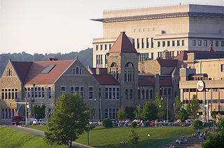
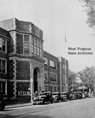
Charleston High School is a former high school that was located on the east end of Charleston, West Virginia. The school was consolidated with Stonewall Jackson High School on the west side of Charleston in 1989 to form Capital High School. Located on multiple parts throughout Charleston during its existence, the final site was on a parcel bordered by Washington Street East, Brooks Street and Lee Street, adjacent from CAMC General Hospital.
References
- ↑ "Historic Houses of Charleston".
- ↑ Kenny, Hamill (1945). West Virginia Place Names: Their Origin and Meaning, Including the Nomenclature of the Streams and Mountains. Piedmont, WV: The Place Name Press. p. 465.
38°19′17″N81°34′55″W / 38.32139°N 81.58194°W
