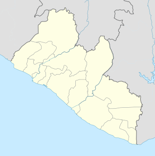
Lofa is a county in the northernmost portion of Liberia. One of 15 counties that constitute the first-level of administrative division in the nation, it has nine districts. Voinjama serves as the capital with the area of the county measuring 9,982 square kilometres (3,854 sq mi). As of the 2008 Census, it had a population of 276,863, making it the third most populous county in Liberia.

Grand Cape Mount is a county in the northwestern portion of the West African nation of Liberia. One of 15 counties that constitute the first-level of administrative division in the nation, it has five districts. Robertsport serves as the capital with the area of the county measuring 5,162 square kilometres (1,993 sq mi). As of the 2008 Census, it had a population of 129,817, making it the eighth most populous county in Liberia. The county is bordered by Gbarpolu County to the northeast and Bomi County to the southeast. The northern part of Grand Cape Mount borders the nation of Sierra Leone, while to the west lies the Atlantic Ocean.

Buchanan is the third largest city in Liberia, lying on Waterhouse Bay, part of the Atlantic Ocean. It is referred to as Gbezohn in the local Bassa language. As of the 2008 census, Buchanan has a population of 34,270. Of this, 16,984 were male and 17,286 female.

Gbarnga is the capital city of Bong County, Liberia, lying north east of Monrovia. During the First Liberian Civil War, it was the base for Charles Taylor's National Patriotic Front of Liberia. Cuttington College, a private, Episcopal-affiliated institution, is located near the town. Its campus was once home to the Africana Museum, which was destroyed during the civil war.

Grand Gedeh is a county in the eastern portion of the West African nation of Liberia. One of 15 counties that constitute the first-level of administrative division in the nation, it has three districts. Zwedru serves as the capital with the area of the county measuring 10,484 square kilometres (4,048 sq mi). As of the 2008 Census, it had a population of 126,146, making it the ninth most populous county in Liberia. Grand Gedeh has lower tropical forests which has mid size hills composed of various valleys and water courses. These forests receive a very high rainfall ranging from 3,000 mm (120 in) to 4,100 mm (160 in) per year.

Zwedru is the capital of Grand Gedeh County, one of the 15 counties in Liberia. Zwedru is located in Tchien District of Grand Gedeh County, near the Cavalla River in the country's south-eastern region and near the border with Côte d'Ivoire. It is located 350 miles southeast from the capital city of Monrovia. The town is a stronghold of the Krahn tribe.

Klay District is one of four districts of Bomi County, Liberia. As of 2008 the population was 22,355.
Greater Monrovia is one of four districts located in Montserrado County, Liberia. It contains the country's capital Monrovia. It recorded a population of 970,824 in the 2008 census.
Gbehlay-Geh District is one of 17 districts located in Nimba County, Liberia. In 2008, the population was 32,176.
The Liberia Institute of Statistics and Geo-Information Services (LISGIS) is an agency of the Liberian government. It organized a census in March 2008, 24 years after the last one.
Boe & Quilla District is one of 17 sub-district of Nimba County, Liberia. As of 2008, the population was 18,262. The clans of Boe & Quilla district: Boe, Gosenter, Quella, Sarlay.
Garr Bain District is one of 17 districts of Nimba County, Liberia. As of 2008, the population was 61,225.
Yarpea Mahn District is one of 17 districts of Nimba County, Liberia. As of 2008, the population was 21,647.
Yarmein District is one of 17 districts of Nimba County, Liberia. As of 2008, the population was 22,718.
Twah River District is one of 17 districts of Nimba County, Liberia. As of 2008, the population was 37,479.
Sanniquellie-Mah District is one of 17 districts of Nimba County, Liberia. As of 2008, the population was 25,370. Its capital lies at Sanniquellie.
Leewehpea-Mahn District is one of 17 districts of Nimba County, Liberia. As of 2008, the population was 24,747.
Gbor District is one of 17 districts of Nimba County, Liberia. As of 2008, the population was 10,875.

Rivercess County is a county in the south-central portion of the West African nation of Liberia. One of 15 counties that compose the first-level of administrative division in the nation, it has six districts. Cesstos City serves as the capital with the area of the county measuring 5,594 square kilometres (2,160 sq mi). As of the 2008 Census, it had a population of 71,509, making it the third least most populous county in Liberia.


