Andrew Geddes Bain, was a Cape Colony geologist, road engineer, palaeontologist and explorer.

The Orange River is a river in Southern Africa. It is the longest river in South Africa. With a total length of 2,432 km (1,511 mi), the Orange River Basin extends from Lesotho into South Africa and Namibia to the north. It rises in the Drakensberg mountains in Lesotho, flowing westwards through South Africa to the Atlantic Ocean. The river forms part of the international borders between South Africa and Lesotho and between South Africa and Namibia, as well as several provincial borders within South Africa. Except for Upington, it does not pass through any major cities. The Orange River plays an important role in the South African economy by providing water for irrigation and hydroelectric power. The river was named the Orange River in honour of the Dutch ruling family, the House of Orange, by the Dutch explorer Robert Jacob Gordon. Other names include simply the word for river, in Khoekhoegowab orthography written as !Garib, which is rendered in Afrikaans as Gariep River with the intrusion of a velar fricative in place of the alveolar click, Groote River or Senqu River, derived from ǂNū "Black". It is known in isiZulu as isAngqu.

The Maputo River, also called Great Usutu River, Lusutfu River, or Suthu River, is a river in South Africa, Eswatini, and Mozambique. The name Suthu refers to Basotho people who lived near the source of the river, but were attacked and displaced by the Swazis. It is also said to mean 'dark brown', a description of the river's muddy water.

The Great Fish River is a river running 644 kilometres (400 mi) through the South African province of the Eastern Cape. The coastal area between Port Elizabeth and the Fish River mouth is known as the Sunshine Coast. The Great Fish River was originally named Rio do Infante, after João Infante, the captain of one of the caravels of Bartolomeu Dias. Infante visited the river in the late 1480s.

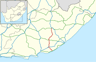
The R63 is a tarred provincial route in South Africa that connects Calvinia with Komga via Carnarvon, Victoria West, Graaff-Reinet, Somerset East and King William's Town. It is cosigned with the N10 between Eastpoort and Cookhouse for 24 kilometres.
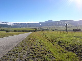
The R67 is a provincial route in Eastern Cape, South Africa that connects Port Alfred with Komani via Grahamstown.
The !Khukaǁgamma or Sundays River is a river in the Eastern Cape Province of South Africa. It is said to be the fastest flowing river in the country. The Inqua Khoi people, who historically were the wealthiest group in Southern Africa, originally named this river !Khukaǁgamma, 'the waters with the spirit of abundance' because the river's banks are always green and grassy despite the arid terrain that it runs through.

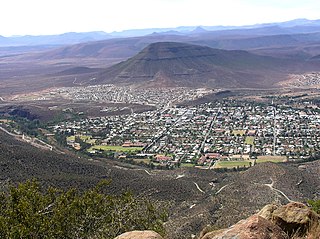
Fort Beaufort, officially renamed KwaMaqoma in March 2023, is a town in the Amatole District of South Africa's Eastern Cape Province, and had a population of 25,668 in 2011. The town was established in 1837 and became a municipality in 1883. The town lies at the confluence of the Kat River and Brak River between the Keiskamma and Great Fish Rivers. KwaMaqoma serves as a mini-'dormitory' for academic staff and students of Fort Hare University, based in the nearby town of Alice, and is also close to Sulphur Springs.

Amatola, Amatole or Amathole are a range of densely forested mountains, situated in the Eastern Cape province of South Africa. The word Amathole means ‘calves’ in Xhosa, and Amathole District Municipality, which lies to the south, is named after these mountains.

The Great Escarpment is a major topographical feature in Africa that consists of steep slopes from the high central Southern African plateau downward in the direction of the oceans that surround southern Africa on three sides. While it lies predominantly within the borders of South Africa, in the east the escarpment extends northward to form the border between Mozambique and Zimbabwe, continuing on beyond the Zambezi river valley to form the Muchinga Escarpment in eastern Zambia. In the west, it extends northward into Namibia and Angola. It is the combination of this escarpment and the aridity of Southern Africa that leads to the lack of navigable rivers in South Africa.
The Great Winterberg is an extensive east–west mountain range lying immediately north of the small towns of Bedford, Adelaide and Fort Beaufort in the Eastern Cape of South Africa. Elevation on average is about 1800 metres above sea-level. The Great Winterberg Peak north of Adelaide rises to 2371 metres, high enough to be occasionally covered in snow. The underlying geology consists of shales and sandstones of the Beaufort Series of the Karoo System, frequently with dolerite intrusions. Rainfall on the southern slopes is fairly high. A notable pass over the range is the Katberg Pass built by Andrew Geddes Bain in 1860–64.
The Sneeuberge or Sneeuberg mountain range was historically known as “Sneeuwbergen”, meaning ‘snow mountains’ in Cape Dutch, and refers to a significant portion of Southern Africa's Great Escarpment in the Cradock, Murraysburg, Richmond, Graaff-Reinet, Nieu-Bethesda and Middelburg districts of the Great Karoo, most of which are in the Eastern Cape Province.
Fish to Tsitsikama WMA, or Fish to Tsitsikama Water Management Area , in South Africa Includes the following major rivers: the Fish River, Kowie River, Boesmans River, Sundays River, Gamtoos River, Kromme River, Tsitsikamma River and Groot River, and covers the following Dams:
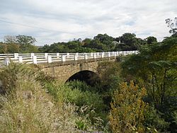
Katrivier Dam is a multi-arch type dam located on the Kat River, near Seymour, Eastern Cape, South Africa. It was established in 1969. The primary purpose of the dam is to serve for irrigation and domestic use. The hazard potential of the dam has been ranked high (3).
The Tarka River is a river in the Eastern Cape, South Africa. Along with the Baviaans River, Grootbrak River and Kat River it is a major eastern tributary of the Great Fish River. The Lake Arthur Dam and the Kommandodrif Dam are located in this river. The latter is included in the Commando Drift Nature Reserve.
Mhlangeni, also known as Hertzog, is a settlement in Amathole District Municipality in the Eastern Cape province of South Africa.
The Tyhume River is a river in Amathole District Municipality in the central part of the Eastern Cape province of South Africa. It springs in the forested mountains of Hogsback, part of the Amatola Mountains, and runs down the Tyhume River Valley and through the eastern verge of the small town of Alice, Eastern Cape, bordering most of the Fort Hare University grounds.

Midland Commando was a light infantry regiment of the South African Army. It formed part of the South African Army Infantry Formation as well as the South African Territorial Reserve.

The Balfour Formation is a geological formation that is found in the Beaufort Group, a major geological group that forms part of the greater Karoo Supergroup in South Africa. The Balfour Formation is the uppermost formation of the Adelaide Subgroup which contains all the Late Permian - Early Triassic aged biozones of the Beaufort Group. Outcrops and exposures of the Balfour Formation are found from east of 24 degrees in the highest mountainous escarpments between Beaufort West and Fraserburg, but most notably in the Winterberg and Sneeuberg mountain ranges near Cradock, the Baviaanskloof river valley, Graaff-Reniet and Nieu Bethesda in the Eastern Cape, and in the southern Free State province.

The Katberg Formation is a geological formation that is found in the Beaufort Group, a major geological group that forms part of the greater Karoo Supergroup in South Africa. The Katberg Formation is the lowermost geological formation of the Tarkastad Subgroup which contains the Lower to Middle Triassic-aged rocks of the Beaufort Group. Outcrops and exposures of the Katberg Formation are found east of 24 degrees onwards and north of Graaff-Reniet, Nieu Bethesda, Cradock, Fort Beaufort, Queensdown, and East London in the south, and ranges as far north as Harrismith in deposits that form a ring around the Drakensberg mountain ranges.