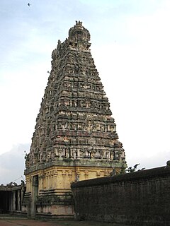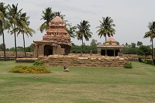
Jayankondam is a Second Grade Municipality in Ariyalur district of Tamil Nadu in India. It is also called Jayamkondacholapuram. As of 2011, the town had a population of 33,945.

Udayarpalayam is a panchayat town in Ariyalur district in the Indian state of Tamil Nadu.

Elakurichi a small village in Ariyalur district, Tamil Nadu, South India, is a Catholic pilgrimage center dedicated to Virgin Mary. It is 65 km from Perambalur. The ancient church built by the famous Catholic Missionary Constanzo Beschi popularly known as ‘Veeramamunivar’ on the year of 1711.

Perambalur is a Lok Sabha constituency in Tamil Nadu.
The Trichinopoly Group is a geological formation in India whose strata date back to the Late Cretaceous. It lies between the Ootatoor and Ariyalur groups. It is broad in its southern extremity but thins as it gradually proceeds northwards as it ultimately meets the Ariyalur group. Dinosaur remains are among the fossils that have been recovered from the formation.
Ariyalur is the legislative assembly, that includes the city, Ariyalur. Until 2006, Ariyalur assembly constituency was part of Perambalur. After 2006, it is part of Chidambaram.
Jayankondam is a state assembly constituency in Ariyalur district in Tamil Nadu. It falls under Chidambaram.

Kallankurichi is a village in the Ariyalur taluk of Ariyalur district, Tamil Nadu, India.

Andimadam is a town in tamil nadu.It is the one of the great block in ariyalur district and Taluk in the Ariyalur district "Land Of Cements", Tamil Nadu, India.It is the greatest location there is good transport facilities and andimadam consist of 3 SH roads.

Devanur is a village in the Udayarpalayam taluk of Ariyalur district, Tamil Nadu, India.
The Trichinopoly district was a district of the erstwhile Madras Presidency of British India. It covered the present-day districts of Tiruchirappalli, Karur, Ariyalur and Perambalur in the Indian state of Tamil Nadu. The administrative headquarters was the town of Trichinopoly, Trichy or Tiruchi, now known as Tiruchirappalli. The district covered an area of 2,632 square miles (6,820 km2) in 1907. It was bound by the districts of South Arcot to the north, Salem to the west, Coimbatore to the west and north-west, Tanjore to the east and Madura to the south. The princely state of Pudukkottai remained within the juridsiction of Trichinopoly district from 1865 to 1947.
Tamil Nadu Cement Corporation Limited (TANCEM) is a state-government undertaking of Government of Tamil Nadu located in the Indian state of Tamil Nadu. It manufactures cement, AC sheets, hollow blocks, concrete and other building materials.
The Chord Line connects Viluppuram Junction and Tiruchirappalli Junction in Tamil Nadu. It is the shortest route connecting Chennai Egmore and Trichy. This rail route is 40 km shorter than the main line.

Ariyalur railway station is the main railway station in Ariyalur, headquarters of the Ariyalur district in Tamil Nadu, India. It is located on the chord line between Viluppuram and Tiruchirappalli. For administrative reasons, it comes under the Tiruchirappalli railway division of the Southern Railway zone.

Ariyalur, is a developing residential area in North Chennai, a metropolitan city in Tamil Nadu, India


