
Sajószentpéter is a town in Borsod-Abaúj-Zemplén county, Northern Hungary. It lies in the Miskolc–Kazincbarcika agglomeration, 10 kilometres away from the county capital.

Caramanta is a town and municipality in the Colombian department of Antioquia. Part of the subregion of Southwestern Antioquia.

San José de la Montaña is a town and municipality in the Colombian department of Antioquia. Part of the subregion of Northern Antioquia.

Turčianky is a village and municipality in Partizánske District in the Trenčín Region of western Slovakia.

El Espino is a town and municipality in the Colombian Department of Boyacá, part of the subregion of the Gutiérrez Province.

Bosanci is a commune located in Suceava County, Romania. It is composed of two villages, Bosanci and Cumpărătura.

Horní Rápotice is a village in the Pelhřimov District, Vysočina Region of the Czech Republic. About 157 people live there and it has 3.98 km². It was first documented in 1352.

Będziaki is a village in the administrative district of Gmina Czarnocin, within Kazimierza County, Świętokrzyskie Voivodeship, in south-central Poland. It lies approximately 6 kilometres (4 mi) south-east of Czarnocin, 9 km (6 mi) north-east of Kazimierza Wielka, and 63 km (39 mi) south of the regional capital Kielce.
Charzowice is a village in the administrative district of Gmina Czarnocin, within Kazimierza County, Świętokrzyskie Voivodeship, in south-central Poland. It lies approximately 6 kilometres (4 mi) south-east of Czarnocin, 9 km (6 mi) north-east of Kazimierza Wielka, and 63 km (39 mi) south of the regional capital Kielce.

Mierki is a village in the administrative district of Gmina Olsztynek, within Olsztyn County, Warmian-Masurian Voivodeship, in northern Poland. It lies approximately 3 kilometres (2 mi) east of Olsztynek and 26 km (16 mi) south-west of the regional capital Olsztyn.
Jákfalva is a village in Borsod-Abaúj-Zemplén County in northeastern Hungary.
Mályinka is a village in Borsod-Abaúj-Zemplén County in northeastern Hungary. Has road connection to the near Dédestapolcsány, Tardona, Nagyvisnyó. The closest town is Kazincbarcika.
Sajóivánka is a village in Borsod-Abaúj-Zemplén County in northeastern Hungary.
Sajókaza is a village in Borsod-Abaúj-Zemplén County in northeastern Hungary.
Kerkaszentkirály is a village in Zala County, Hungary.
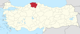
Kurucaören is a village in the District of Kastamonu, Kastamonu Province, Turkey.
Kampala Central Division is one of the five divisions that make up Kampala, the capital of Uganda. The city's five divisions are: (a) Kampala Central Division (b) Kawempe Division (c) Lubaga Division (d) Makindye Division and (e) Nakawa Division.

Edelény is a district in northern part of Borsod-Abaúj-Zemplén County. Edelény is also the name of the town where the district seat is found. The district is located in the Northern Hungary Statistical Region.
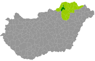
Kazincbarcika is a district in north-western part of Borsod-Abaúj-Zemplén County. Kazincbarcika is also the name of the town where the district seat is found. The district is located in the Northern Hungary Statistical Region.

Ózd is a district in western part of Borsod-Abaúj-Zemplén County. Ózd is also the name of the town where the district seat is found. The district is located in the Northern Hungary Statistical Region.


