Kellersberger's Map

Last updated

Kellersberger's Map is a plat map created in 1854 of Rancho San Antonio on the northeastern shore lands, the Contra Costa of San Francisco Bay, in present day Alameda County, California. The area surveyed today comprises the entire extent of the cities of Berkeley and Albany, and the northern part of Oakland, including its downtown and waterfront.
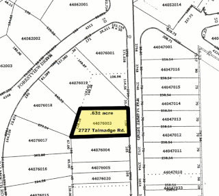
Plat scale map showing the divisions of a piece of land

In the United States, a plat is a map, drawn to scale, showing the divisions of a piece of land. United States General Land Office surveyors drafted township plats of Public Lands Surveys to show the distance and bearing between section corners, sometimes including topographic or vegetation information. City, town or village plats show subdivisions into blocks with streets and alleys. Further refinement often splits blocks into individual lots, usually for the purpose of selling the described lots; this has become known as subdivision.

Rancho San Antonio (Peralta)

Rancho San Antonio, also known as the Peralta Grant, was a 44,800-acre (181 km2) land grant by Governor Pablo Vicente de Solá, the last Spanish governor of California, to Don Luís María Peralta, a sergeant in the Spanish Army and later, commissioner of the Pueblo of San José, in recognition of his forty years of service. The grant, issued on August 3, 1820, embraced the sites of the cities of San Leandro, Oakland, Alameda, Emeryville, Piedmont, Berkeley, and Albany.
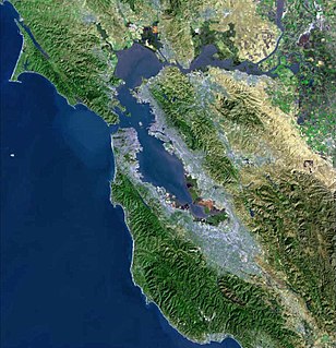
San Francisco Bay bay on the California coast of the United States

San Francisco Bay is a shallow estuary in the US state of California. It is surrounded by a contiguous region known as the San Francisco Bay Area, and is dominated by the large cities of San Jose, San Francisco and Oakland.

Contents

The map can be seen here: 1854 Map of the Vicente & Domingo Peralta Ranchos, Lithographed by Britton & Rey, courtesy of Barry Lawrence Ruderman Antique Maps Inc.

Kellersberger's Map was created by surveyor Julius Kellersberger in order to facilitate the subdivision of a portion of the Mexican land grant lands of the Alta California era Rancho San Antonio following the Mexican-American War and U.S. statehood.

The Spanish and later Mexican governments encouraged settlement of the coastal region of Alta California by giving prominent men large land grants called ranchos, usually two or more square leagues, or 35 square kilometres (14 sq mi). Land-grant titles (concessions) were government-issued, permanent, unencumbered property-ownership rights to land called ranchos. The ranchos encompassed virtually all of the most valuable land near the coast, around San Francisco Bay, and inland along the Sacramento River and nearby lands in the Central Valley.

Alta California province of New Spain

Alta California, known sometimes unofficially as Nueva California, California Septentrional, California del Norte or California Superior, began in 1804 as a province of New Spain. Along with the Baja California peninsula, it had previously comprised the province of Las Californias, but was split off into a separate province in 1804. Following the Mexican War of Independence, it became a territory of Mexico in April 1822 and was renamed "Alta California" in 1824. The claimed territory included all of the modern US states of California, Nevada and Utah, and parts of Arizona, Wyoming, Colorado and New Mexico.

U.S. state constituent political entity of the United States

In the United States, a state is a constituent political entity, of which there are currently 50. Bound together in a political union, each state holds governmental jurisdiction over a separate and defined geographic territory and shares its sovereignty with the federal government. Due to this shared sovereignty, Americans are citizens both of the federal republic and of the state in which they reside. State citizenship and residency are flexible, and no government approval is required to move between states, except for persons restricted by certain types of court orders. Four states use the term commonwealth rather than state in their full official names.

Kellersberger had previously surveyed a map of the original claimed extent of the city of Oakland.

Oakland, California City in California, United States

Oakland is the largest city and the county seat of Alameda County, California, United States. A major West Coast port city, Oakland is the largest city in the East Bay region of the San Francisco Bay Area, the third largest city overall in the San Francisco Bay Area, the eighth most populated city in California, and the 45th largest city in the United States. With a population of 425,195 as of 2017, it serves as a trade center for the San Francisco Bay Area; its Port of Oakland is the busiest port in the San Francisco Bay, the entirety of Northern California, and the fifth busiest in the United States of America. An act to incorporate the city was passed on May 4, 1852, and incorporation was later approved on March 25, 1854, which officially made Oakland a city. Oakland is a charter city.

List of plots

The following is a partial list of the subdivision plots on Kellersberger's Map together with the names of their original claimants:

Francis Kittredge Shattuck was the most prominent civic leader in the early history of Berkeley, California, and played an important role in the creation and government of Alameda County as well. He also served as the fifth mayor of the city of Oakland in 1859, and represented the 4th District in the California State Assembly from 1860-61. He also served many years on the Board of Supervisors of Alameda County starting in 1860. He was elected to the board of trustees of the Town of Berkeley in 1884. He was instrumental in founding First Congregational Church of Oakland.

See also

Related Research Articles

Peralta may refer to:

Oakland Ballpark a proposed baseball stadium in Oakland, California

Oakland Ballpark is the working name for a proposed ballpark to be built in the Jack London Square neighborhood of Oakland, California. It is proposed as the new home of Major League Baseball's Oakland Athletics. It would serve as the replacement to their current home at the Oakland–Alameda County Coliseum, where the team has resided since 1968. This would mark the first time that the A's franchise has played in a brand new stadium since the completion of Shibe Park in 1909.

Luis María Peralta was a soldier in the Spanish Army, who received one of the largest of the Spanish land grants, Rancho San Antonio, a 44,800-acre (181 km2) plot that encompassed most of the East Bay region of California.

Rancho Suscol was an 84,000-acre (340 km2) Mexican land grant in present day Napa County, California and Solano County, California given in 1843 by governor Manuel Micheltorena to General Mariano Guadalupe Vallejo. In a significant land law decision, the land claim was rejected by the US Supreme Court in 1862. Rancho Suscol extended from Rancho Petaluma on the west, south down to the San Francisco Bay and Mare Island and Carquinez Strait, and then to Rancho Suisun on the east. It included present day cities of Vallejo and Benicia.

The California Land Act of 1851, enacted following the Treaty of Guadalupe Hidalgo and the admission of California as a state in 1850, established a three-member Public Land Commission to determine the validity of prior Spanish and Mexican land grants. It required landowners who claimed title under the Mexican government to file their claim with a commission within two years. Contrary to the Treaty of Guadalupe Hidalgo, which guaranteed full protection of all property rights for Mexican citizens, it placed the burden on landholders to prove their title.

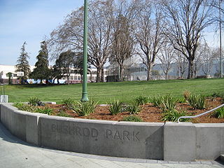
Bushrod Park, Oakland, California Neighborhood of Oakland in Alameda, California, United States

The Bushrod Park neighborhood in North Oakland, Oakland, California is an area surrounding its namesake park, and bounded by Martin Luther King, Jr. Way to the west, Claremont Avenue to the east, Highway 24 to the south, and the Berkeley border to the north. It borders the neighborhoods of Sante Fe to the west, Fairview Park to the east, and Temescal and Shafter to the south and southeast, respectively. Notable landmarks include the Bushrod Park ballfields and the former Bushrod Washington Elementary School, which share adjoining land on a large greenbelt and open space in the heart of the neighborhood.

Rancho La Providencia was a 4,064-acre (16.45 km2) Mexican land grant in present-day Los Angeles County, California given by governor Juan B. Alvarado in 1843 to Vincente de la Osa. The majority of Rancho Providencia land north of the modern channel of the Los Angeles River is now part of Burbank. The street grid change along Burbank Boulevard marks the northwestern boundary of the rancho grant. The Walt Disney Studios, Warner Bros. Studios, NBC Studios Burbank, Providence High School, and Providence Saint Joseph Medical Center are all within the former boundaries of Rancho Providencia. The Burbank Equestrian Center and portions of the Rancho south of the river are now part of the city of Los Angeles.

Rancho Santa Rita was a 8,894-acre (35.99 km2) Mexican land grant in the Amador Valley and western Livermore Valley, which is in present day Alameda County, California.

Rancho San Leandro was a 6,830-acre (27.6 km2) Mexican land grant in present-day Alameda County, California given in 1842 by Governor Juan Alvarado to José Joaquín Estudillo. The grant extended along the east San Francisco Bay from San Leandro Creek south to San Lorenzo Creek, and encompassed present-day San Leandro.

Rancho Santa Rosa was a 13,184-acre (53.35 km2) Mexican land grant in present-day San Luis Obispo County, California.

Rancho Moro y Cayucos

Rancho Moro y Cayucos was a 8,045-acre (32.56 km2) Mexican land grant in present-day San Luis Obispo County, California given in 1842 by Governor Juan B. Alvarado to Martin Olivera and Vicente Feliz (Felis). The grant extended along the Pacific Coast from just north of present-day Cayucos south to Moro Creek just north of present-day Moro Bay.

Rancho Cañada del Corte de Madera

Rancho Cañada del Corte de Madera was a 3,566-acre (14.43 km2) Mexican land grant in present day Santa Clara County, California given in 1833 by Governor José Figueroa to José Domingo Peralta and Máximo Martínez. The name translates as "the valley where lumber is cut". The grant was located west of today's I-280, and south of San Francisquito Creek near Searsville Lake, and covered most of the Portola Valley.

Rancho Corte de Madera

Rancho el Corte de Madera was a 13,316-acre (53.89 km2) Mexican land grant in present day Santa Clara County, California given in 1844 by Governor Manuel Micheltorena to Máximo Martínez. The name translates as "the place where lumber is cut". The roughly triangular shaped grant was west of today's I-280, and bounded on the north by Alambique Creek and San Francisquito Creek, on the south by Los Trancos Creek and Matadero Creek, and on the west by what is now Skyline Boulevard. The grant surrounded Rancho Cañada del Corte de Madera which extended along the Portola Valley. The land grant included parts of present day Woodside, Ladera and Stanford University.

Rancho Arroyo de la Laguna was a 4,418-acre (17.88 km2) Mexican land grant in present-day Santa Cruz County, California given in 1840 by Governor Juan B. Alvarado to Gil Sanchez. The grant extended along the Pacific coast south-east from Rancho San Vicente and San Vicente Creek to Laguna Creek and Rancho Refugio.

Rancho Cañada de San Vicente y Mesa del Padre Barona was a 13,316-acre (53.89 km2) Mexican land grant in present-day San Diego County, California given in 1846 by Governor Pío Pico to Juan Bautista Lopez. The grant was located in the San Vicente and Padre Barona Valleys, which lie south of Ramona. The area served as grazing lands for the Mission San Diego. Father José Barona served at the Mission San Diego from 1798 to 1810, before moving to the Mission San Juan Capistrano.

Shattuck Avenue street in California, United States

Shattuck Avenue is a major city street running north-south through Berkeley, California and Oakland, California. At its southern end, the street branches from Telegraph Avenue in Oakland's Temescal district, then ends at Indian Rock Park in the Berkeley Hills to the north. Shattuck Avenue is the main street of Berkeley, forming the spine of that city's downtown, and the site of the Gourmet Ghetto in North Berkeley. The street was named for Francis Kittredge Shattuck, an early landowner and booster who later served as Mayor of Oakland. Shattuck was largely responsible for the original construction of the road as well as for a railroad built along its route.

Alameda (island) island in California, United States of America

Alameda Island is an island in the San Francisco Bay in California. It is south and west of, and adjacent to Oakland, and across the bay eastward from San Francisco. Located on the island is most of the city of Alameda, a city in Alameda County. Also located on the island is the Naval Air Station Alameda, a defunct naval air station, as well as a small uninhabited part of San Francisco. The island was originally a peninsula and a part of Oakland, and is now separated from the mainland by the Oakland Estuary. The island is connected to the mainland by four bridges: the Park Street Bridge, Fruitvale Bridge, High Street Bridge, and Bay Farm Island Bridge. The Posey and Webster Street tubes also connect Oakland to Alameda Island.

References