The Rai people are indigenous ethnolinguistic groups of the Indian subcontinent, what is now modern-day Nepal and present-day India, mainly in the Indian states of Sikkim and West Bengal. They were Rai meaning king (Rai means King in old Khas Kura. When the king Prithvi Narayan Shah couldn't defeat Khambu king, Ram saha somehow took them in confidence that the land is theirs forever and gave them the name Rai in around B.S. 1632. Then the post-Rai was provided to the topmost leaders of the region. They were given the power to collect land tax. That's why sometimes Rai people are called Jimee or Jimee-wal. The Rai belong to the Kirati group or the Kirat confederate Limbu, Sunuwar, Yakkha and Dhimal ethnic groups.

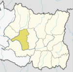
Bhojpur is one of two urban municipalities in Bhojpur District of Province No. 1 of Nepal. It was established on 18 May 2014 merging the existing Bhaisipankha, Bokhim, Bhojpur, Taksar Village Development Committees It is the district headquarters of Bhojpur District, a hilly/mountainous district in Province No. 1. At the time of the 2011 Nepal census it had a population of 27204 with an area of 159.51 square kilometres (61.59 sq mi).

The Sunuwar is an indigenous tribe from the subcontinent, mainly modern-day Nepal and present-day India. They speak the Sunuwar language. According to the 2001 census of Nepal, 17% of the tribe follow the Kirant religion and adopt the Mundhum (Kiranti) culture.

Triyuga is an urban municipality out of 4 urban municipalities located in the Udayapur district of the Province No. 1 of Nepal. Gaighat is the headquarter of the municipality. According to the 1991 Nepal census, it had a population of 55,291. According to the 2011 Nepal census, Triyuga had 87,557 inhabitants. It is divided into 16 wards. Triyuga Municipality was established on B.S. Chaitra 13, 2053. It was named after Triyuga River. A river which flows through the town. Triyuga is the 3rd largest municipality in Nepal and 1st largest in Province No. 1 in term of size (area). The total area of the municipality is 547.43 square kilometres (211.36 sq mi)

Kirat Mundhum, also known as Kirati MundhumorKiratism, are the stories recited/sung by the shamans of the Kirati ethnic groups of Nepal: Limbu, Rai, Sunuwar and Yakkha peoples. The practice is also known as Kirat Veda, Kirat-Ko Veda or Kirat Ko Ved. According to some scholars, such as Tom Woodhatch, it is an animistic religion or blend of animism, and Saivism. It is practiced by about 3.1% of the Nepali population. It's slogan is, "ᤀᤠᤪᤣ ᤕᤪᤔᤠ ᤗᤠᤶᤔᤠᤲ"

Sakela (साकेला) is the main festival of Rai people which is celebrated twice a year and is distinguished by two names Ubhauli and Udhauli. Sakela Ubhauli is celebrated during Baisakh Purnima and Sakela Udhauli is celebrated during the full moon day in the month of Mangsir.

Takukot is a Ward of Barpak sulikot Rural Municipality in Gorkha District in the Gandaki Province of northern-central Nepal. At the time of the 1991 Nepal census it had a population of 4,234 and had 801 houses in the town.

Turang is 8 number ward of Chandrakot Rural Municipality in Gulmi District in the Province No. 5 of Nepal. At the time of the 1991 Nepal census it had a population of 4383 persons living in 1044 individual households. Majuwa Bazer is the economic and educational center of this place where people from Jubhung, Balithum, Rupakot and Aanpchour visit for shopping, education and other official works. Manaka Tikaram Multiple College, Gyanodaya Higher Secondary School and Polaris Secondary Boarding School are the famous educational institutions of this place. Notable person are Sompal Kami
Phakphok is a town and Village Development Committee (VDC) in Ilam District in the Mechi Zone of eastern Nepal. At the time of the 1991 Nepal census it had a population of 4,233 persons living in 734 individual households.
Baksila is a village and Village Development Committee in Khotang District in the Sagarmatha Zone of eastern Nepal. At the time of the 1991 Nepal census it had a population of 3,996 persons living in 796 individual households. Baksila is located at five hours walk from Diktel, headquarters of Khotang District. Surrounded by Baspani, Sungdel, Dipsung, Rakha Saptewor and Kharmi, this village split into nine wards geographically
Buipaबुइपा is a village and Village Development Committee in Khotang District in the Sagarmatha Zone of eastern Nepal. At the time of the 1991 Nepal census it had a population of 5,195 persons living in 980 individual households.
Dipsung is a village and Village Development Committee in Khotang District in the Sagarmatha Zone of eastern Nepal. At the time of the 1991 Nepal census, it had a population of 950 living in 205 individual households.
Jalapa is a village and also the Village Development Committee of Khotang District in the Sagarmatha Zone of eastern Nepal is located here. At the time of the 1991 Nepal census, it had a population of 2,351 persons living in 448 individual households.
Sungdel is a village and Village Development Committee in Khotang District in the Sagarmatha Zone of eastern Nepal. At the time of the 1991 Nepal census it had a population of 2,846 persons living in 585 individual households.Its situated at northern east belt of khotang district. Currently, there is a high school, Shree surya Ma. Vi, and four other primary schools as means of education. Peoples running their own hydropower.Mojority of people are Koyee Rai. It is the only one place where Koyee people speaks their mothertone language Koyee. This language is also known as sungdele bhasa. Most of people depends on farming.The highest hill in khotang district Loure is situated in Sungdel. Sungdel is famous for wild bee honey.
Subhang or Suvang is a village development committee in Panchthar District in the Mechi Zone of eastern Nepal. At the time of the 1991 Nepal census it had a population of 4862 people living in 800 individual households. Mostly Limbu people live here.Others ethnic groups are Tamang, Sherpa, Brahmins, Rai, Chhettris etc. Suhang, Yonghang, Pandhak, Moktan, Ojha, Mainali, Rais etc. surnamed people live here. It is surrounded by Bharapa,Ekteen,Panchami, Tharpu, Chiyandada and Chattedhunga VDCs.Suvang khola and Tambar Khola are the majors river. Mostly kirant religion is followed.Also Buddhism, Hinduism etc. follower can be found. Jorpokhari and Chatture bazaar are major market areas.Every two weeks chatture local mela is organised. Main economic activities include Agriculture.Animal husbandry,Cash crops and staple crops are cultivated. Animal husbandry includes chickens, pigs, cow, goat, buffalo, sheep etc. And main cash crop includes Cardamom. Other cash crops may include Amlisho, Ginger and vegetables.
Letang, "लेटाङ " is a Municipality in Morang District in the Kosi Zone of south-eastern Nepal formed by merging existing Village Development Committees Letang Jante,_Nepal warrangi and Bhogateni. It is a municipality and the urban core of a rapidly growing urban agglomerate in Nepal. It has neighbouring municipalities like Koshi Haraicha, Belbari, Pathari-Sanischare etc.. At the time of the 2011 Nepal census it had a population of 18,552 people living in 4,359 individual households. It is situated at the bank of Chisang River. It is located 46 km North east of Biratnagar 394 km east of Kathmandu, at the northern edge of the Terai plain below the Hills.More than 70% of the people in this VDC are engaged in agriculture. Temples including Rajarani temple, Laxmi Narayan Mandir, Laxmi Panchayan Mandir etc. lies here. The main ethnic groups here are Limbu, Brahmin, Chhetri, Magar, Rai, Tamang etc. The villages including Phadani, Budhabare, Kheruwa, Khaireni, Kirtiman, Kamalpur, Lokhra, Kuinkunda, Biran etc. lies here. Among them Letang Bazaar is most developed and Rajarani has religious and tourism importance being old village in Letang. This Letang Municipality is one of the developed municipality of Morang district with various utilities including drinking water, electricity, communication etc. District-famous schools and campus including Letang Campus, Shanti Bhagawati School Shree Shiksha Vikash M. V. (Kheruwa), Laxmi School, Galaxy Academy, Green Valley School, Minaruwa School, Letang Secondary Boarding School, Bal Niketan School, Pathibhara Boarding School lies here. The town Letang Bazaar is also a part of municipality. Many developmental efforts are active in this area. There is also uneven population distribution in this VDC. Many national politicians, players and film actors such as Babu Bogati, Praween Khatiwada, Ram Bhujel are also from this village. Far more, yearly Rajarani Festival (Mohatshob) is also celebrated by various organizations for its popularity and fame. There is the eastern regional training academy of Nepal Army and also the eastern regional training centre of Agricultural Development Bank, though the bank does not exist nearby.
Rajghat is a small village in the Urlabari Municipality in the Morang District in the Koshi Zone of south-eastern Nepal. It is located in North-East part of Morang and 1.5 kilometers south of the East West highway of Nepal. It is situated at the region no. 1 of Morang during the election period (2070). Durgapuri Bazar is the main Bazar of Rajghat.

Balankha is the center (headquarter) of newly formed Aamchok rural municipality in Bhojpur District of Province No. 1 of Nepal. Balankha was a separate Village development committee before 2017. It became part of Aamchock rural municipality fulfilling the requirement of the new Constitution of Nepal 2015. Ministry of Federal Affairs and Local Development replaced all old VDCs and Municipalities into 753 new local level body (Municipality).
Ubhauli (उभौली) is festival of the Kirat communities of Sunuwar, Rai, Limbu and Yakkha of Nepal celebrated every year marking the migration phase upwards towards the hilly regions when the summer season arrives. The migration from hills downwards to areas of lower altitude is called Udhauli (downwards), which is also an annual festival of these communities. Sakela is the dance performed during the festival. On this Ubhauli festival day, the Kirat people pray to mother nature for healthy crops and protection from natural calamities in that year.