
The Hooghly River is the westernmost distributary of the Ganges, situated in West Bengal, India. It is known in its upper reaches as the Bhagirathi. The Bhagirathi splits off from the main branch of the Ganges at Giria. A short distance west, it meets the man-made Farakka Feeder Canal, which massively increases its flow. The river then flows south to join the Jalangi at Nabadwip, where it becomes the Hooghly proper. The Hooghly continues southwards, passing through the metropolis of Kolkata. Thereafter, it empties into the Bay of Bengal. Its tributaries include the Ajay, Damodar, Rupnarayan, and Haldi.
Berhampore, also known as Baharampur, is a city and a municipality in the state of West Bengal, India. Berhampore is the administrative headquarters of the Murshidabad district. As of 2011 census, Berhampore is the seventh largest city in West Bengal. It is located about 186 km (116 mi) from Kolkata, the state capital.

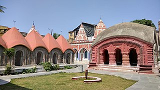
Khidirpur or Kidderpore is a neighbourhood of South Kolkata in Kolkata district in the Indian state of West Bengal.

Beldanga [Bengali:বেলডাঙ্গা] is a municipality town under the Berhampore subdivision of Murshidabad district in the state of West Bengal, India. Beldanga is an important trade centre of this district.
Chachanda is a census town in the Samserganj CD block in the Jangipur subdivision of the Murshidabad district in the state of West Bengal, India.
Dafahat is a census town in the Suti II CD block in the Jangipur subdivision of the Murshidabad district in the state of West Bengal, India.

Dhuliyan is a municipality town in the Samserganj block of Jangipur subdivision of Murshidabad district in the state of West Bengal, India. This municipality was established in the year 1909 and comprises 21 wards. It is located between the Ganges and the Feeder canal.

Calcutta Tramways Company (CTC) was a state-run company that operated trams and buses in and around Kolkata in West Bengal, India. The Kolkata tram is the only operating tramway in India and is the oldest electric tram in India, operating since 1902.
Paschim Punropara is a census town in the Suti II CD block in the Jangipur subdivision of the Murshidabad district in the Indian state of West Bengal.

Kadamtala is a neighbourhood in Howrah of Howrah district in the Indian state of West Bengal. It is a part of the area covered by Kolkata Metropolitan Development Authority (KMDA). Kadamtala is under the jurisdiction of Bantra Police Station of Howrah City Police.

Sealdah railway division is one of the four railway divisions under the Eastern Railway zone of the Indian Railways. Its headquarters is located in Kaiser Street in Kolkata, West Bengal near the Sealdah railway station. Geographically the division covers the railway tracks and services in the areas between the Hooghly river on the west, Bangladesh on the north and east and the Sundarbans in the south. The Railway network under Sealdah Division was part of the Eastern Bengal Railway. The Eastern Bengal Railway was formed on 1st July, 1884. On 1st January, 1942, Assam Bengal Railway and Eastern Bengal Railway were amalgamated to form Bengal Assam Railway. Sealdah Division became a part of East Indian Railway on 15th August, 1947, after the Partition of India and Partition of Bengal. The East Indian Railway was formed on 1st June, 1845. On 14th April, 1952, East Indian Railway was renamed as Eastern Railway.
Debipur is a census town in the Suti II CD block in the Jangipur subdivision of the Murshidabad district in the state of West Bengal, India.
Mahendrapur is a census town in the Suti II CD block in the Jangipur subdivision of the Murshidabad district in the state of West Bengal, India.
Hafania is a census town in the Suti II CD block in the Jangipur subdivision of the Murshidabad district in the state of West Bengal, India.
Ichhlampur is a census town in the Suti II CD block in the Jangipur subdivision of the Murshidabad district in the state of West Bengal, India.
Kakramari is a census town in the Suti II CD block in the Jangipur subdivision of the Murshidabad district in the state of West Bengal, India.
Khanpur is a census town in the Suti II CD block in the Jangipur subdivision of the Murshidabad district in the state of West Bengal, India.
Khidirpur is a census town in the Suti II CD block in the Jangipur subdivision of the Murshidabad district in the state of West Bengal, India.
Bhabki is a census town in the Suti II CD block in the Jangipur subdivision of the Murshidabad district in the state of West Bengal, India.
Tarapur is an inhabited place in the Samserganj CD block in the Jangipur subdivision of Murshidabad district in the state of West Bengal, India. It has not been identified in 2011 census as a separate place.
This page is based on this
Wikipedia article Text is available under the
CC BY-SA 4.0 license; additional terms may apply.
Images, videos and audio are available under their respective licenses.