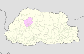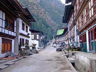
Khoma is a settlement in the north of Bhutan. It is located in Lhuntse District.

Khoma is a settlement in the north of Bhutan. It is located in Lhuntse District.

Trashigang District is Bhutan's easternmost dzongkhag (district).

Lhuntse District is one of the 20 dzongkhag (districts) comprising Bhutan. It consists of 2506 households. Located in the northeast, Lhuntse is one of the least developed dzhongkhags of Bhutan. There are few roads, the first gas station was opened in September 2005, electricity is not well distributed, and the difficult terrain makes distribution of social welfare problematic. Despite its favourable climate, farming is hindered by the lack of infrastructure.

Mongar District is one of the 20 dzongkhags (districts) comprising Bhutan. Mongar is the fastest-developing dzongkhag in eastern Bhutan. A regional hospital has been constructed and the region is bustling with many economic activities. Mongar is noted for its lemon grass, a plant that can be used to produce an essential oil. It also has a hydroelectric power-plant on the Kuri Chhu river.

Pemagatshel District is one of the 20 dzongkhags (districts) constituting Bhutan.

Punakha District is one of the 20 dzongkhags (districts) comprising Bhutan. It is bordered by Thimphu, Gasa, and Wangdue Phodrang Districts. The dominant language in the district is Dzongkha, the national language.

Samdrup Jongkhar District is one of the 20 dzongkhags (districts) comprising Bhutan. The dominant languages of the district are Tshangla (Sharchopkha) in the north and west, and Nepali in the east.

Trashiyangtse District is one of the twenty dzongkhags (districts) comprising Bhutan. It was created in 1992 when Trashiyangtse district was split off from Trashigang District. Trashiyangtse covers an area of 1,437.9 square kilometres (555.2 sq mi). At an elevation of 1750–1880 m, Trashi yangtse dzongkhag is rich of culture filled with sacred places blessed by Guru Rimpoche and dwelled by Yangtseps, Tshanglas, Bramis from Tawang, Khengpas from Zhemgang and Kurtoeps from Lhuentse.

Trashigang, or Tashigang, is a town in eastern Bhutan and the district capital of the Trashigang Dzongkhag (district).

Merak is a settlement in the far east of Bhutan. Merak is under Sakteng Dungkhag, Trashigang District. The people are widely known as Brokpa, meaning 'highlander'. The main activities of these highlanders are raising of the domestic animals. Until 2012, Merak could only be reached by a two-day hike. In 2012 a new road was constructed that shortened the hike to one day. According to local legend, the surrounding valley is inhabited by Yeti.
Zugne is a village in Bumthang District in central Bhutan, located south of Jakar and east of Gyetsa on the Chume River in the Chume Valley. The village is noted for its weavers with scarves tied to their heads in the Bumthang style. They weave woolen yatras on pedal looms and also make belts. It has two notable workshops along the main road, the Thogmela and the Khampa Gonpo which make brightly colored textiles.

The Kuri Chhu, also known as the Lhozhag Xung Qu or Norbu Lag Qu, is a major river of eastern Bhutan, that has formed a scenic valley with high peaks and steep hills. Kuri Chhu is a tributary of the Manas River system, which is the largest river of Bhutan and a major tributary of the Brahmaputra River that drains most of eastern Bhutan.

Khoma Gewog is a gewog of Lhuntse District, Bhutan.

Menbi Gewog is a gewog of Lhuntse District, Bhutan.

Phongmed Gewog is a gewog of Trashigang District, in the East of Bhutan.

Sakteng Wildlife Sanctuary is a wildlife sanctuary located mostly in Trashigang District and just crossing the border into Samdrup Jongkhar District, Bhutan. It is one of the country's protected areas. It is listed as a tentative site in Bhutan's Tentative List for UNESCO inclusion.

This is a list of the extreme points of Bhutan.

The Bumdeling Wildlife Sanctuary, which contains the former Kulong Chu Wildlife Sanctuary, covers 1,520.61 square kilometres (587.11 sq mi) in northeastern Bhutan at elevations between 1,500 metres (4,900 ft) and 6,000 metres (20,000 ft). The sanctuary covers most of Trashiyangtse District, including Bumdeling Gewog. The sanctuary was planned in 1995 and established in 1998. It contains diverse flora, fauna, and scenery including alpine lakes and the Bumdeling Valley. The sanctuary also contains several cultural and religious sites. In the park live 3,000 resident households.

Jomotsangkha Wildlife Sanctuary is the smallest protected area of Bhutan covering 334.73 square kilometres (129.24 sq mi) in Samdrup Jongkhar District along the southern border with Assam. Its elevations range between 400 metres (1,300 ft) and 2,200 metres (7,200 ft). Khaling Wildlife Sanctuary is, despite its small acreage, an important habitat for elephants, gaur, and other tropical wildlife. It may also contain the rare pygmy hog and hispid hare known to inhabit the adjacent Khaling Reserve in Assam, with which Khaling Wildlife Sanctuary forms a trans-border reserve.
Lumla is the headqarter of eponymous subdivision, tehsil and Legislative Assembly of Arunachal Pradesh in the Tawang district of Indian state of Arunachal Pradesh. The current MLA (August-2016) of this constituency is Jambey Tashi. Lumla borders Bhutan in the west, Tibet in the north.

Zhongar Dzong is a large medieval ruin overlooking the valley between Lingmethang Town and Thidangbi Village in the Mongar District of Eastern Bhutan. Constructed in the 17th century from white stone mined from the nearby Kuri Chhu river, it once stretched over 4 acres of land and was one of the largest fortresses in the country. Because of its size and construction material, the dzong came to be known as Zhongkar "white bowl".
Coordinates: 27°26′N91°10′E / 27.44°N 91.17°E
| This Bhutan location article is a stub. You can help Wikipedia by expanding it. |