The Shire of Yarra Ranges, also known as Yarra Ranges Council, is a local government area in Victoria, Australia, located in the outer eastern and northeastern suburbs of Melbourne extending into the Yarra Valley and Dandenong Ranges. It has an area of 2,469 square kilometres (953 sq mi), of which 3% is classified as urban. At the 2016 Australian census, it had a population of 149,537.

Massachusetts's 3rd congressional district is located in northeastern and central Massachusetts.
The demographics of Toronto, Ontario, Canada make Toronto one of the most multicultural and multiracial cities in the world. In 2016, 51.5% of the residents of the city proper belonged to a visible minority group, compared with 49.1% in 2011, and 13.6% in 1981. Toronto also has established ethnic neighbourhoods such as Chinatown, Corso Italia, Little Italy, Little India, Greektown, Koreatown, Little Jamaica, Little Portugal and Roncesvalles, which celebrate the city's multiculturalism.

Massachusetts's 7th congressional district is a congressional district located in eastern Massachusetts, including roughly three-fourths of the city of Boston and a few of its northern and southern suburbs. Massachusetts congressional redistricting after the 2010 census changed the borders of the district starting with the elections of 2012, with most of the old 7th district redistricted to the new 5th district. Most of the old 8th district now comprises the new 7th district. The seat is currently held by Ayanna Pressley.

Virginia is a suburb in Brisbane, Queensland, Australia. It is located 10 kilometres (6.2 mi) north of the Brisbane central business district. It is primarily a residential suburb with many timber and tin Queenslander style housing.
Parkinson is an outer southern suburb of Brisbane, Australia. It is 19 kilometres (12 mi) south of the CBD and borders Logan City. It was named after Henry Parkinson, railway engineer. It is in the Electoral district of Algester.
Kidman Park is a western suburb of Adelaide, South Australia. It is located in the City of Charles Sturt.

The Shire of Denmark is a local government area in the Great Southern region of Western Australia, about 55 kilometres (34 mi) west of Albany and about 420 kilometres (261 mi) south-southeast of the state capital, Perth. The Shire of Denmark covers an area of 1,860 square kilometres (718 sq mi), and its seat of government is located in the townsite and locality of Denmark.
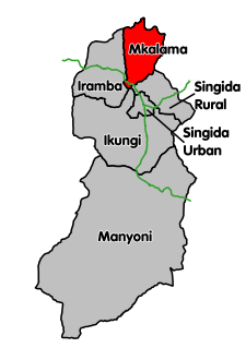
Gumanga is an administrative ward in the Mkalama District of the Singida Region of Tanzania. According to the 2002 census, the ward has a total population of 9,896. According to the 2012 census, the population had increased to 10,948.
Ibaga is an administrative ward in the Mkalama District of the Singida Region of Tanzania. According to the 2002 census, the ward has a total population of 10,672. According to the 2012 census, the population had increased to 11,712.
Iguguno is an administrative ward in the Mkalama District of the Singida Region of Tanzania. According to the 2002 census, the ward had a total population of 21,617. The town is popular business center for crops like cereals and sunflower. It is arguably the most developed town in the district.There are a few schools both primary and secondary in the town. According to the 2012 census, the population had increased to 25,860.
Ilunda is an administrative ward in the Mkalama District of the Singida Region of Tanzania. According to the 2002 census, the ward has a total population of 19,465. According to the 2012 census, the population had increased to 21,622.
Mpambala is an administrative ward in the Mkalama District of the Singida Region of Tanzania. According to the 2002 census, the ward had a total population of 10,882. According to the 2012 census, the population had increased to 11,192.
Msingi is an administrative ward in the Mkalama District of the Singida Region of Tanzania. According to the 2002 census, the ward has a total population of 6,439. According to the 2012 census, the population had increased to 7,289.
Mwanga is an administrative ward in the Mkalama District of the Singida Region of Tanzania. According to the 2002 census, the ward had a total population of 21,474. According to the 2012 census, the population had increased to 26,024.
Mwangeza is an administrative ward in the Mkalama District of the Singida Region of Tanzania. According to the 2002 census, the ward has a total population of 12,445. According to the 2012 census, the population had increased to 19,258.
Nduguti is an administrative ward in the Mkalama District of the Singida Region of Tanzania. According to the 2002 census, the ward has a total population of 15,955. According to the 2012 census, the population had decreased to 8,638.
Nkinto is an administrative ward in the Mkalama District of the Singida Region of Tanzania. According to the 2002 census, the ward has a total population of 13,367. According to the 2012 census, the population had decreased to 10,372.
Matongo is an administrative ward in the Mkalama District of the Singida Region of Tanzania. According to the 2012 census, the ward had a total population of 6,338.
Miganga is an administrative ward in the Mkalama District of the Singida Region of Tanzania. According to the 2012 census, the ward had a total population of 8,486.