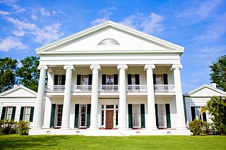
Historic buildings
Several historic buildings of the plantation survive, and are listed on the U.S. National Register of Historic Places (NRHP). [5] Among these are several stone buildings, of a local style that took advantage of fieldstone removed from sugarcane fields. Temporary railway tracks were laid down to transport the fieldstone from piles beside the fields to the building locations. [2]
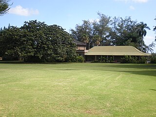
Kilauea Plantation Manager's House
Kilauea Plantation Manager's House | |
| Location | 4591 Kauwa Rd., Kilauea, Hawaii |
|---|---|
| Coordinates | 22°12′20″N159°24′44″W / 22.20556°N 159.41222°W |
| Area | 13 acres (5.3 ha) |
| Built | 1926 |
| Built by | Larsen, L. David |
| Architectural style | Bungalow/craftsman |
| MPS | Kilauea Plantation Stone Buildings MPS |
| NRHP reference No. | 93000777 [5] |
| Added to NRHP | August 5, 1993 |
The Kilauea Plantation Manager's House, at 4591 Kuawa Rd. in Kilauea, was NRHP-listed in 1993; the listing includes three contributing buildings. [6]
Kilauea Plantation Head Luna's House
Kilauea Plantation Head Luna's House | |
 | |
| Location | 2457 Kolo Rd., Kilauea, Hawaii |
|---|---|
| Coordinates | 22°12′30″N159°24′46″W / 22.20833°N 159.41278°W |
| Area | less than one acre |
| Built | 1931 |
| Built by | Allen, Ray M. |
| Architectural style | Bungalow/craftsman |
| MPS | Kilauea Plantation Stone Buildings MPS |
| NRHP reference No. | 93000775 [5] |
| Added to NRHP | August 5, 1993 |
Also known at the William Akana Residence, the Kilauea Plantation Head Luna's House, at 2457 Kolo Rd. in Kilauea, also was NRHP-listed in 1993. [5] [7]
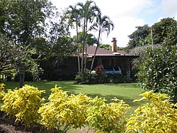
Kilauea Plantation Head Bookkeeper's House
Kilauea Plantation Head Bookkeeper's House | |
 | |
| Location | 2421 Kolo Rd., Kilauea, Hawaii |
|---|---|
| Coordinates | 22°12′30″N159°24′46″W / 22.20833°N 159.41278°W |
| Area | less than one acre |
| Built | 1930 |
| Built by | Allen, Ray M. |
| Architectural style | Bungalow/craftsman |
| MPS | Kilauea Plantation Stone Buildings MPS |
| NRHP reference No. | 93000774 [5] |
| Added to NRHP | August 5, 1993 |
The Kilauea Plantation Head Bookkeeper's House, at 2421 Kolo Rd. in Kilauea, Hawaii, was built in 1930. Its NRHP listing, also in 1993, included two contributing buildings. [5] The main house was the seventh stone house built by the plantation, and is "a good example of the bungalow/craftsman style in Hawaii". [8]
Kilauea School
22°12′39″N159°24′44″W / 22.21083°N 159.41222°W

The school for the community was the Kilauea School, located on the edge of the plantation, at 2440 Kolo Rd., Kilauea, Hawaii. It was built in 1922 and is NRHP-listed, but is not built of stone. It was listed for its architecture and its association with the community. [5] [9]
Kong Lung Store
22°12′55″N159°24′35″W / 22.21528°N 159.40972°W

This was a grocery store for plantation workers, located on W. side of Lighthouse Rd., about .5 mi N. of HI 56., and is listed on the National Register. Built in c.1941, it was the last stone building built by the plantation. [10]