Related Research Articles

Castlelost is a townland in County Westmeath, Ireland. The townland is located in the civil parish of Castlelost. The R446 regional road runs through the middle of the area, and a section of the R400 regional road links the townland with the M6 motorway. The western side of the town of Rochfortbridge lies in the townland, with the east laying in the neighbouring townland of Rahanine.

Pass of Kilbride is a civil parish in County Westmeath, Ireland. It is located about 11.97 kilometres (7 mi) south‑south‑east of Mullingar.

Castlelost is a civil parish in County Westmeath, Ireland. It is located about 12.81 kilometres (8 mi) south of Mullingar.
Kilbride is a civil parish in County Westmeath, Ireland. It is located about 9.26 kilometres (6 mi) south of Mullingar.
Carrick is a civil parish in County Westmeath, Ireland. It is located about 8.47 kilometres (5 mi) south of Mullingar.
The De Profundis Stone is a recumbent stone located in the townland of Kilbride, County Westmeath, Ireland, near the town of Mullingar. The stone was possibly used to mark an ancient graveyard, as was sometimes customary in Ireland. The monument takes its name from a local tradition of stopping a funerary procession at the stone, and reciting the "De Profundis". The Kilbride stone is the only known remaining example in Ireland at which this "De Profundis" tradition was performed.
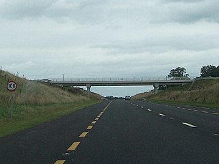
Farthingstown is a townland in County Westmeath, Ireland. The townland is located on the border with County Offaly and is in the civil parish of Castlelost. The M6 Motorway runs through the middle, with a junction linking up with the R400 regional road. The Monagh River flows through the south of the area. The town of Rochfortbridge is to the north.

Rahanine is a townland in County Westmeath, Ireland. The townland is located on the border with County Offaly and is in the civil parish of Castlelost. The M6 Motorway runs through the middle, with the R446 regional road cutting through the north. The Monagh River flows through the south of the area. The eastern side of the town of Rochfortbridge lies in the townland, which contains a number of neighborhoods including Derrygreenagh Park.The eastern side of the town lies within the townland of Castlelost.
Castlelost West is a townland in County Westmeath, Ireland. The townland is located in the civil parish of the same name. The R446 regional road runs through the south of the area. The townland of Castlelost lies to the east and contains the town of Rochfortbridge. The town of Tyrrellspass stands to the west of the townland.
Clontytallon is a rural townland in County Westmeath, Ireland. The townland is located in the civil parish of Castlelost. The townland is bordered by the townlands of Fearmore, Whitewell, Castlelost and Derry to the east, Castlelost West to the west and Kilbride to the north. The town of Rochfortbridge is to the south, with Tyrrellspass to the south-west.
Derry is a townland in County Westmeath, Ireland. The townland is located in the civil parish Castlelost. The R400 regional road runs through the east of the area. The townland of Castlelost lies to the east and contains the town of Rochfortbridge. The small townlands of Clontytallon and Whitewell are to the west. Fearmore lies to the north.
Fearmore is a townland in County Westmeath, Ireland. The townland is located in the civil parish of Kilbride. The R400 regional road runs through the east of the area. The townland of Derry lies to the south, Clontytallon and Whitewell to the west, Gibbonstown to the east and the town of Rochfortbridge is to the south.
Gibbonstown is a townland in County Westmeath, Ireland. The townland is located in the civil parish of Kilbride. The R400 regional road runs to the west of the area. The townland of Fearmore lies to the south, Gaulstown and Whitewell to the west, and the town of Rochfortbridge to the south.
Killotan and Collinstown is a townland in County Westmeath, Ireland. The townland is located on the border with County Offaly and is in the civil parish of Castlelost. The M6 Motorway runs through the middle, near the junction linking up with the R400 regional road. The Monagh River flows through the south of the area. The town of Rochfortbridge is to the east.
Oldtown is a townland in County Westmeath, Ireland. The townland is located near the border with County Offaly and is in the civil parish of Castlelost. The M6 Motorway runs to the south near the junction linking up with the R400 regional road. The R446 regional road cuts through the middle of the townland. The town of Rochfortbridge is to the east.
Gneevebane is a townland in County Westmeath, Ireland. The townland is located near the border with County Offaly and is in the civil parish of Castlelost. The M6 Motorway runs through the south near the junction linking up with the R400 regional road. The R446 regional road cuts through the middle of the townland. The town of Rochfortbridge is to the east, with Tyrrellspass to the west.
Garrane is a townland in County Westmeath, Ireland. The townland is in the civil parish of Castlelost. The M6 Motorway runs through the south of the area, and the R446 regional road cuts through the middle of the townland. The town of Rochfortbridge is to the east, with Tyrrellspass to the west.
Gortumly is a townland in County Westmeath, Ireland, within the civil parish of Castlelost. The R446 regional road cuts through the south of the townland with the R400 to the west. The town of Rochfortbridge is directly to the south in the townlands of Rahanine and Castlelost. Bordering townlands include Derry, Fearmore and Gibbonstown to the west, Drumman to the east, and Gallstown to the north.
Kilbrennan is a townland in County Westmeath, Ireland. The townland is located in the civil parish Castlelost. The N52 is to the west of the area, connecting the towns of Mullingar and Tyrrellspass.
Piercetown is a townland in County Westmeath, Ireland. The townland is in the civil parish of Castlelost. The town of Tyrrellspass lies to the south-west, and Rochfortbridge is to the east. Bordering townlands include Meedin to the west, Castlelost West to the east, Gneevebane to the south and Kilbrennan to the north.
References
- ↑ "Kilbride Townland, Co. Westmeath". www.townlands.ie. Retrieved 30 April 2020.
- ↑ "Cill Bhríde/Kilbride". Logainm.ie. Retrieved 30 April 2020.
- ↑ "THE DE PROFUNDIS STONE/MEGALITHIC MONUMENTS OF IRELAND.COM". www.megalithicmonumentsofireland.com. Retrieved 30 April 2020.
| | This Irish location article is a stub. You can help Wikipedia by expanding it. |