Tremont Township is a township in Schuylkill County, Pennsylvania, United States. The population was 250 at the 2000 census.

The Stickeen Territories, also colloquially rendered as Stickeen Territory,Stikine Territory, and Stikeen Territory, was a territory of British North America whose brief existence began July 19, 1862, and concluded July of the following year. The region was split from the North-Western Territory in the wake of the Stikine Gold Rush. The initial strike attracted large numbers of miners — mostly American — to the region; by detaching the region from the exclusive trade zone of the Hudson's Bay Company, British authorities were able to impose tariffs and licences on the speculators. The new territory, named after the Stikine River, was under the responsibility of the Governor of the Colony of British Columbia, James Douglas, who was appointed "Administrator of the Stickeen Territories" and under British law, within the jurisdiction of the Supreme Court of British Columbia.

Práznovce is a municipality in the Topoľčany District of the Nitra Region, Slovakia. In 2011 it had 962 inhabitants.
Lipovník is a municipality in the Topoľčany District of the Nitra Region, Slovakia. In 2011 it had 326 inhabitants.
Kwikwasut'inuxw Haxwa'mis, formerly the Kwicksutaineuk-ah-kwa-mish First Nation is a First Nations band government based on northern Vancouver Island in British Columbia, Canada, in the Queen Charlotte Strait region. It is a member of the Musgamagw Tsawataineuk Tribal Council, along with the ‘Namgis First Nation and the Tsawataineuk First Nation. The Kwikwasut'inuxw and Haxwa'mis are two of the many subgroups of the peoples known as Kwakwaka'wakw, which means "speakers of Kwak'wala", their language, and were combined into one band by the Department of Indian and Northern Affairs.
The Alkali Lake Indian Band, also known as the Esketemc First Nation, is a First Nations government of the Secwepemc (Shuswap) people, located at Alkali Lake in the Cariboo region of the Central Interior of the Canadian province of British Columbia. It was created when the government of the then-Colony of British Columbia established an Indian Reserve system in the 1860s. It is one of three Secwepemc bands that is not a member of either the Shuswap Nation Tribal Council or the Northern Shuswap Tribal Council.
The Lytton First Nation, a First Nations government, has its headquarters at Lytton in the Fraser Canyon region of the Canadian province of British Columbia. While it is the largest of all Nlaka'pamux bands, unlike all other governments of the Nlaka'pamux (Thompson) people, it is not a member of any of the three Nlaka'pamux tribal councils, which are the Nicola Tribal Association, the Fraser Canyon Indian Administration and the Nlaka'pamux Nation Tribal Council.

The French submarine Rubis was a Saphir-class minelaying submarine which first served in the French submarine pavilion, then the Free French Naval Forces (FNFL) during the Second World War and back with the French Navy. The boat was awarded numerous awards. Accordingly, as a result of Rubis's service with the FNFL, the boat was made a companion of the Ordre de la Libération by a decree issued by General Charles de Gaulle on 14 October 1941.
Saint-Denis is a village near the Belgian town Mons in the province of Hainaut.
Hpapun Township is a township of Hpapun District in the Karen State of Myanmar. It lies on the border of Thailand across the Salween River. The central part of the township is bounded on the west by the Yunzalin River. Hpapun Township's administrative center is Papun.
The Nazko First Nation is a First Nations government of the Dakelh people in the north-central Interior of British Columbia. Its reserves are located around the community of Nazko, British Columbia, which is 120 km west of Quesnel and southwest of Prince George.

Cuvarlı is a village in the Fizuli Rayon of Azerbaijan.
Dzhangyan is a village in the Salyan Rayon of Azerbaijan.
Yale First Nation is a First Nations government located at Yale, British Columbia. Yale has 16 distinct reserves stretching from near Sawmill Creek to American Creek, with the most southern reserve situated at Ruby Creek in the District of Kent.
The Taku River Tlingit First Nation are the band government of the Inland Tlinkit in far northern British Columbia, Canada and also in Yukon. They comprise two ḵwaan (tribes) of the Tlingit people, who are otherwise coastal, the Áa Tlein Ḵwáan of the Atlin Lake area and the Deisleen Ḵwáan of Teslin Lake, whose main focus is the Teslin Tlingit Council in Teslin, Yukon. Their band offices are in Atlin, British Columbia.
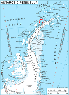
Sigmen Glacier is a 2.2 km long and 2 km wide glacier draining the northwest slopes of Brugmann Mountains on Liège Island in the Palmer Archipelago, Antarctica. It is situated northeast of Zbelsurd Glacier and southwest of Shterna Glacier, draining the west-southwest slopes of Vazharov Peak and the northwest slopes of Mount Kozyak, and flows northwestwards to enter Palakariya Cove.

Milanovo is a village in the municipality of Leskovac, Serbia. According to the 2002 census, the village has a population of 546 people.
Oisu is a small borough in Türi Parish, Järva County in central Estonia.
Mõisaküla is a village in Lääne-Nigula Parish, Lääne County, in western Estonia.