Kilo | |
|---|---|
 | |
| Coordinates: 8°20′36″S118°24′48″E / 8.3433°S 118.4133°E | |
| Country | |
| Province | |
| Regency | |
Kilo is a district in Dompu Regency, West Nusa Tenggara, Indonesia. [1] [2]
Kilo | |
|---|---|
 | |
| Coordinates: 8°20′36″S118°24′48″E / 8.3433°S 118.4133°E | |
| Country | |
| Province | |
| Regency | |
Kilo is a district in Dompu Regency, West Nusa Tenggara, Indonesia. [1] [2]

Provinces are the first-level administrative divisions of Indonesia. It is formerly called the first-level provincial region before the Reform era. Provinces have a local government, consisting of a governor and a regional legislative body. The governor and members of local representative bodies are elected by popular vote for five-year terms, but governors can only serve for two terms. Provincial governments have the authority to regulate and manage their own government affairs, subject to the limits of the central government. The average land area of all 38 provinces in Indonesia is about 49,800 km2 (19,200 sq mi), and they had an average population in mid 2023 of 7,334,111 people.

West Nusa Tenggara is a province of Indonesia. It comprises the western portion of the Lesser Sunda Islands, with the exception of Bali which is its own province. The area of this province is 19,675.89 km2 (7,596.90 sq mi) which consists of two main islands, namely Lombok Island and Sumbawa Island as well as several other small islands. The two largest islands in this province are the smaller but much more populated Lombok in the west and the much larger in area but much less densely populated Sumbawa island in the east. Mataram, on Lombok, is the capital and largest city of the province. It shares maritime borders with Bali to the west and East Nusa Tenggara to the east.

Batam, officially the City of Batam, is the largest city in the Indonesian province of Riau Islands. The city administrative area covers three main islands of Batam, Rempang and Galang, as well as Bulang to the west and several smaller islands. Batam Island is the core urban and industrial zone, while both Rempang Island and Galang Island maintain their rural character and low-density population; they are connected to Batam Island by short bridges. Bulang Island and the islands to its north forming Belakang Padang District lie to the west of Batam Island but are also administratively within the city. Batam is an industrial boomtown, an emerging transport hub and part of a free trade zone in the Indonesia–Malaysia–Singapore Growth Triangle, located 20 km (12 mi) off Singapore's south coast.

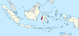
West Sulawesi is a province of Indonesia. It borders the provinces of South Sulawesi and Central Sulawesi to the east, Makassar Strait to the west, and the Pacific Ocean to the south. The province also shares maritime borders with East Kalimantan and South Kalimantan to the west and West Nusa Tenggara to the south. It is located on the western side of Sulawesi island. It covers a land area of 17,152.99 km2, and its capital is the town of Mamuju. The 2010 Census recorded a population of 1,158,651, while that in 2020 recorded 1,419,228; the official estimate as at mid 2023 was 1,481,077.

In Indonesia, village or subdistrict is the fourth-level subdivision and the smallest administrative division of Indonesia below a district, regency/city, and province. Similar administrative divisions outside of Indonesia include barangays in the Philippines, Muban in Thailand, civil townships and incorporated municipalities in the United States and Canada, communes in France and Vietnam, dehestan in Iran, hromada in Ukraine, Gemeinden in Germany, comuni in Italy, or municipios in Spain. The UK equivalent are civil parishes in England and communities in Wales. There are a number of names and types for villages in Indonesia, with desa being the most frequently used for regencies, and kelurahan for cities or for those communities within regencies which have town characteristics. According to the 2019 report by the Ministry of Home Affairs, there are 8,488 urban villages and 74,953 rural villages in Indonesia. North Aceh Regency contained the highest number of rural villages (852) amongst all of the regencies of Indonesia, followed by Pidie Regency with 730 rural villages and Bireuen Regency with 609 rural villages. Prabumulih, with only 12 rural villages, contained the fewest. Counted together, the sixteen regencies of Indonesia containing the most rural villages—namely, North Aceh (852), Pidie (730), Bireuen (609), Aceh Besar (604), Tolikara (541), East Aceh (513), Yahukimo (510), Purworejo (469), Lamongan (462), South Nias (459), Kebumen (449), Garut (421), Bojonegoro (419), Bogor (416), Cirebon (412), and Pati (401)—contain one-third of all the rural villages in Indonesia. Five of these are located in Aceh, two in Highland Papua, three in Central Java, two in East Java, three in West Java, and one in North Sumatra. An average number of rural villages in the regencies and 15 cities of Indonesia is 172 villages. A village is the lowest administrative division in Indonesia, and it is the lowest of the four levels. The average land area of villages in Indonesia is about 25.41 km2 (9.81 sq mi), while its average population is about 3,723 people.

Kartasura is a district (kecamatan) in Sukoharjo Regency, Central Java, Indonesia. Kartasura is considered Surakarta's satellite city and a junction of highways to Yogyakarta and Semarang. It can be reached within minutes southward of Surakarta's Adisumarmo International Airport.

Bima city is a coastal city on the east of the island of Sumbawa in Indonesia's province of West Nusa Tenggara. It is the largest city on the island of Sumbawa, with a population of 142,443 at the 2010 census and 155,140 at the 2020 census; the official estimate as at mid-2023 was 161,362. It is separate from the adjoining Bima Regency which had a population of 535,530 according to the mid-2023 official estimates.

Dompu Regency is a regency of the Indonesian Province of West Nusa Tenggara. It is located on the island of Sumbawa and the capital is Dompu. It is bordered to the north and to the east by two non-contiguous parts of Bima Regency, and to the west by Sumbawa Regency, as well as on its coasts by Saleh Bay, Sanggar Bay, and Cempi Bay. It covers an area of 2,324.55 km2, and the population at the 2010 Census was 218,984 and at the 2020 Census was 236,665; the official estimate as at mid 2023 was 247,188.

Dompu is a town and the administrative centre of the Dompu Regency, located in the eastern part of the island of Sumbawa, in central Indonesia's province of West Nusa Tenggara. It is the third largest town on the island of Sumbawa, with a district population of 49,854 at the 2010 Census, which by the 2020 Census had grown to 54,987; the official estimate as at mid 2023 was 57,680. It is connected by provincial road to Bima and Sape.
In Indonesian law, the term "city" is generally defined as the second-level administrative subdivision of the Republic of Indonesia, an equivalent to regency. The difference between a city and a regency is that a city has non-agricultural economic activities and a dense urban population, while a regency comprises predominantly rural areas and is larger in area than a city. However, Indonesia historically had several classifications of cities.
Woja is a district in Dompu Regency, West Nusa Tenggara, Indonesia.
Hu'u is a district in Dompu Regency, West Nusa Tenggara, Indonesia.

Pekat is a district in Dompu Regency, West Nusa Tenggara, Indonesia.